Category:Road maps of state highways in Florida
Jump to navigation
Jump to search
States of the United States: Alabama · Arizona · Arkansas · California · Colorado · Connecticut · Delaware · Florida · Georgia · Idaho · Illinois · Iowa · Kansas · Louisiana · Maine · Maryland · Massachusetts · Michigan · Missouri · Nevada · New Jersey · New Mexico · New York · North Carolina · Ohio · Oklahoma · Oregon · Pennsylvania · South Carolina · South Dakota · Utah · Virginia · Washington · Wyoming
English: Road maps of state highways in Florida.
Media in category "Road maps of state highways in Florida"
The following 21 files are in this category, out of 21 total.
-
FL-50 map.svg 772 × 542; 608 KB
-
FL-50A map.svg 772 × 543; 1.14 MB
-
FL-52 map.svg 773 × 543; 1.09 MB
-
Florida 115 map.png 1,245 × 738; 35 KB
-
FL State Road 116 map.svg 1,450 × 860; 436 KB
-
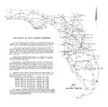
1946 numbering.jpg 1,749 × 1,740; 367 KB
-
FloridaSR520map.gif 1,187 × 553; 21 KB
-
Florida State Road 804 map.png 2,205 × 1,286; 68 KB
-
A1a at ksc small.jpg 522 × 799; 154 KB
-
Fl200.svg 558 × 560; 471 KB
-
Florida 228 map.png 6,850 × 4,062; 2.04 MB
-
Florida 56 map.svg 1,027 × 609; 1.04 MB
-
Florida 568 map.png 6,850 × 4,062; 3.02 MB
-
Florida 589 map.png 6,850 × 4,062; 2.73 MB
-
Florida Major State Roads.png 4,269 × 4,333; 597 KB
-
Florida pre-1945 SR 10 map.png 1,482 × 526; 32 KB
-
Florida SR 29 Map.svg 1,029 × 537; 3.21 MB
-
Florida State Road 235 map.svg 1,027 × 609; 75 KB
-
Florida State Road 366 map.svg 1,027 × 609; 479 KB
-
Florida State Road 528 map.png 6,850 × 4,062; 2.61 MB
-
HEFT map.png 6,850 × 4,062; 1.47 MB


