Category:Road maps of state highways in Illinois
Jump to navigation
Jump to search
States of the United States: Alabama · Arizona · Arkansas · California · Colorado · Connecticut · Delaware · Florida · Georgia · Idaho · Illinois · Iowa · Kansas · Louisiana · Maine · Maryland · Massachusetts · Michigan · Missouri · Nevada · New Jersey · New Mexico · New York · North Carolina · Ohio · Oklahoma · Oregon · Pennsylvania · South Carolina · South Dakota · Utah · Virginia · Washington · Wyoming
Media in category "Road maps of state highways in Illinois"
The following 18 files are in this category, out of 18 total.
-
 Illinois 5 map.svg 1,026 × 608; 3.06 MB
-
 IL 19 map.svg 1,475 × 860; 418 KB
-
 IL22 map.svg 1,044 × 619; 565 KB
-
 Illinois 84 map.svg 1,026 × 608; 825 KB
-
 Illinois 89 map.svg 1,028 × 610; 805 KB
-
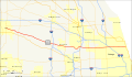
 Illinois 90 map.svg 1,028 × 610; 563 KB
-
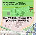 Varney at Big Hollow (Map).jpg 502 × 479; 202 KB
-
 Illinois 92 map.svg 1,028 × 610; 811 KB
-
 Illinois 95 map.svg 1,028 × 610; 518 KB
-
 Illinois 96 map.svg 1,028 × 610; 1.33 MB
-
 Illinois 97 map.svg 1,028 × 610; 1.09 MB
-
 Illinois 99 map.svg 1,028 × 610; 587 KB
-
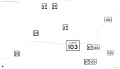 Illinois State Route 103 map.svg 1,439 × 824; 124 KB
-
 IL-120.png 1,414 × 822; 49 KB
-
 IL120.svg 1,414 × 822; 180 KB
-
 Illinois 150 map.svg 1,027 × 609; 466 KB
-
 IL 267 map.svg 1,475 × 860; 464 KB
-
 Illinois 351 map.svg 1,026 × 608; 786 KB


.jpg)


