Category:Road maps of New Jersey
Jump to navigation
Jump to search
States of the United States: Alabama · Alaska · Arizona · Arkansas · California · Colorado · Connecticut · Delaware · Florida · Georgia · Hawaii · Idaho · Illinois · Indiana · Iowa · Kansas · Kentucky · Louisiana · Maine · Maryland · Massachusetts · Michigan · Minnesota · Mississippi · Missouri · Montana · Nebraska · Nevada · New Hampshire · New Jersey · New Mexico · New York · North Carolina · North Dakota · Ohio · Oklahoma · Oregon · Pennsylvania · Rhode Island · South Carolina · South Dakota · Tennessee · Texas · Utah · Vermont · Virginia · Washington · West Virginia · Wisconsin · Wyoming – Washington, D.C.
Puerto Rico
Puerto Rico
Subcategories
This category has the following 5 subcategories, out of 5 total.
Media in category "Road maps of New Jersey"
The following 32 files are in this category, out of 32 total.
-
 Garden State Parkway map.svg 3,425 × 2,031; 1.01 MB
-
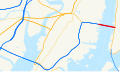
 Palisades Interstate Parkway map.png 2,205 × 1,286; 284 KB
-
 ACE map.svg 982 × 730; 629 KB
-
 ACBC map.svg 1,180 × 688; 573 KB
-
 New Jersey Turnpike simple map.svg 1,208 × 712; 110 KB
-
 Airport Circle NJ map.svg 800 × 712; 60 KB
-
 Berlin Circle current map.svg 800 × 712; 39 KB
-
 Berlin Circle old map.svg 800 × 712; 28 KB
-
 Black Horse Pike map.svg 1,208 × 712; 304 KB
-
 Darlington's Bridge approximate location.svg 1,004 × 895; 277 KB
-
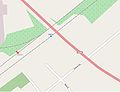 Edison NJ Transit station viewed from OpenStreetMap.JPG 831 × 639; 34 KB
-
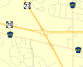
 Flemington as viewed by OpenStreetMap.JPG 663 × 637; 63 KB
-
 Great Notch station map.PNG 986 × 600; 87 KB
-
 Holland Tunnel.svg 1,152 × 684; 104 KB
-
 Marlton Circle current map.svg 885 × 712; 64 KB
-
 Marlton Circle old map.svg 885 × 713; 45 KB
-
 MiddlesexCounty 1947.jpg 2,940 × 3,150; 1.4 MB
-
 Montclair old road map.jpg 4,434 × 4,707; 6.97 MB
-

-
 New Jersey pre-1927 State Highways.png 1,417 × 2,846; 158 KB
-
 New Jersey-Roads-GIS.png 5,888 × 10,000; 19.3 MB
-
 Newark Airport Interchange map.svg 1,146 × 649; 145 KB
-
 NJ Numbered Roads 1927.svg 1,360 × 2,498; 373 KB
-
 NJTP exit 13 intermediate.jpg 526 × 666; 124 KB
-
 Old NJTP exit 13.jpg 130 × 144; 6 KB
-
 Pulaski Skyway map.png 738 × 288; 22 KB
-
 Pulaski Skyway.svg 1,152 × 684; 158 KB
-
 Route 1 Extension.png 1,041 × 722; 40 KB
-
 Route 85 proposed Interchange 4.PNG 849 × 590; 172 KB
-
 SR map Cape May.svg 343 × 342; 165 KB
-
 Tonnelle Circle map.png 336 × 160; 12 KB
-
 Transportation Map of New Jersey - DPLA - 810e855d24117fd0be028c97414065ea (page 1).jpg 2,702 × 3,500; 2.73 MB


.jpg)