Category:Road maps of Minnesota
Jump to navigation
Jump to search
States of the United States: Alabama · Alaska · Arizona · Arkansas · California · Colorado · Connecticut · Delaware · Florida · Georgia · Hawaii · Idaho · Illinois · Indiana · Iowa · Kansas · Kentucky · Louisiana · Maine · Maryland · Massachusetts · Michigan · Minnesota · Mississippi · Missouri · Montana · Nebraska · Nevada · New Hampshire · New Jersey · New Mexico · New York · North Carolina · North Dakota · Ohio · Oklahoma · Oregon · Pennsylvania · Rhode Island · South Carolina · South Dakota · Tennessee · Texas · Utah · Vermont · Virginia · Washington · West Virginia · Wisconsin · Wyoming – Washington, D.C.
Puerto Rico
Puerto Rico
Subcategories
This category has only the following subcategory.
Media in category "Road maps of Minnesota"
The following 43 files are in this category, out of 43 total.
-
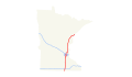
 US 8 map.svg 1,027 × 609; 1.37 MB
-
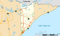
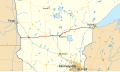
 Cook County Road 12 map.svg 1,026 × 608; 926 KB
-
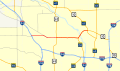
 CSAH 81 map.svg 1,026 × 608; 1,009 KB
-
 Hennepin County Road 122.svg 1,026 × 608; 757 KB
-
 I-35 (MN) map.svg 1,475 × 860; 99 KB
-
 I-35W (MN) map.svg 1,475 × 860; 788 KB
-
 I-394 (MN) map.svg 1,475 × 860; 769 KB
-
 I-494 (MN) map.svg 1,475 × 860; 799 KB
-
 I-535 (MN-WI) map.svg 1,475 × 860; 710 KB
-
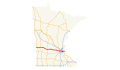
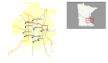 I-694 (MN) map.svg 1,180 × 688; 576 KB
-
 I-90 (MN) map.svg 1,475 × 860; 104 KB
-
 I-94 (MN) map.svg 1,475 × 860; 102 KB
-
 Lake County MN highways.svg 1,026 × 608; 1.54 MB
-
 Minn026.svg 702 × 800; 1.71 MB
-
 Minn043.svg 702 × 800; 1.71 MB
-
 Minn044.svg 702 × 800; 1.71 MB
-
 Minn076.svg 702 × 800; 1.71 MB
-
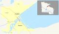
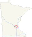
 Minn610 zoomed.svg 1,358 × 800; 2.41 MB
-
 Minn610.svg 702 × 800; 1.7 MB
-
 Minn610FutureUpdate.png 2,000 × 1,178; 301 KB
-
 Minneapolis-St. Paul, Minnesota 1955 Yellow Book.jpg 800 × 959; 183 KB
-
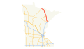
 Minnesota 210 map.svg 1,028 × 610; 1.6 MB
-
 MN 7 map.svg 1,027 × 609; 479 KB
-
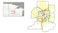
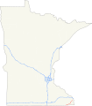
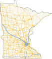 MN highways map.svg 563 × 646; 1.63 MB
-
 National Highways Preliminary Map of the State of Minnesota WDL11538.png 1,024 × 1,262; 2.2 MB
-
 US 10 (MN) map.svg 1,180 × 688; 253 KB
-
 US 12 (MN) map.svg 1,180 × 688; 237 KB
-
 US 14 (MN) map.svg 1,180 × 688; 241 KB
-
 US 169 (MN) map.svg 1,180 × 688; 244 KB
-
 US 2 (MN) map.svg 1,180 × 688; 239 KB
-
 US 212 (MN) map.svg 1,180 × 688; 235 KB
-
 US 218 (MN) map.svg 1,180 × 688; 233 KB
-
 US 52 (MN) map.svg 1,180 × 688; 247 KB
-
 US 53 (MN) map.svg 1,180 × 688; 235 KB
-
 US 55 map.svg 1,027 × 609; 1.24 MB
-
 US 59 (MN) map.svg 1,180 × 688; 239 KB
-
 US 61 (MN) map.svg 1,180 × 688; 240 KB
-
 US 63 (MN) map.svg 1,180 × 688; 234 KB
-
 US 65 (MN) map.svg 1,180 × 688; 232 KB
-
 US 69 (MN) map.svg 1,180 × 688; 231 KB
-
 US 71 (MN) map.svg 1,180 × 688; 239 KB
-
 US 75 (MN) map.svg 1,180 × 688; 239 KB
-
 US 8 (MN) map.svg 1,180 × 688; 231 KB


_map.svg)
_map.svg)
_map.svg)
_map.svg)
_map.svg)
_map.svg)
_map.svg)
_map.svg)


_map.svg)
_map.svg)
_map.svg)
_map.svg)
_map.svg)
_map.svg)
_map.svg)
_map.svg)
_map.svg)

_map.svg)
_map.svg)
_map.svg)
_map.svg)
_map.svg)
_map.svg)
_map.svg)
_map.svg)