Category:Road maps of Interstate Highways in New York (state)
Jump to navigation
Jump to search
States of the United States: Alabama · Alaska · Arizona · Colorado · Florida · Hawaii · Idaho · Iowa · Louisiana · Maryland · Michigan · Nevada · New Jersey · New Mexico · New York · North Carolina · Pennsylvania · South Carolina · South Dakota · Utah · Wyoming
Media in category "Road maps of Interstate Highways in New York (state)"
The following 37 files are in this category, out of 37 total.
-
 NYInterstates.svg 1,475 × 860; 1.16 MB
-
 30 years of progress, 1934-1964 - Bushwick Expressway.jpg 1,441 × 1,005; 299 KB
-
 30 years of progress, 1934-1964 - Clearview Expressway.jpg 853 × 1,544; 262 KB
-

-
 30 years of progress, 1934-1964 - I-78 Unbuilt Brooklyn and Queens.jpg 1,441 × 1,005; 279 KB
-
 30 years of progress, 1934-1964 - I-78 Unbuilt.jpg 1,980 × 1,005; 399 KB
-
 30 years of progress, 1934-1964 - Sheridan Expressway 01.jpg 1,504 × 1,108; 370 KB
-
 30 years of progress, 1934-1964 - Sheridan Expressway 02.jpg 609 × 533; 102 KB
-
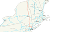
 I-278 (NJ-NY) map.svg 1,475 × 860; 871 KB
-
 I-678 map.svg 1,475 × 860; 629 KB
-
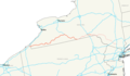
 I-81 (NY) map.svg 1,475 × 860; 702 KB
-
 I-481 (NY) map.svg 1,475 × 860; 622 KB
-
 I-84 (NY) map.svg 1,475 × 860; 697 KB
-
 I-684 map.svg 1,475 × 860; 616 KB
-
 Interstate 86 E Future map.png 1,464 × 853; 33 KB
-
 Interstate 87 map.png 2,205 × 1,239; 120 KB
-
 I-287 (NJ-NY) map.svg 1,475 × 860; 1.12 MB
-
 I-787 map.svg 1,475 × 860; 616 KB
-
 Interstate 88 E map.png 2,205 × 1,239; 76 KB
-
 I-90 (NY) map.svg 1,475 × 860; 620 KB
-
 I-190 (NY) map.svg 1,475 × 860; 616 KB
-
 Interstate 190 (NY) map.png 917 × 624; 49 KB
-
 Interstate 290 (NY) map.png 917 × 624; 49 KB
-
 Interstate 390 (NY) map.png 2,128 × 1,286; 33 KB
-
 Interstate 490 (NY) map.png 2,128 × 1,286; 33 KB
-
 Interstate 590 (NY) map.png 2,128 × 1,286; 91 KB
-
 Interstate 590 (NY) map.svg 1,021 × 617; 436 KB
-
 Interstate 590 NY map.svg 1,450 × 860; 282 KB
-
 I-690 (NY) map.svg 1,475 × 860; 617 KB
-
 I-890 (NY) map.svg 1,475 × 860; 617 KB
-
 Interstate 990 map.png 933 × 610; 56 KB
-
 I-95 (NY) map.svg 1,475 × 860; 616 KB
-
 I-495 (NY) map.svg 1,475 × 860; 621 KB
-
 Interstate 295 (New York) Map.svg 1,027 × 609; 1.48 MB
-
 Interstate 95 in New York Map.svg 1,028 × 609; 3.41 MB
-
 Major Deegan Expressway Map.svg 1,027 × 609; 2.35 MB
-
 New York, New York 1955 Yellow Book.jpg 800 × 833; 226 KB


_(16478136350).jpg)


_map.svg)

_map.svg)
_map.svg)
_map.svg)


_map.svg)


_map.svg)
_map.svg)
_map.png)
_map.png)
_map.png)
_map.png)
_map.png)
_map.svg)

_map.svg)
_map.svg)

_map.svg)
_map.svg)
_Map.svg)


