Category:Road maps of India
Jump to navigation
Jump to search
Media in category "Road maps of India"
The following 34 files are in this category, out of 34 total.
-
Dal-See OpenStreetMap.svg 2,011 × 2,965; 3.71 MB
-
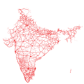
Highway and Railway Map of India OSM.png 2,000 × 2,230; 4.03 MB
-
India major road network map.png 3,209 × 3,217; 2.04 MB
-
India ne2.png 519 × 458; 223 KB
-
India roadway map (cropped).png 691 × 488; 113 KB
-
India roadway map.png 3,840 × 4,500; 1.54 MB
-
India roadway map.svg 1,639 × 1,852; 1.11 MB
-
Kerala-road-map-ml.png 2,000 × 2,556; 412 KB
-
Kerala-road-map-ml.svg 2,000 × 2,556; 104 KB
-
Local Roads vs Highways of India in OSM.png 3,998 × 4,199; 15.64 MB
-
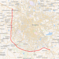
Location map Bangalore Mysore Infrastructure Corridor.png 860 × 861; 1.08 MB
-
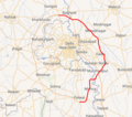
Location Map Delhi Gurgaon Expressway.png 658 × 764; 386 KB
-
Mandi City National Highways Road Network.svg 1,600 × 1,200; 26 KB
-
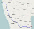
Map Bengaluru-Chennai Expressway.svg 911 × 363; 121 KB
-
Map DND Flyway.png 878 × 748; 1.07 MB
-
Map2kolad.jpg 3,450 × 2,200; 401 KB
-
National Highway 1 (India).png 1,132 × 780; 566 KB
-
National Highway 18 (India).png 692 × 827; 205 KB
-
National Highway 21 (India).png 978 × 525; 311 KB
-
National Highway 24 (India).png 1,002 × 644; 363 KB
-
National Highway 37 (India).png 1,189 × 644; 364 KB
-
National Highway 4 (India).png 967 × 828; 348 KB
-
National Highway 42 (India).png 1,589 × 704; 481 KB
-
National Highway 46 (India).png 1,068 × 599; 323 KB
-
National Highway 54 (India).png 475 × 774; 196 KB
-
National Highway 6 (India).png 1,195 × 350; 397 KB
-
National highway network map.png 1,000 × 1,138; 146 KB
-
OpenStreetMap roads coverage in India.png 993 × 572; 156 KB
-
Outer Ring Road Chennai.png 570 × 694; 429 KB
-
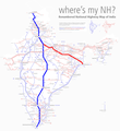
Renumbered National Highways map of India (Schematic) hilight 19 44.png 937 × 1,024; 580 KB
-
Renumbered National Highways map of India (Schematic).jpg 937 × 1,024; 382 KB
-
TN Road Map NEW NH.jpg 485 × 671; 137 KB
-
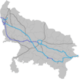
Uttar Pradesh Expressway map.png 2,072 × 2,088; 374 KB


