Category:Road maps of North Korea
Jump to navigation
Jump to search
Media in category "Road maps of North Korea"
The following 11 files are in this category, out of 11 total.
-
 Motorway future plan-KP.png 2,000 × 1,964; 165 KB
-
 Motorway Map-KP.png 2,000 × 1,964; 155 KB
-
 NKroads.svg 585 × 588; 48 KB
-
 Pyongyang-Hyangsan tourist expressway.PNG 2,000 × 1,964; 155 KB
-
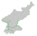
 Pyongyang-Kaesong motorway.PNG 2,000 × 1,964; 156 KB
-
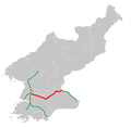
 Pyongyang-Sinuiju expressway.png 2,000 × 1,964; 156 KB
-
 Pyongyang-Wonsan tourist expressway.PNG 2,000 × 1,964; 155 KB
-
 Road Map of Korea - DPLA - 1168318c0f7a055a942d6e31b43c9a0e.jpg 10,368 × 11,539; 15.37 MB
-
 Sariwon-Sinchon expressway.png 2,000 × 1,964; 155 KB
-
 Wonsan-Mount Kumgang expressway.png 2,000 × 1,964; 155 KB
-
 Youth Hero Motorway.PNG 2,000 × 1,964; 155 KB


