Category:Rivers of County Antrim
Jump to navigation
Jump to search
Wikimedia category | |||||
| Upload media | |||||
| Instance of | |||||
|---|---|---|---|---|---|
| Category combines topics | |||||
| County Antrim | |||||
county of Northern Ireland     | |||||
| Instance of | |||||
| Part of | |||||
| Named after | |||||
| Location |
| ||||
| Located in or next to body of water |
| ||||
| Capital | |||||
| Population |
| ||||
| Area |
| ||||
| Different from | |||||
 | |||||
Subcategories
This category has the following 17 subcategories, out of 17 total.
A
- Agivey River (13 F)
B
- Braid River (5 F)
- River Bush (8 F)
C
- Clady River, Northern Ireland (11 F)
- Crumlin River, County Antrim (3 F)
D
- River Dall, County Antrim (5 F)
E
- Ess-Na-Crub Waterfall (15 F)
- Ess-Na-Larach Waterfall (1 F)
F
- River Farset (2 F)
- Fords in County Antrim (1 F)
G
- Glenarm River (10 F)
K
- Kells Water (9 F)
L
M
- River Maine, County Antrim (1 F)
S
- Six Mile Water (27 F)
Media in category "Rivers of County Antrim"
The following 44 files are in this category, out of 44 total.
-
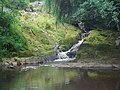
 Above Glenoe waterfall - geograph.org.uk - 212098.jpg 640 × 426; 186 KB
-

-

-
 Cataract on Collin River. - geograph.org.uk - 76914.jpg 640 × 480; 76 KB
-
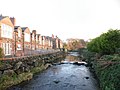 Converted Mill Houses Beside Race - geograph.org.uk - 1076920.jpg 640 × 480; 77 KB
-
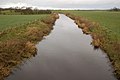
 Derriaghy River - geograph.org.uk - 409033.jpg 640 × 480; 154 KB
-

-
 Dunadry River near Old Mill - geograph.org.uk - 1076924.jpg 640 × 480; 105 KB
-
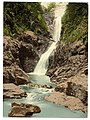 Fall in Glenariff. County Antrim, Ireland.jpg 771 × 1,024; 279 KB
-
 Glenariff Forest Park - geograph.org.uk - 742694.jpg 600 × 450; 89 KB
-
 Inver River with Collin Top behind - geograph.org.uk - 828543.jpg 640 × 480; 68 KB
-
 Kilroot River near Carrickfergus - geograph.org.uk - 221254.jpg 640 × 426; 185 KB
-
 Oldtown Bridge - geograph.org.uk - 722347.jpg 640 × 360; 47 KB
-
 River at Fifty Acres - geograph.org.uk - 1580953.jpg 640 × 480; 74 KB
-
 River bridge - geograph.org.uk - 820483.jpg 640 × 360; 100 KB
-
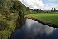
 River Main - geograph.org.uk - 433838.jpg 640 × 480; 84 KB
-
 River view at Carnkirn bridge - geograph.org.uk - 1300342.jpg 640 × 480; 129 KB
-
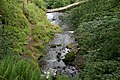
 River, Glenoe glen (4) - geograph.org.uk - 411683.jpg 640 × 413; 117 KB
-
 Sylvan Scene - geograph.org.uk - 116070.jpg 640 × 480; 165 KB
-
 The Blackstaff River, Belfast - geograph.org.uk - 1806043.jpg 640 × 464; 442 KB
-

-
 The Burn Gushet River near Ballymoney - geograph.org.uk - 568431.jpg 636 × 422; 92 KB
-
 The Clogh River near Glarryford Cross - geograph.org.uk - 306656.jpg 640 × 426; 150 KB
-
 The Glenshesk River - geograph.org.uk - 414601.jpg 640 × 480; 121 KB
-
 The Killagan Water at Glarryford - geograph.org.uk - 290720.jpg 640 × 426; 120 KB
-
 Three Mile Water - geograph.org.uk - 1103434.jpg 640 × 480; 140 KB
-
 Two rivers near Lisburn - geograph.org.uk - 586730.jpg 636 × 423; 77 KB
-
 Weir on the Inver River - geograph.org.uk - 828489.jpg 640 × 480; 84 KB
-
 Above Glenoe waterfall (5) - geograph.org.uk - 678600.jpg 640 × 416; 62 KB
-
 Glendun - geograph.org.uk - 410383.jpg 640 × 480; 138 KB
-
 Glenwhirry River (view upstream) - geograph.org.uk - 257225.jpg 640 × 426; 140 KB
-
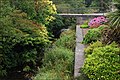
 Park bench on the Fisherman's Walk - geograph.org.uk - 515710.jpg 640 × 427; 107 KB
-
 River, Glenoe glen (1) - geograph.org.uk - 365571.jpg 640 × 426; 156 KB
-
 River, Glenoe glen (2) - geograph.org.uk - 365579.jpg 640 × 426; 164 KB
-
 River, Glenoe glen (3) - geograph.org.uk - 411645.jpg 640 × 426; 193 KB
-
 River, Glenoe glen (5) - geograph.org.uk - 512498.jpg 640 × 426; 109 KB
-
 River, Glenoe glen (6) - geograph.org.uk - 678562.jpg 640 × 419; 81 KB
-
 River, Glenoe village - geograph.org.uk - 525597.jpg 640 × 426; 132 KB
-
 River,Glenoe Glen (7) - geograph.org.uk - 708545.jpg 640 × 391; 86 KB
-
 The Glenwhirry River (downstream) - geograph.org.uk - 257230.jpg 640 × 426; 151 KB
-

-
 The Glynn River, Glynn (1) - geograph.org.uk - 678428.jpg 640 × 399; 110 KB
-
 The Glynn River, Glynn (2) - geograph.org.uk - 678441.jpg 640 × 403; 105 KB
-
 The Raloo Water above Glenoe - geograph.org.uk - 402886.jpg 640 × 426; 189 KB


_-_geograph.org.uk_-_411683.jpg)


_-_geograph.org.uk_-_568435.jpg)


_-_geograph.org.uk_-_678600.jpg)

_-_geograph.org.uk_-_257225.jpg)

_-_geograph.org.uk_-_365571.jpg)
_-_geograph.org.uk_-_365579.jpg)
_-_geograph.org.uk_-_411645.jpg)
_-_geograph.org.uk_-_512498.jpg)
_-_geograph.org.uk_-_678562.jpg)

_-_geograph.org.uk_-_708545.jpg)
_-_geograph.org.uk_-_257230.jpg)

_-_geograph.org.uk_-_678428.jpg)
_-_geograph.org.uk_-_678441.jpg)
