Category:Clady River, Northern Ireland
Jump to navigation
Jump to search
English: The Clady River flows from the Sperrin Mountains past Culnady and Clady and empties into the Lower Bann below the town of Portglenone in County Antrim, Northern Ireland.
river in the United Kingdom  | |||||
| Upload media | |||||
| Instance of | |||||
|---|---|---|---|---|---|
| Location |
| ||||
| Elevation above sea level |
| ||||
 | |||||
Media in category "Clady River, Northern Ireland"
The following 11 files are in this category, out of 11 total.
-

-
 Along the Clady - geograph.org.uk - 475327.jpg 427 × 640; 88 KB
-
 Clady River Portglenone.jpg 4,160 × 3,120; 1.72 MB
-
 Clady River Slaughtneil.jpg 4,160 × 3,120; 2.62 MB
-
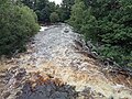 Clady River Spate Glenone Bridge Clady Co Derry.jpg 4,160 × 3,120; 6.23 MB
-

-
 Ford on the Clady near Innishrush - geograph.org.uk - 475407.jpg 640 × 427; 92 KB
-
 Glenone Bridge close-up - geograph.org.uk - 475335.jpg 640 × 427; 57 KB
-
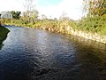
 Glenone bridge over the Clady River - geograph.org.uk - 474940.jpg 640 × 427; 128 KB
-
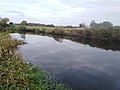
 The Clady River near Inishrush - geograph.org.uk - 475429.jpg 640 × 427; 88 KB
-
 The Waterwall Bar near Clady - geograph.org.uk - 475458.jpg 640 × 390; 56 KB


