Category:River Mole

tributary of the River Thames in southern England   | |||||
| Upload media | |||||
| Instance of | |||||
|---|---|---|---|---|---|
| Location |
| ||||
| Length |
| ||||
| Mouth of the watercourse | |||||
| Tributary |
| ||||
| Different from | |||||
 | |||||
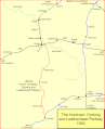
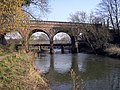
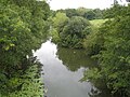
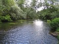
The River Mole is a tributary of the River Thames in south east England. The Mole rises in West Sussex south of the village centre of Rusper, north of Horsham, in Rusper civil and ecclesiastical parish. It collects wealden streams from the Worth/Tilgate/Holmwood forest flowing eastwards to almost encircle Gatwick Airport after which is flows generally northwards passing Horley, Salfords, Leigh, Reigate Heath, through Buckland, Brockham and Betchworth then passing Pixham (a village by Dorking), Westhumble, Mickleham, Leatherhead, circuitously Cobham, Hersham and Esher to meet the Thames between East Molesey and Thames Ditton.
The Westhumble/Mickleham stretch is the shallowest in Surrey as in summer a large proportion of the flow at this point here is underground. This stretch and tidal action in previous epochs helped to carve 'the Mole Gap' beside Box Hill from the North Downs. Its passage underground has been linked with its name 'the mole' since at least Speed's map of 1610, marked 'the river passeth under', and academics debate whether the river was named after this attribute or not. The return of the waters is easily seen from springs in the water meadows at Fetcham, near Leatherhead. The river passing under through a chalk stratum known. In this brief, shallow mid-section the North Downs Way can be taken over traditional stepping stones or a nearby bridge. This route with part of the prehistoric Harrow Way from Folkestone to part of Salisbury Plain (Stonehenge and Avebury) via Winchester, with a later detour by Pilgrims to Canterbury.
The Mole has one named corollary, the Ember which has been enlarged and weir-controlled for flood prevention passing by fields and nature reserves of Hersham and Molesey on the left bank and homes of Esher and Thames Ditton on the right bank. This rejoins the Mole west of the trees and petrol station along the A309, Hampton Court Way about 200 metres from its mouth.
Subcategories
This category has the following 13 subcategories, out of 13 total.
B
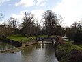
- Betchworth Bridge (4 F)
- Box Hill, Stepping Stones (15 F)
C
F
- Flanchford Bridge (66 F)
L
- Leatherhead Bridge (12 F)
M
- Mickleham Bridge (6 F)
R
- River Mole LNR (5 F)
S
- Sidlow Bridge (4 F)
T
Media in category "River Mole"
The following 80 files are in this category, out of 80 total.
-
 Alder by the River Mole, north of Mickleham - geograph.org.uk - 2799207.jpg 728 × 1,024; 149 KB
-
 Betchworth Bridge, Snowerhill Road, Betchworth (July 2013).JPG 2,592 × 1,944; 1.69 MB
-
 Box Hill footbridge over the River Mole - geograph.org.uk - 2110267.jpg 3,072 × 2,304; 4.76 MB
-
 Boxhill Bridge - geograph.org.uk - 1817151.jpg 426 × 640; 153 KB
-
 Bridge at Young Street - geograph.org.uk - 687745.jpg 480 × 640; 81 KB
-
 Bridge over the River Mole - geograph.org.uk - 4247375.jpg 2,560 × 1,920; 2.05 MB
-
 Bridge over the River Mole - geograph.org.uk - 51477.jpg 640 × 480; 150 KB
-
 Bridges at Brockham - geograph.org.uk - 147641.jpg 640 × 480; 146 KB
-
 Bridges over the River Mole - geograph.org.uk - 311213.jpg 640 × 480; 153 KB
-
 Brockham Pillbox by footbridge over the river Mole.jpg 3,000 × 1,995; 3.03 MB
-
 Canoes on the River Mole - geograph.org.uk - 148899.jpg 480 × 640; 161 KB
-
 Derelict car on river bend - geograph.org.uk - 147063.jpg 640 × 480; 136 KB
-
 Diverted course of River Mole - geograph.org.uk - 1953207.jpg 640 × 428; 149 KB
-
 Dry River Mole, 20 July 2022.jpg 2,587 × 1,940; 2.57 MB
-
 Dry River Mole, July 2022.jpg 2,587 × 1,940; 2.58 MB
-
 Footbridge over River Mole - geograph.org.uk - 147059.jpg 640 × 480; 181 KB
-
 Hampton Court stn river bridge.JPG 1,600 × 1,200; 626 KB
-
 Leatherhead River Mole Bridge and River Mole Viaduct.jpg 768 × 1,024; 333 KB
-
 Leatherhead River Mole Bridge.jpg 768 × 1,024; 307 KB
-
 Leatherhead-horsham.gif 872 × 1,074; 61 KB
-
 Mole Gap Trail - geograph.org.uk - 168110.jpg 640 × 480; 165 KB
-
 MoleAtGatwick1.jpg 600 × 450; 21 KB
-
 MoleEmber.JPG 1,024 × 716; 348 KB
-
 MoleRiverNearMickleham07202013.jpg 2,592 × 1,552; 1.12 MB
-
 MoleThames.JPG 1,024 × 738; 377 KB
-
 On the Mole Boxhill by Stephen Thompson 1875.jpg 914 × 712; 290 KB
-
 Picturesque Surrey The River Mole near Boxhill (NBY 442677).jpg 3,600 × 2,312; 2.11 MB
-
 Railway bridge at Leatherhead - geograph.org.uk - 342266.jpg 640 × 479; 148 KB
-
 Rice Bridge - geograph.org.uk - 853657.jpg 640 × 426; 140 KB
-
 RivEmber01.JPG 1,024 × 768; 422 KB
-
 River Ember Flood Relief Scheme - geograph.org.uk - 4412.jpg 640 × 427; 67 KB
-
 River Mole - geograph.org.uk - 686167.jpg 640 × 480; 132 KB
-
 River Mole - geograph.org.uk - 687731.jpg 640 × 480; 126 KB
-
 River Mole - geograph.org.uk - 820954.jpg 640 × 426; 131 KB
-
 River Mole - geograph.org.uk - 853652.jpg 640 × 426; 129 KB
-
 River Mole and Box Hill escarpment - geograph.org.uk - 1166863.jpg 640 × 480; 75 KB
-
 River Mole at Baldhorns Park - geograph.org.uk - 1811633.jpg 2,560 × 1,920; 1.88 MB
-
 River Mole at Betchworth - geograph.org.uk - 1630493.jpg 640 × 426; 156 KB
-
 River Mole at Bridge Street, Leatherhead (July 2013).JPG 2,592 × 1,944; 1.15 MB
-
 River Mole at Deepdene Bridge (1) - geograph.org.uk - 806256.jpg 640 × 480; 94 KB
-
 River Mole at Deepdene Bridge (2) - geograph.org.uk - 806264.jpg 640 × 480; 106 KB
-
 River Mole at Kinnersley Manor - geograph.org.uk - 1194625.jpg 640 × 480; 81 KB
-
 River Mole at Kinnersley Manor - geograph.org.uk - 280288.jpg 640 × 480; 131 KB
-
 River Mole at Sidlow Bridge - geograph.org.uk - 1270594.jpg 640 × 426; 81 KB
-
 River Mole at Thorncroft - geograph.org.uk - 687989.jpg 640 × 480; 137 KB
-
 River Mole by Slyfield - geograph.org.uk - 676509.jpg 640 × 480; 108 KB
-
 River Mole footbridge, near the Stepping Stones, Box Hill, Surrey.jpg 4,032 × 1,960; 2.76 MB
-
 River Mole from Boxhill Bridge - geograph.org.uk - 325991.jpg 640 × 480; 126 KB
-
 River Mole from Common Meadow, Leatherhead.jpg 3,500 × 2,625; 2.7 MB
-
 River Mole from Flanchford Bridge - geograph.org.uk - 244970.jpg 640 × 480; 88 KB
-
 River Mole in Betchworth - geograph.org.uk - 230475.jpg 640 × 480; 132 KB
-
 River Mole in Pixham - geograph.org.uk - 806239.jpg 640 × 480; 112 KB
-
 River Mole Map.png 447 × 544; 67 KB
-
 River Mole Map.svg 450 × 515; 269 KB
-
 River Mole Meander - geograph.org.uk - 311203.jpg 640 × 318; 62 KB
-
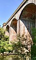
 River Mole viaduct (north side), North Downs Line, Pixham, Dorking, Surrey.jpg 1,940 × 3,233; 1.94 MB
-
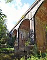
 River Mole viaduct (south side), North Downs Line, Pixham, Dorking, Surrey.jpg 1,876 × 3,128; 1.88 MB
-
 River Mole Viaduct, Pixham.jpg 2,325 × 3,000; 2.07 MB
-
 River Mole west of Horley - geograph.org.uk - 1511990.jpg 640 × 427; 519 KB
-
 River Mole, downstream - geograph.org.uk - 856015.jpg 640 × 480; 151 KB
-
 River Mole, Leatherhead, Surrey - geograph.org.uk - 1394499.jpg 428 × 640; 109 KB
-
 River Mole, Westhumble, Surrey - geograph.org.uk - 1504073.jpg 640 × 428; 105 KB
-
 RivMole01.JPG 1,024 × 768; 356 KB
-
 Stepping Stones - geograph.org.uk - 215283.jpg 640 × 480; 482 KB
-
 The River Mole at Thorncroft Manor - geograph.org.uk - 86065.jpg 640 × 480; 186 KB
-
 The Stepping Stones - geograph.org.uk - 158891.jpg 2,136 × 2,848; 3.16 MB
-
 Through the Mole Gap on foot - geograph.org.uk - 105565.jpg 640 × 431; 133 KB
-
 Train waiting at Hampton Court Station - geograph.org.uk - 4639227.jpg 800 × 588; 151 KB
-
 Young Street Bridge - geograph.org.uk - 687721.jpg 640 × 480; 122 KB
-
 Boxhill Bridge - geograph.org.uk - 148897.jpg 640 × 480; 163 KB
-
 Footbridge over the Mole - geograph.org.uk - 158896.jpg 2,848 × 2,136; 3.13 MB
-
 River Mole - geograph.org.uk - 167786.jpg 640 × 480; 149 KB
-
 River Mole - geograph.org.uk - 233136.jpg 640 × 480; 141 KB
-

-
 River Mole at Stoke d'Abernon Bridge - geograph.org.uk - 676490.jpg 640 × 480; 115 KB
-
 River Mole from Sidlow Bridge - geograph.org.uk - 230469.jpg 640 × 480; 111 KB
-
 River Mole near Dorking - geograph.org.uk - 54138.jpg 640 × 480; 168 KB
-
 River Mole near Horley - geograph.org.uk - 221686.jpg 640 × 480; 133 KB
-
 River Mole, Deepdene Bridge - geograph.org.uk - 244365.jpg 480 × 640; 103 KB
-
 River Mole, East Molesey - geograph.org.uk - 38002.jpg 640 × 480; 130 KB

.JPG)


.jpg)


.JPG)
_-_geograph.org.uk_-_806256.jpg)
_-_geograph.org.uk_-_806264.jpg)


,_North_Downs_Line,_Pixham,_Dorking,_Surrey.jpg)
,_North_Downs_Line,_Pixham,_Dorking,_Surrey.jpg)


,_Near_Ifield,_Crawley,_West_Sussex_-_geograph.org.uk_-_27856.jpg)


