Category:Borough of Elmbridge
Jump to navigation
Jump to search
local government district with borough status in Surrey, England, UK   | |||||
| Upload media | |||||
| Instance of | |||||
|---|---|---|---|---|---|
| Location | Surrey, South East England, England | ||||
| Capital | |||||
| Legislative body |
| ||||
| Population |
| ||||
| Area |
| ||||
| official website | |||||
 | |||||
English: Elmbridge is a local government district of the county of Surrey in England.
Subcategories
This category has the following 7 subcategories, out of 7 total.
Media in category "Borough of Elmbridge"
The following 200 files are in this category, out of 1,866 total.
(previous page) (next page)-
 "Howzat" - geograph.org.uk - 5774982.jpg 3,856 × 2,169; 3.31 MB
-

-
 "The Marquis of Granby" PH - geograph.org.uk - 5061253.jpg 800 × 600; 124 KB
-
 "Toby" in Sunbury Lock - geograph.org.uk - 5857127.jpg 1,024 × 768; 252 KB
-

-
 'The Abbey' - a folly at Painshill, Cobham - geograph.org.uk - 6357704.jpg 1,600 × 1,067; 465 KB
-
 'The Abbey' - a folly at Painshill, Cobham - geograph.org.uk - 6357706.jpg 1,600 × 1,067; 496 KB
-
 'The Gothic Temple' - a folly at Painshill, Cobham - geograph.org.uk - 6357711.jpg 1,600 × 1,067; 661 KB
-
 'The Gothic Temple' - a folly at Painshill, Cobham - geograph.org.uk - 6357725.jpg 1,600 × 1,067; 417 KB
-
 'The Gothic Tower' - a folly at Painshill, Cobham - geograph.org.uk - 6357729.jpg 1,600 × 1,067; 585 KB
-
 'The Grotto' - a folly at Painshill, Cobham - geograph.org.uk - 6357723.jpg 1,600 × 1,067; 688 KB
-
 'The Grotto' - a folly at Painshill, Cobham - geograph.org.uk - 6357735.jpg 1,600 × 1,067; 543 KB
-
 'Waterlily' eases up to Sunbury Lock - geograph.org.uk - 6456497.jpg 1,024 × 768; 494 KB
-

-
 1938 Wolseley outside Cobham bus museum on open day - geograph.org.uk - 2268822.jpg 1,600 × 1,200; 582 KB
-
 1950s Vauxhall Cresta on Redhill Road - geograph.org.uk - 2268839.jpg 1,600 × 1,200; 572 KB
-
 1950s Vauxhall Cresta on Redhill Road - geograph.org.uk - 2268840.jpg 1,600 × 1,200; 544 KB
-
 2016, a year on Geograph (Day 268) - geograph.org.uk - 5129301.jpg 640 × 480; 48 KB
-
 A congested M25 - geograph.org.uk - 4451881.jpg 640 × 409; 54 KB
-
 A fall of willow - geograph.org.uk - 2171909.jpg 640 × 424; 246 KB
-
 A gloomy afternoon in Betts Way - geograph.org.uk - 6083495.jpg 640 × 480; 52 KB
-
 A green, Hersham Golf Club - geograph.org.uk - 6457761.jpg 1,024 × 768; 309 KB
-

-
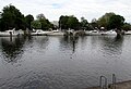
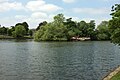
 A loop of the Thames - geograph.org.uk - 2658761.jpg 640 × 480; 65 KB
-
 A military camp beside Claremont Lake - geograph.org.uk - 5407847.jpg 800 × 600; 138 KB
-
 A pig at Piglets Play Centre, Burhill Road, Hersham - geograph.org.uk - 6090457.jpg 1,600 × 900; 1,015 KB
-
 A rather muddy path alongside the Thames - geograph.org.uk - 3864608.jpg 4,000 × 3,000; 4.04 MB
-
 A tree-lined section of the Thames Path - geograph.org.uk - 5305948.jpg 2,346 × 3,128; 2.69 MB
-
 A245 bridge, A3 - geograph.org.uk - 5702299.jpg 640 × 426; 56 KB
-
 A245 bridge, A3 - geograph.org.uk - 5702302.jpg 640 × 426; 47 KB
-
 A245 Byfleet Road - geograph.org.uk - 6339756.jpg 1,024 × 684; 269 KB
-
 A245 Byfleet Road - geograph.org.uk - 6339774.jpg 1,024 × 684; 348 KB
-
 A245, Stoke Road - geograph.org.uk - 2690664.jpg 640 × 428; 91 KB
-
 A3 - geograph.org.uk - 5702339.jpg 640 × 426; 43 KB
-
 A3 across Esher Common - geograph.org.uk - 3097453.jpg 640 × 480; 81 KB
-
 A3 Bridge over Farm Track - Birchwood Lane - geograph.org.uk - 5073222.jpg 4,608 × 3,456; 5.64 MB
-
 A3 Lane on the M25 - geograph.org.uk - 4921326.jpg 3,264 × 1,840; 1.88 MB
-
 A3 southbound - geograph.org.uk - 2178754.jpg 1,600 × 1,200; 862 KB
-
 A3 towards London - geograph.org.uk - 3097559.jpg 640 × 428; 62 KB
-
 A3 towards London - geograph.org.uk - 3098865.jpg 640 × 428; 98 KB
-
 A3, Esher Bypass - geograph.org.uk - 2183769.jpg 1,600 × 1,200; 978 KB
-
 A3, Esher Common - geograph.org.uk - 5702331.jpg 640 × 426; 48 KB
-
 A3, northbound - geograph.org.uk - 5702275.jpg 640 × 426; 63 KB
-
 A309 - geograph.org.uk - 5706966.jpg 640 × 426; 64 KB
-
 A309 - geograph.org.uk - 5706980.jpg 640 × 426; 75 KB
-
 A309 - geograph.org.uk - 5710145.jpg 640 × 439; 69 KB
-
 A309 - geograph.org.uk - 5710168.jpg 640 × 453; 64 KB
-
 A309 - geograph.org.uk - 5710173.jpg 640 × 426; 70 KB
-
 A309 - geograph.org.uk - 5710202.jpg 640 × 426; 64 KB
-
 A309 - geograph.org.uk - 5710204.jpg 640 × 465; 80 KB
-
 A309 - geograph.org.uk - 5710209.jpg 640 × 426; 74 KB
-
 A309 - geograph.org.uk - 5710223.jpg 640 × 426; 80 KB
-
 A309 - geograph.org.uk - 5710228.jpg 640 × 426; 47 KB
-
 A309 - geograph.org.uk - 5710248.jpg 640 × 426; 65 KB
-
 A309 junction Thames Ditton - geograph.org.uk - 2084181.jpg 1,600 × 1,200; 600 KB
-
 A309 junction Thames Ditton - geograph.org.uk - 2084188.jpg 1,600 × 1,200; 611 KB
-
 A309 passing under South Western Main Line - geograph.org.uk - 5172523.jpg 3,072 × 2,048; 1.33 MB
-
 A317 to Weybridge - geograph.org.uk - 5610239.jpg 640 × 428; 121 KB
-
 Above Manor Farm - geograph.org.uk - 2115510.jpg 2,560 × 1,920; 1.93 MB
-
 Access road for Oxshott railway station - geograph.org.uk - 3341748.jpg 1,024 × 834; 232 KB
-
 Access road near Hatchford House - geograph.org.uk - 4955325.jpg 2,000 × 1,333; 2.17 MB
-
 Access road to Chatley Heath - geograph.org.uk - 4939246.jpg 2,000 × 1,333; 3.02 MB
-
 Access Road, Desborough Island - geograph.org.uk - 4459383.jpg 2,048 × 1,536; 3.16 MB
-
 Across the River Wey - geograph.org.uk - 4547917.jpg 4,000 × 2,666; 6.69 MB
-
 Across the River Wey - geograph.org.uk - 4547924.jpg 3,973 × 2,648; 7.46 MB
-
 Albany Bridge - geograph.org.uk - 2183901.jpg 1,600 × 1,200; 908 KB
-
 Alexandr Vinokurov - geograph.org.uk - 3064046.jpg 5,484 × 3,814; 6.46 MB
-
-

-

-

-

-
-

-
 Alleyway on Bankside Drive, Long Ditton - geograph.org.uk - 3609173.jpg 1,200 × 1,600; 531 KB
-
 Allotments next to Long Ditton Cricket Club - geograph.org.uk - 3609298.jpg 1,600 × 1,200; 470 KB
-
 Allotments, Burhill Road - geograph.org.uk - 3097562.jpg 640 × 480; 146 KB
-
 Alma Rd - geograph.org.uk - 5706961.jpg 640 × 426; 78 KB
-
 Almshouse , Tilt Green - geograph.org.uk - 4108477.jpg 2,418 × 1,933; 1,002 KB
-
 An island next to Thames Ditton Island - geograph.org.uk - 3862427.jpg 4,000 × 3,000; 4.14 MB
-
 An island next to Thames Ditton Island - geograph.org.uk - 3862429.jpg 4,000 × 3,000; 4.22 MB
-
 Ancient oak near Cobham - geograph.org.uk - 4942852.jpg 2,000 × 1,333; 2.86 MB
-
 Angel at Stoke d'Abernon - geograph.org.uk - 2115443.jpg 2,560 × 1,920; 1.74 MB
-
 Angel Road, Thames Ditton, from the railway - geograph.org.uk - 4879206.jpg 1,600 × 850; 238 KB
-
 Angel Street - geograph.org.uk - 4628046.jpg 768 × 1,024; 160 KB
-
 Anti-clockwise M25 - geograph.org.uk - 3731118.jpg 640 × 480; 249 KB
-
 Approach to Sunbury Lock - geograph.org.uk - 4347572.jpg 3,552 × 1,572; 1.15 MB
-
 Approaching J10, M25 - geograph.org.uk - 4523220.jpg 640 × 426; 55 KB
-
 Approaching roadworks on the M25 - geograph.org.uk - 2443912.jpg 640 × 430; 42 KB
-

-
 Apps Court Farm, West Molesey - geograph.org.uk - 5035109.jpg 2,000 × 1,333; 2.65 MB
-
 Arbrook Common - geograph.org.uk - 3564948.jpg 427 × 640; 196 KB
-
 Arbrook Farm - geograph.org.uk - 5073231.jpg 4,608 × 3,456; 6.03 MB
-
 Arbrook Farm Cottages - geograph.org.uk - 3572340.jpg 640 × 426; 194 KB
-
 Arbrook Farm Drive towards Copsem Lane - geograph.org.uk - 3572880.jpg 427 × 640; 199 KB
-
 Arrived In Good Time - geograph.org.uk - 2335347.jpg 1,067 × 1,600; 356 KB
-
 Art deco offices on De Havilland Drive, Brooklands - geograph.org.uk - 4775238.jpg 2,304 × 1,728; 849 KB
-
 Aseroe rubra, Esher Common - geograph.org.uk - 2116330.jpg 480 × 640; 77 KB
-
 Aseroe rubra, Esher Common - geograph.org.uk - 2116339.jpg 480 × 640; 280 KB
-
 Atwell Place Thames Ditton - geograph.org.uk - 5371360.jpg 640 × 480; 81 KB
-
 Autumn afternoon, Esher Common - geograph.org.uk - 5602402.jpg 1,024 × 683; 271 KB
-
 Autumn afternoon, Esher Common - geograph.org.uk - 5602415.jpg 1,024 × 683; 252 KB
-
 Autumn colour in Painshill Park - geograph.org.uk - 5915805.jpg 640 × 480; 142 KB
-
 Autumn on the Thames - geograph.org.uk - 4710623.jpg 2,000 × 1,333; 2.92 MB
-
 Autumn shadows at Brooklands - geograph.org.uk - 5129485.jpg 640 × 480; 63 KB
-
 Aviation Fuel Storage - geograph.org.uk - 4437473.jpg 1,280 × 720; 439 KB
-
 Avro Way, Brooklands - geograph.org.uk - 4775231.jpg 2,268 × 1,680; 1.07 MB
-
 B364 Road - geograph.org.uk - 5706978.jpg 640 × 426; 108 KB
-
 B365 heading north - geograph.org.uk - 5610272.jpg 640 × 428; 118 KB
-
 B365 Seven Hills Road - geograph.org.uk - 5610290.jpg 640 × 428; 114 KB
-
 B369 Between Knight Reservoir and QE II Storage Reservoir - geograph.org.uk - 4961278.jpg 4,608 × 3,456; 6.06 MB
-
 B369 between the reservoirs - geograph.org.uk - 3109655.jpg 640 × 480; 90 KB
-

-

-
 Bank's Common - geograph.org.uk - 3120158.jpg 2,048 × 1,536; 3.14 MB
-
 Bankside Drive, Long Ditton - geograph.org.uk - 4021093.jpg 2,304 × 1,728; 804 KB
-
 Bankside Drive, Long Ditton - geograph.org.uk - 4021096.jpg 2,304 × 1,728; 824 KB
-
 Barges on the River Thames - Weybridge - geograph.org.uk - 4945557.jpg 3,264 × 1,840; 2.91 MB
-
 Be careful not to drive in - geograph.org.uk - 3400020.jpg 640 × 425; 125 KB
-
 Beanos shop in East Molesey - geograph.org.uk - 5369896.jpg 719 × 800; 119 KB
-
 Beasley's Ait Lane - geograph.org.uk - 5870129.jpg 1,024 × 768; 295 KB
-
 Beaumont Cottage - geograph.org.uk - 5706935.jpg 640 × 426; 52 KB
-

-

-
 Beech trees in Limekiln Wood, Oxshott - geograph.org.uk - 5602361.jpg 1,024 × 683; 298 KB
-
 Beech woodland in Great Oaks, Oxshott - geograph.org.uk - 5602371.jpg 683 × 1,024; 304 KB
-
 Bench by the path - geograph.org.uk - 3097039.jpg 640 × 480; 164 KB
-
 Bench with a View - geograph.org.uk - 2913017.jpg 4,288 × 3,216; 3.41 MB
-
 Benchmark on ^16 Riverside - geograph.org.uk - 4343786.jpg 683 × 1,024; 162 KB
-
 Between the lines - geograph.org.uk - 3222944.jpg 1,600 × 1,200; 1.05 MB
-
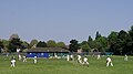
 Big screen at Weston Green - geograph.org.uk - 3099812.jpg 4,000 × 3,000; 2.43 MB
-
 Birchwood Lane - geograph.org.uk - 3572400.jpg 427 × 640; 194 KB
-
 Birchwood Lane - geograph.org.uk - 3582685.jpg 2,592 × 1,936; 2.51 MB
-
 Birchwood Lane on Arbrook Common - geograph.org.uk - 3572426.jpg 640 × 427; 196 KB
-
 Birchwood Lane, Oxshott - geograph.org.uk - 5602362.jpg 1,024 × 683; 297 KB
-
 Birds Hill Drive, Oxshott - geograph.org.uk - 3228602.jpg 2,048 × 1,536; 1.8 MB
-
 Birds Hill, Oxshott Crown Estate - geograph.org.uk - 2183676.jpg 1,600 × 1,200; 998 KB
-
 Blackhills - geograph.org.uk - 3851157.jpg 640 × 480; 116 KB
-
 Blackhills - geograph.org.uk - 3851162.jpg 640 × 480; 82 KB
-
 Bluebell Woods off Pointers Road - geograph.org.uk - 4939582.jpg 2,000 × 1,333; 3.89 MB
-
 Blundel Lane at the junction of Randolph Close - geograph.org.uk - 4147657.jpg 2,560 × 1,920; 2.12 MB
-
 Blundel Lane at the junction of Stoke Road - geograph.org.uk - 4147800.jpg 2,560 × 1,920; 1.97 MB
-
 Blundel Lane, Oxshott - geograph.org.uk - 5700798.jpg 2,034 × 1,526; 1.33 MB
-
 Blundel Lane, Stoke D'Abernon - geograph.org.uk - 4147193.jpg 2,560 × 1,920; 1.9 MB
-
 Blundel Lane, Stoke D'Abernon - geograph.org.uk - 4147782.jpg 2,560 × 1,920; 2.01 MB
-
 Blundel Lane, Stoke D'Abernon - geograph.org.uk - 4147785.jpg 2,560 × 1,920; 1.99 MB
-
 Boat Entering Sunbury Lock - geograph.org.uk - 6429184.jpg 1,024 × 768; 200 KB
-
 Boat houses on Rivermead Island - geograph.org.uk - 5855885.jpg 1,024 × 768; 249 KB
-
 Boathouse on The Lake - geograph.org.uk - 5595431.jpg 3,264 × 2,448; 1.85 MB
-
 Boats by the Bridge - geograph.org.uk - 5035769.jpg 3,877 × 2,715; 2.09 MB
-
 Boats moored at Thames Ditton - geograph.org.uk - 2655953.jpg 640 × 480; 75 KB
-
-
 Boatyard at Wheatley's Eyot - geograph.org.uk - 6677938.jpg 2,685 × 1,729; 1.35 MB
-
 Boatyard on the Thames at Sunbury - geograph.org.uk - 2658713.jpg 640 × 480; 79 KB
-
 Boatyards on Wheatley's Ait - geograph.org.uk - 6429232.jpg 1,024 × 768; 158 KB
-
 Bookham Road - geograph.org.uk - 4146692.jpg 2,001 × 1,500; 1.01 MB
-
 Bookham Road - geograph.org.uk - 4147158.jpg 2,560 × 1,920; 1.93 MB
-
 Bookham Road - geograph.org.uk - 4147679.jpg 2,048 × 1,536; 1.15 MB
-
 Bookham Road - geograph.org.uk - 4147690.jpg 2,048 × 1,536; 1.25 MB
-
 Bookham Road by New Barn Farm - geograph.org.uk - 4147804.jpg 2,560 × 1,920; 1.98 MB
-
 Bookham Road going under the M25 - geograph.org.uk - 4147369.jpg 2,560 × 1,920; 1.98 MB
-
 Bookham Road, Downside - geograph.org.uk - 2387071.jpg 4,320 × 3,240; 4.38 MB
-
 Bookham Road, Downside - geograph.org.uk - 4147820.jpg 2,560 × 1,920; 1.26 MB
-

-
 Boyle Farm Island - geograph.org.uk - 5170052.jpg 3,072 × 2,048; 1.21 MB
-

-
 BP Petrol Pump, Brooklands Museum - geograph.org.uk - 6066092.jpg 2,288 × 4,331; 3.08 MB
-
 Bramble Rise - geograph.org.uk - 3851242.jpg 640 × 480; 92 KB
-
 Bridge 15-11B, Oxshott - geograph.org.uk - 2117536.jpg 2,560 × 1,920; 1.81 MB
-
 Bridge and weir, River Mole - geograph.org.uk - 6457350.jpg 1,024 × 768; 404 KB
-
 Bridge at the western end of Desborough Island - geograph.org.uk - 5360971.jpg 5,202 × 3,465; 3.95 MB
-
 Bridge House and Fontenay - geograph.org.uk - 5710147.jpg 640 × 426; 74 KB
-
 Bridge over A309 - geograph.org.uk - 5172531.jpg 3,072 × 2,048; 1.18 MB
-
 Bridge over old course of River Mole - geograph.org.uk - 6457338.jpg 1,024 × 768; 449 KB
-
 Bridge over River Mole - geograph.org.uk - 3109775.jpg 640 × 480; 106 KB
-
 Bridge over River Mole - geograph.org.uk - 6457154.jpg 1,024 × 768; 403 KB
-
 Bridge over River Thames - geograph.org.uk - 3586811.jpg 1,600 × 1,183; 671 KB
-
 Bridge over the A3 - Esher Common - geograph.org.uk - 4942920.jpg 3,264 × 1,840; 2.26 MB
-
 Bridge over the A3, Claygate - geograph.org.uk - 2748238.jpg 1,600 × 1,200; 619 KB
-
 Bridge over the A3, Oxshott - geograph.org.uk - 2748251.jpg 1,600 × 1,200; 652 KB
-
 Bridge over the Desborough Cut - geograph.org.uk - 4459353.jpg 2,048 × 1,536; 3.02 MB
-
 Bridge over the River Ember - geograph.org.uk - 1924716.jpg 480 × 640; 68 KB
-
 Bridge over the River Wey - geograph.org.uk - 4076940.jpg 2,048 × 1,536; 1.63 MB
-
 Bridge Road roundabout, East Molesey - geograph.org.uk - 5370268.jpg 800 × 657; 134 KB
-
 Bridge to Ditton Island - geograph.org.uk - 1924674.jpg 480 × 640; 107 KB
-
 Bridle bridge on Arbrook Common - geograph.org.uk - 2574911.jpg 427 × 640; 192 KB
-
 Bridleway off Queen's Drive - geograph.org.uk - 2558349.jpg 3,888 × 2,592; 6.95 MB
-
 Bridleway past Limekiln Wood - geograph.org.uk - 2178790.jpg 1,600 × 1,200; 1.85 MB
-
 Bridleway to Queen's Drive - geograph.org.uk - 2558388.jpg 427 × 640; 186 KB
-
 Broad Water - Burwood Park - geograph.org.uk - 4929809.jpg 3,264 × 1,840; 3.82 MB
-
 Broad Water - Burwood Park - geograph.org.uk - 4929822.jpg 3,264 × 1,840; 3.73 MB
-
 Broad Water - geograph.org.uk - 6452741.jpg 5,184 × 3,880; 5.06 MB
-
 Broad Water - geograph.org.uk - 6454607.jpg 6,016 × 4,512; 5.9 MB
-
 Broad Water Walk - geograph.org.uk - 6459184.jpg 6,016 × 4,512; 6.15 MB
-
 Broadfields - geograph.org.uk - 5847095.jpg 1,024 × 768; 311 KB
-
 Brooklands - Barton Bus - geograph.org.uk - 6746840.jpg 4,291 × 2,782; 3.99 MB
-
 Brooklands - Brighton ^ Hove Bus - geograph.org.uk - 6747593.jpg 4,267 × 2,852; 3.76 MB
-
 Brooklands - Bus Gathering - geograph.org.uk - 6747513.jpg 4,433 × 2,252; 3.39 MB
-
 Brooklands - Bus Rally - geograph.org.uk - 6747570.jpg 4,228 × 2,892; 3.59 MB
-
 Brooklands - Clydeside Bus - geograph.org.uk - 6747742.jpg 2,788 × 3,832; 3.4 MB


_gully_feeding_an_off-shoot_of_the_River_Ember_-_geograph.org.uk_-_5847136.jpg)


_-_geograph.org.uk_-_5129301.jpg)


_-_geograph.org.uk_-_6123217.jpg)
_-_geograph.org.uk_-_6123220.jpg)
_-_geograph.org.uk_-_6123221.jpg)
_-_geograph.org.uk_-_6123222.jpg)
_-_geograph.org.uk_-_6123223.jpg)


