Category:Resolis (civil parish)
Jump to navigation
Jump to search
Scottish parish in Highland, Scotland, UK | |||||
| Upload media | |||||
| Instance of | |||||
|---|---|---|---|---|---|
| Named after | |||||
| Location |
| ||||
| Population |
| ||||
| Area |
| ||||
 | |||||
Subcategories
This category has the following 4 subcategories, out of 4 total.
Media in category "Resolis (civil parish)"
The following 200 files are in this category, out of 445 total.
(previous page) (next page)-
 A birdwatcher's view of Udale Bay - geograph.org.uk - 4268246.jpg 3,596 × 2,158; 5.49 MB
-
 A compartment boundary in the Millbuie Forest - geograph.org.uk - 4704266.jpg 1,600 × 1,200; 1.07 MB
-
 A long straight road - geograph.org.uk - 2173035.jpg 640 × 480; 86 KB
-
 A straight forestry road across the Millbuie Forest - geograph.org.uk - 4704257.jpg 1,600 × 1,200; 1.04 MB
-
 Access road at Bog of Cullicudden - geograph.org.uk - 5502109.jpg 1,024 × 576; 120 KB
-
 Access road to West Brae - geograph.org.uk - 4704441.jpg 1,600 × 1,200; 885 KB
-
 Across the Cromarty Firth - geograph.org.uk - 4818599.jpg 640 × 480; 41 KB
-
 Across Udale Bay - geograph.org.uk - 5096034.jpg 3,000 × 2,082; 2.14 MB
-
 Agnes Hill South - geograph.org.uk - 4702703.jpg 1,600 × 1,200; 801 KB
-
 An open part of the Millbuie Forest - geograph.org.uk - 4165641.jpg 1,400 × 1,050; 620 KB
-
 An open section of the Millbuie Forest - geograph.org.uk - 4701418.jpg 1,600 × 1,200; 940 KB
-
 At a junction in the Millbuie Forest track network - geograph.org.uk - 5774785.jpg 1,600 × 1,063; 859 KB
-
 At Balblair Pier - geograph.org.uk - 3539839.jpg 640 × 496; 330 KB
-
 Axis of Wester Brae Long Cairn - geograph.org.uk - 4704415.jpg 1,600 × 1,200; 866 KB
-
 B9160 - geograph.org.uk - 663518.jpg 640 × 426; 87 KB
-
 B9163 by St. Martins - geograph.org.uk - 4367286.jpg 931 × 620; 316 KB
-
 B9163 near Cullicudden - geograph.org.uk - 2008315.jpg 800 × 531; 187 KB
-
 B9163 near Cullicudden - geograph.org.uk - 663650.jpg 640 × 426; 68 KB
-
 B9163 near Toberchurn - geograph.org.uk - 2008312.jpg 800 × 531; 160 KB
-
 Balblair loop road - geograph.org.uk - 2174280.jpg 640 × 480; 103 KB
-
 Balblair Shoreline - geograph.org.uk - 6147683.jpg 640 × 379; 46 KB
-
 Bales in field by Kinbeachie - geograph.org.uk - 4340585.jpg 1,024 × 576; 160 KB
-
 Ballicherry Burn - geograph.org.uk - 4367442.jpg 1,024 × 768; 270 KB
-
 Ballicherry Burn, near Newhall Bridge - geograph.org.uk - 4820755.jpg 1,600 × 1,200; 960 KB
-
 Barley Field - Craigton - geograph.org.uk - 5372505.jpg 800 × 312; 47 KB
-
 Beech tree above St Martins - geograph.org.uk - 4825917.jpg 1,600 × 1,200; 587 KB
-
 Beech tree above St Martins - geograph.org.uk - 4825921.jpg 1,600 × 1,200; 719 KB
-
 Beech trees by St Martins - geograph.org.uk - 4825924.jpg 1,600 × 1,200; 860 KB
-
 Beside the road to Poyntzfield, Black Isle - geograph.org.uk - 4847115.jpg 1,600 × 1,200; 695 KB
-
 Bins lined up at the roadside near Easter Brae - geograph.org.uk - 3716949.jpg 1,600 × 1,200; 529 KB
-
 Birds circling - RSPB Udale Bay - geograph.org.uk - 4676230.jpg 1,600 × 1,200; 604 KB
-
 Black Isle - geograph.org.uk - 2381939.jpg 2,816 × 1,949; 802 KB
-
 Black Isle coastline below Toberchurn - geograph.org.uk - 4824658.jpg 1,600 × 1,202; 489 KB
-
 Blacksmith's works at Newhall - geograph.org.uk - 4133247.jpg 800 × 600; 98 KB
-
 Boat yard Inverbreakie Pier - geograph.org.uk - 5886815.jpg 640 × 364; 73 KB
-
 Boats near Balblair - geograph.org.uk - 4657386.jpg 427 × 640; 94 KB
-
 Boatyard at Inverbreakie Pier - geograph.org.uk - 5474719.jpg 1,600 × 900; 329 KB
-
 Boatyard near Balblair - geograph.org.uk - 4657382.jpg 640 × 427; 94 KB
-
 Braelangwell Wood SSSI - geograph.org.uk - 3704168.jpg 1,200 × 731; 584 KB
-
 Bridge over the Ballycherry Burn - geograph.org.uk - 5497642.jpg 640 × 480; 188 KB
-
 Bridge over the Newhall Burn - geograph.org.uk - 5563292.jpg 640 × 480; 150 KB
-
 Bruichglas trig point near Kinbeachie in the Black Isle - geograph.org.uk - 5855568.jpg 4,000 × 3,000; 4.61 MB
-
 Bus shelter at Mounthigh - geograph.org.uk - 4142063.jpg 1,024 × 614; 281 KB
-
 By a boundary in the Millbuie Forest - geograph.org.uk - 4704299.jpg 1,600 × 1,200; 1.16 MB
-
 Car in the middle of a field - geograph.org.uk - 5543903.jpg 1,600 × 1,048; 338 KB
-
 Caribbean Princess at Invergordon - geograph.org.uk - 5543878.jpg 1,600 × 961; 241 KB
-
 Castle Craig - geograph.org.uk - 3825066.jpg 1,400 × 1,050; 401 KB
-
 Castle Craig - geograph.org.uk - 5365265.jpg 640 × 400; 57 KB
-
 Castle Craig - geograph.org.uk - 5365269.jpg 640 × 400; 93 KB
-
 Castle Craig - geograph.org.uk - 5372426.jpg 640 × 480; 95 KB
-
 Castle Craig - geograph.org.uk - 5372439.jpg 768 × 1,024; 269 KB
-
 Cleared compartment beside the Kingsley Wood Way - geograph.org.uk - 4298522.jpg 1,400 × 1,050; 581 KB
-
 Coast near Balblair - geograph.org.uk - 4657385.jpg 640 × 427; 95 KB
-
 Coastline of the Cromarty Firth below Sheeppark - geograph.org.uk - 4708821.jpg 1,600 × 1,200; 686 KB
-

-
 Cottage at Resolis - geograph.org.uk - 4142144.jpg 1,024 × 614; 131 KB
-
 Cromarty Firth - geograph.org.uk - 5918968.jpg 800 × 366; 64 KB
-
 Cromarty Firth near Alnessferry - geograph.org.uk - 4250921.jpg 1,400 × 1,051; 233 KB
-
 Culbo Mains - geograph.org.uk - 4825657.jpg 1,600 × 900; 540 KB
-
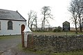
 Cullicudden Church (remains of) - geograph.org.uk - 4250964.jpg 1,400 × 1,050; 424 KB
-
 Date Stones on the bridge over the Udale Burn - geograph.org.uk - 6378453.jpg 1,024 × 768; 301 KB
-

-
 Dilapidated building near Ferryton - geograph.org.uk - 2173168.jpg 640 × 480; 78 KB
-
 Disorganised forest - geograph.org.uk - 3795398.jpg 1,280 × 960; 1.5 MB
-
 Doocot at Braelangwell - geograph.org.uk - 4367428.jpg 800 × 600; 75 KB
-
 Draught horse at Sheeppark - geograph.org.uk - 1039940.jpg 640 × 480; 175 KB
-
 Drive to Braelangwell - geograph.org.uk - 4820706.jpg 1,600 × 1,200; 1.23 MB
-
 Drive to Store House at Ferryton Point - geograph.org.uk - 4028475.jpg 1,400 × 1,051; 640 KB
-
 Easter Badgrinnan - geograph.org.uk - 4825634.jpg 1,600 × 1,200; 666 KB
-
 End of the public road at Mount High - geograph.org.uk - 3716960.jpg 1,600 × 1,200; 553 KB
-
 Entrance gates to Kirkmichael Church - geograph.org.uk - 6250777.jpg 1,249 × 797; 1.42 MB
-
 Entrance to Resolis Church carpark - geograph.org.uk - 663639.jpg 640 × 426; 77 KB
-
 Estate sign announcing the way into Wood of Brae - geograph.org.uk - 4913460.jpg 1,600 × 900; 761 KB
-
 Estate track in Braelangwell, Black Isle - geograph.org.uk - 4701388.jpg 1,600 × 1,200; 839 KB
-
 Estate Track to Braelangwell House - geograph.org.uk - 5497629.jpg 480 × 640; 160 KB
-
 Farm building at Henrietta Park - geograph.org.uk - 4458430.jpg 1,024 × 576; 78 KB
-

-
 Farm buildings at Cullicudden - geograph.org.uk - 2173062.jpg 640 × 480; 68 KB
-
 Farm buildings in the Braelangwell Estate - geograph.org.uk - 4820709.jpg 1,600 × 1,200; 488 KB
-
 Farm buildings near Alnessferry - geograph.org.uk - 2008475.jpg 800 × 531; 173 KB
-
 Farm buildings near Resolis - geograph.org.uk - 2008494.jpg 800 × 531; 181 KB
-
 Farm road near Easter Brae - geograph.org.uk - 3716929.jpg 1,600 × 1,200; 307 KB
-
 Farm road to Mid Ferryton - geograph.org.uk - 2008513.jpg 800 × 531; 154 KB
-
 Farm track near Brae Farm - geograph.org.uk - 3716917.jpg 1,600 × 1,200; 400 KB
-
 Farm track to Poyntzfield - geograph.org.uk - 4847314.jpg 1,600 × 1,200; 803 KB
-
 Farm track to Toberchurn - geograph.org.uk - 2173060.jpg 640 × 480; 71 KB
-
 Farm track, Braelangwell - geograph.org.uk - 4367422.jpg 1,024 × 768; 166 KB
-
 Farming on the Black Isle - October - geograph.org.uk - 5162729.jpg 1,600 × 900; 506 KB
-
 Farmland at Culag - geograph.org.uk - 2008502.jpg 800 × 531; 193 KB
-
 Farmland at Culbo - geograph.org.uk - 3716901.jpg 1,600 × 1,200; 469 KB
-
 Farmland at Newhall House - geograph.org.uk - 2008726.jpg 800 × 531; 266 KB
-
 Farmland at Newhall House - geograph.org.uk - 2008728.jpg 800 × 531; 211 KB
-
 Farmland at Wester Brae - geograph.org.uk - 3716906.jpg 1,600 × 1,200; 375 KB
-
 Farmland below St Martins - geograph.org.uk - 4825892.jpg 1,600 × 900; 735 KB
-
 Farmland below the Milbuie Ridge - geograph.org.uk - 4824627.jpg 1,600 × 1,200; 612 KB
-
 Farmland near Balblair, Ross And Cromarty - geograph.org.uk - 5458547.jpg 1,025 × 1,407; 393 KB
-
 Farmland near Easter Brae - geograph.org.uk - 3716951.jpg 1,600 × 1,200; 454 KB
-
 Farmland near Kinbeachie, Black Isle - geograph.org.uk - 4825650.jpg 1,600 × 900; 446 KB
-
 Farmland of Springfield and Cullicudden - geograph.org.uk - 4704461.jpg 1,600 × 1,200; 556 KB
-
 Festoons of lichens, Millbuie Forest - geograph.org.uk - 4790803.jpg 1,600 × 1,200; 948 KB
-
 Field at Craigton - geograph.org.uk - 2172995.jpg 640 × 480; 74 KB
-
 Field at Easter Culbo - geograph.org.uk - 4458698.jpg 1,024 × 576; 101 KB
-
 Field near Alnessferry Farm - geograph.org.uk - 2008360.jpg 800 × 531; 279 KB
-
 Field near Easter Brae - geograph.org.uk - 4458443.jpg 1,024 × 585; 94 KB
-
 Field near Kinbeachie - geograph.org.uk - 2008247.jpg 800 × 531; 208 KB
-
 Field overlooking the Cromarty Firth - geograph.org.uk - 2172998.jpg 640 × 490; 60 KB
-

-
 Fields and buildings at Brae Farm - geograph.org.uk - 3716918.jpg 1,600 × 1,200; 346 KB
-
 Fields at Ferryton - geograph.org.uk - 2173119.jpg 640 × 480; 51 KB
-
 Fields at Ferryton - geograph.org.uk - 2173130.jpg 640 × 480; 46 KB
-
 Fields at St Martins, Black Isle - geograph.org.uk - 4825909.jpg 1,600 × 1,200; 851 KB
-
 Fields beside St Michael's Church - geograph.org.uk - 5543894.jpg 1,600 × 1,067; 330 KB
-
 Fields by Balblair - geograph.org.uk - 5831341.jpg 3,000 × 2,015; 2.86 MB
-
 Flooded track - geograph.org.uk - 3795437.jpg 1,280 × 1,707; 2.38 MB
-
 Floor of the Millbuie Forest - geograph.org.uk - 4704245.jpg 1,600 × 1,200; 1,017 KB
-
 Flourishing verge to a forest track, Millbuie Forest - geograph.org.uk - 4790814.jpg 1,600 × 1,200; 1.08 MB
-
 Footpath at Burnside - geograph.org.uk - 5563309.jpg 1,024 × 530; 187 KB
-
 Footpath Markers Castle Craig - geograph.org.uk - 5365276.jpg 1,024 × 768; 273 KB
-
 Ford and footbridge at Agnes Hill - geograph.org.uk - 3704156.jpg 1,200 × 913; 713 KB
-
 Ford at Agneshill - geograph.org.uk - 5613125.jpg 1,024 × 466; 166 KB
-
 Ford on the Braelangwell Burn - geograph.org.uk - 4367415.jpg 600 × 800; 117 KB
-
 Foreshore near Craigton - geograph.org.uk - 4892541.jpg 1,024 × 576; 132 KB
-
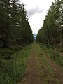
 Forest footpath - geograph.org.uk - 3795434.jpg 1,280 × 1,707; 2.31 MB
-
 Forest track - geograph.org.uk - 6232307.jpg 768 × 1,024; 329 KB
-
 Forest track - geograph.org.uk - 6232312.jpg 768 × 1,024; 214 KB
-
 Forest track above Wood of Brae - geograph.org.uk - 4367298.jpg 800 × 600; 139 KB
-
 Forest track by Wester Culbo Wood - geograph.org.uk - 3898228.jpg 1,024 × 768; 349 KB
-
 Forest track junction - geograph.org.uk - 3795415.jpg 1,280 × 960; 1.47 MB
-
 Forest track near Easter Toberchurn - geograph.org.uk - 2008304.jpg 800 × 531; 266 KB
-
 Forest track near Mount High - geograph.org.uk - 5356180.jpg 1,024 × 768; 185 KB
-
 Forest track near Poyntzfield - geograph.org.uk - 5355651.jpg 1,024 × 768; 177 KB
-
 Forest track, Millbuie Forest - geograph.org.uk - 4367303.jpg 800 × 600; 151 KB
-
 Forest track, Millbuie Forest - geograph.org.uk - 4367375.jpg 800 × 600; 107 KB
-
 Forest track, Millbuie Forest - geograph.org.uk - 4367394.jpg 800 × 600; 140 KB
-
 Forest track, Millbuie Forest - geograph.org.uk - 4367398.jpg 800 × 600; 155 KB
-
 Forestry by Agneshill - geograph.org.uk - 5614585.jpg 640 × 300; 88 KB
-
 Forestry road in Millbuie Forest - geograph.org.uk - 5774768.jpg 1,600 × 1,066; 850 KB
-
 Forestry road into Wester Culbo Wood - geograph.org.uk - 3716894.jpg 1,600 × 1,200; 691 KB
-
 Forestry road into Wester Culbo Wood - geograph.org.uk - 3716896.jpg 1,600 × 1,200; 684 KB
-
 Forestry road near Mount High - geograph.org.uk - 3716978.jpg 1,600 × 1,200; 471 KB
-
 Forestry Road near Mounthigh - geograph.org.uk - 4790789.jpg 1,600 × 1,200; 645 KB
-

-
 Forestry road through the Millbuie Forest - geograph.org.uk - 4702746.jpg 1,600 × 1,200; 1.01 MB
-

-
 Forestry track near Mount High - geograph.org.uk - 3716992.jpg 1,600 × 1,200; 396 KB
-
 Former Church Hall Jemimaville - geograph.org.uk - 6361186.jpg 800 × 800; 158 KB
-
 Former Church Hall Jemimaville - geograph.org.uk - 6361422.jpg 1,024 × 768; 262 KB
-
 Former School at Newhall - geograph.org.uk - 3548398.jpg 1,440 × 964; 545 KB
-
 Former Schoolhouse at Newhall - geograph.org.uk - 4133245.jpg 800 × 600; 122 KB
-
 Frosted field at Upperwood - geograph.org.uk - 5202443.jpg 1,600 × 1,198; 763 KB
-
 Gated track - geograph.org.uk - 3795381.jpg 1,280 × 960; 1.68 MB
-
 Gean and ruin at Agneshill - geograph.org.uk - 5774761.jpg 1,600 × 1,063; 1.01 MB
-
 Glade in the Millbuie Forest - geograph.org.uk - 4702729.jpg 1,600 × 1,200; 752 KB
-
 Glade in the Millbuie Forest - geograph.org.uk - 5772746.jpg 1,600 × 1,202; 904 KB
-
 Glade in the Millbuie Forest - geograph.org.uk - 5772750.jpg 1,600 × 900; 590 KB
-

-
 Grants of Ardoch mausoleum - geograph.org.uk - 5543943.jpg 1,600 × 1,034; 345 KB
-

-
 Grave slab, Kirkmichael - geograph.org.uk - 6250768.jpg 1,280 × 852; 2.05 MB
-
 Grave slab, Kirkmichael - geograph.org.uk - 6250769.jpg 1,280 × 852; 1.73 MB
-
 Graveyard of St Michael's Kirk - geograph.org.uk - 5474678.jpg 1,600 × 1,201; 752 KB
-
 Grazing land at Sheeppark - geograph.org.uk - 2174265.jpg 640 × 480; 70 KB
-
 Gulls over field at Culbo - geograph.org.uk - 4340575.jpg 1,024 × 576; 106 KB
-
 Harvested field, Black Isle - geograph.org.uk - 4669251.jpg 1,600 × 1,200; 340 KB
-
 Haybales at Culbo - geograph.org.uk - 902327.jpg 640 × 426; 49 KB
-
 Head of Udale Bay, Black Isle - geograph.org.uk - 1247540.jpg 640 × 426; 87 KB
-
 Heading out from the farm at St Martins, Black Isle - geograph.org.uk - 4825898.jpg 1,600 × 1,200; 700 KB
-

-
 High water at the RSPB Udale Bay Reserve - geograph.org.uk - 4333658.jpg 1,400 × 1,053; 555 KB
-
 Highland coastline on the Black Isle - geograph.org.uk - 1347098.jpg 425 × 640; 115 KB
-

-
 HMS Queen Elizabeth - geograph.org.uk - 5515494.jpg 640 × 400; 93 KB
-
 Hooded Crow - geograph.org.uk - 5566970.jpg 640 × 640; 63 KB
-
 House at Wood of Brae from the track towards Agneshill - geograph.org.uk - 5774614.jpg 1,600 × 1,066; 652 KB
-
 Houses beside Newhall Point - geograph.org.uk - 5543805.jpg 1,600 × 1,049; 345 KB
-
 Houses near Newhall Point - geograph.org.uk - 5101889.jpg 640 × 427; 359 KB
-
 Inside Kirkmichael - geograph.org.uk - 5733572.jpg 1,600 × 1,200; 388 KB
-
 Inside Kirkmichael, Black Isle - geograph.org.uk - 5733577.jpg 1,600 × 1,200; 333 KB
-
 Inverbreakie Pier - geograph.org.uk - 5370234.jpg 640 × 480; 89 KB
-
 It's in there somewhere - geograph.org.uk - 3795060.jpg 1,280 × 960; 1.55 MB
-
 Jemimaville Village - geograph.org.uk - 6349189.jpg 800 × 500; 109 KB
-
 Jemimaville Village Pump - geograph.org.uk - 6348346.jpg 800 × 600; 210 KB
-

-

-
 Junction off the track - geograph.org.uk - 3795422.jpg 1,280 × 960; 1.38 MB
-
 Junction with the B9163 near Craigton - geograph.org.uk - 4892572.jpg 1,024 × 576; 149 KB
-
 Junction with the track to Wood of Brae - geograph.org.uk - 4367289.jpg 960 × 768; 435 KB
-
 Kinbeachie road end - geograph.org.uk - 5502090.jpg 1,024 × 576; 117 KB
-
 Kingsley Wood Way - geograph.org.uk - 4165655.jpg 1,400 × 1,050; 582 KB
-
 Kirkmichael after restoration - geograph.org.uk - 5474499.jpg 1,600 × 1,201; 733 KB
-
 Kirkmichael Burial Ground - geograph.org.uk - 2281852.jpg 1,000 × 669; 220 KB
-
 Kirkmichael Church - geograph.org.uk - 5543919.jpg 1,600 × 1,053; 344 KB
-
 Kirkmichael Church - geograph.org.uk - 5543925.jpg 1,600 × 1,055; 314 KB
-
 Kirkmichael Church - geograph.org.uk - 5543966.jpg 1,600 × 1,067; 273 KB
-
 Kirkmichael Church - geograph.org.uk - 6250772.jpg 1,280 × 852; 936 KB
-
 Kirkmichael Church - geograph.org.uk - 6250774.jpg 1,280 × 852; 1.03 MB
-
 Kirkmichael Church and graveyard - geograph.org.uk - 5851088.jpg 3,968 × 2,976; 2.09 MB
-
 Kirkmichael graveyard - geograph.org.uk - 2174439.jpg 640 × 480; 69 KB
-
 Kirkmichael Graveyard, Blablair - geograph.org.uk - 5733583.jpg 1,600 × 1,079; 532 KB
-
 Kirkmichael Trust Information Boards - geograph.org.uk - 5885404.jpg 1,184 × 1,000; 442 KB


_-_geograph.org.uk_-_4250964.jpg)


&filefrom=Kirkmichael%2C+Balblair+-+geograph.org.uk+-+5733567.jpg#mw-category-media)