Category:Rail transport maps of Saint Petersburg
Jump to navigation
Jump to search
Federal subjects of the Russian Federation:
Republics: Buryatia ·Krais: Krasnoyarsk ·
Oblasts:
Federal cities: Moscow · Saint Petersburg ·
Autonomous oblast:
Autonomous okrugs:
Subcategories
This category has the following 2 subcategories, out of 2 total.
S
T
- Tram maps of Saint Petersburg (17 F)
Media in category "Rail transport maps of Saint Petersburg"
The following 15 files are in this category, out of 15 total.
-
 Connecting Line.png 1,733 × 1,246; 3.51 MB
-
 Kresty semi-station Petersburg.png 3,063 × 1,518; 2.18 MB
-
 MOZhD by year.svg 600 × 900; 1.03 MB
-
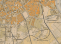
 Peterburg railway junctions? early 1880-ies.png 2,732 × 1,348; 2.38 MB
-
 Petrogradskiy uzel 1914.png 1,064 × 1,041; 903 KB
-
 Putilov Bahnstrecke in Petersburg, 1912.jpg 3,100 × 1,188; 958 KB
-
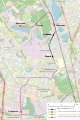
 Railway-osm-mozd-kupchino.png 917 × 1,507; 748 KB
-
 Railway-osm-mozd-ozerki.png 465 × 487; 154 KB
-
 Saint Petersburg public transport system map (with stations).png 7,670 × 11,149; 37.58 MB
-
 Saint Petersburg railways from OpenRailwayMap.png 1,530 × 1,032; 1.09 MB
-
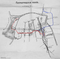
 Soedinitelnaya Vetka in Petersburg (1884).jpg 2,400 × 799; 590 KB
-
 Tsarskoye Selo railway map 400.png 400 × 398; 46 KB
-
 Yuzhnaya Portovaya Vetv.png 2,463 × 1,031; 2.06 MB
-
 Могила Н.И. Путилова на плане СПб 1888 года.jpg 1,504 × 2,200; 2.19 MB
-
 Южное железнодорожное полукольцо Петербурга location map.svg 618 × 347; 259 KB


.png)
.jpg)