Category:Public transport maps of Saint Petersburg
Jump to navigation
Jump to search
Subcategories
This category has the following 3 subcategories, out of 3 total.
Media in category "Public transport maps of Saint Petersburg"
The following 13 files are in this category, out of 13 total.
-
 AquabusScheme.svg 3,579 × 3,437; 513 KB
-
 Len1933 tr.jpg 3,054 × 4,333; 1.46 MB
-
 MOZhD by year.svg 600 × 900; 1.03 MB
-
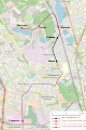
 Railway-osm-mozd-kupchino.png 917 × 1,507; 748 KB
-
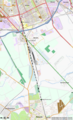
 Railway-osm-mozd-ozerki.png 465 × 487; 154 KB
-
 Saint Petersburg public transport system map (with stations).png 7,670 × 11,149; 37.58 MB
-
 Saint Petersburg Ring Road.PNG 925 × 966; 793 KB
-
 Saint Petersburg Trolley System Map.svg 2,451 × 3,000; 3.77 MB
-
 Saint Petersburg Trolleybus System OSM Map.svg 3,750 × 3,750; 4.77 MB
-
 Sankt-Peterburg trolleybus routes map 2012.svg 744 × 1,052; 6.61 MB
-
 Slavyanka tram network plan 2024.png 11,325 × 14,850; 73.02 MB
-
 Spbtb1939.gif 1,411 × 1,811; 32 KB
-
 Spbtb1956.gif 1,493 × 2,205; 69 KB


.png)