Category:Rail transport maps of India
Jump to navigation
Jump to search
States of India: Andhra Pradesh · Assam · Bihar · Chhattisgarh · Gujarat · Haryana · Karnataka · Kerala · Madhya Pradesh · Maharashtra · Odisha · Tamil Nadu · Telangana · Uttar Pradesh · West Bengal
Union territories: Jammu and Kashmir · Puducherry
Former states of India:
Former union territories:
Union territories: Jammu and Kashmir · Puducherry
Former states of India:
Former union territories:

Subcategories
This category has the following 8 subcategories, out of 8 total.
Media in category "Rail transport maps of India"
The following 59 files are in this category, out of 59 total.
-

-
 2005 Indian railways gauges-blank.png 1,090 × 1,223; 56 KB
-
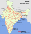 2005 Indian Railways network-de.png 500 × 552; 62 KB
-
 2005 Indian Railways network-en.png 500 × 552; 57 KB
-
 2005 Indian Railways network-fr.png 500 × 552; 36 KB
-

-
 509 of 'The International Geography. ... Edited by H. R. Mill' (11169559464).jpg 839 × 1,115; 274 KB
-
 Cities of South India with Highway and Railway Network Map.png 1,400 × 1,331; 750 KB
-
 Diesel Locomotive Sheds of Indian Railways location map.png 1,519 × 1,773; 192 KB
-
 Electric Locomotive Sheds of Indian Railways location map 01.png 1,519 × 1,773; 191 KB
-
 Gondia map.jpg 504 × 360; 73 KB
-
 Great Indian Peninsula Railway 1870.png 3,319 × 3,244; 98 KB
-
 Highway and Railway Map of India OSM.png 2,000 × 2,230; 4.03 MB
-
 India HSR potential route.png 669 × 650; 81 KB
-
 India Rail Lines 1955.jpg 2,320 × 2,964; 1.45 MB
-
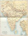
 India Railways map.jpg 1,951 × 2,447; 2.11 MB
-
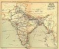 India railways1909a.jpg 1,322 × 1,103; 336 KB
-
 India- The Bengal-Nagpur Railway - DPLA - 58caf37c814885a448a25012ce50a15f.jpg 3,429 × 3,330; 1.36 MB
-
 Indian Midland Railway (map).jpg 4,994 × 3,848; 3.99 MB
-
 Indian Railway network 1893.jpg 985 × 1,273; 242 KB
-
 Indian Railway network.jpg 1,000 × 1,125; 351 KB
-
 Indian Railways DFC.png 1,000 × 1,138; 89 KB
-
 Indian Railways Duronto map.gif 892 × 1,050; 23 KB
-
 Indian Railways Map.JPG 2,768 × 3,448; 4.59 MB
-
 Indian Railways Network Connectivity Map with cities and population density.png 1,500 × 1,555; 1,000 KB
-
 Indian Railways network-de.svg 675 × 738; 2.19 MB
-
 Indian Railways network-en.svg 675 × 738; 2.18 MB
-
 Indian Railways network-fr.svg 675 × 738; 2.19 MB
-
 Indian Railways Reachability Map.png 1,230 × 1,282; 1.01 MB
-
 IndianRailways1871b.jpg 1,018 × 1,331; 976 KB
-
 Indianrailwayzones-blank.png 500 × 558; 29 KB
-
 Indianrailwayzones-numbered-bn.svg 500 × 563; 98 KB
-
 Indianrailwayzones-numbered.png 500 × 563; 33 KB
-
 Indianrailwayzones-numbered.svg 500 × 563; 96 KB
-
 Indianrailwayzones-without number.svg 500 × 563; 86 KB
-
 IndiaRailwaysCompletedBy1871.jpg 1,228 × 1,350; 276 KB
-
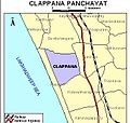 Klm-clappana.jpg 342 × 326; 51 KB
-
 Map of Indian Railways, 1882.jpg 1,524 × 1,943; 2.39 MB
-
 Mapa dos caminhos de ferro em Portugal 1895.jpg 2,382 × 3,892; 8.51 MB
-
 Mumbai Metropolitan Railway Schematic Map (simplified).svg 542 × 772; 2.36 MB
-
 Mumbai Metropolitan Railway Schematic Map.svg 744 × 1,052; 535 KB
-
 NDLS-Kanpur-.DDU-Daltonganj-Ranchi railway route.gif 650 × 443; 41 KB
-
 Proposed Bhutan Rail Connections.png 1,605 × 1,028; 2.24 MB
-
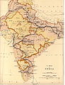
 Railway map 1912.jpg 2,073 × 2,838; 2.74 MB
-
 Railway map india ILN 1865.jpg 974 × 1,107; 782 KB
-
 Railway network map of India - Schematic.png 2,282 × 2,500; 928 KB
-
 Railway network map of India - Schematic.svg 879 × 965; 865 KB
-
 Railway network of India.png 1,000 × 1,138; 130 KB
-
 Railway Network of South Asia Map 2014.png 3,507 × 2,480; 6.81 MB
-
 Railways and airports in india.png 1,457 × 1,406; 1,006 KB
-
 Rapid Transit Map of Delhi.jpg 6,675 × 4,808; 17.08 MB
-
 Rapid transit map of Mumbai.jpg 4,150 × 6,363; 5.82 MB
-
 Trainroute.jpg 330 × 587; 23 KB
-
 Urban Transit in India bn.svg 512 × 652; 5.77 MB
-
 Urban Transit in India New.svg 6,859 × 8,733; 3.5 MB
-
 Urban Transit in India.svg 6,859 × 8,733; 3.45 MB
-
 Urban Transit Systems in India-bn.svg 1,486 × 1,734; 323 KB
-
 Urban Transit Systems in India.jpg 6,859 × 8,733; 2.47 MB
-
 Urban Transit Systems in India.svg 1,486 × 1,734; 317 KB
.jpg)


%27_(11204570565).jpg)
.jpg)


.jpg)


.svg)


