Category:Rail transport maps of Haute-Garonne
Jump to navigation
Jump to search
Media in category "Rail transport maps of Haute-Garonne"
The following 10 files are in this category, out of 10 total.
-
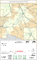
 Railway map of France - 31 - 1870 - fr - small.svg 705 × 1,126; 6.32 MB
-
 Railway map of France - 31 - 1890 - fr - small.svg 705 × 1,126; 6.36 MB
-
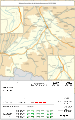
 Railway map of France - 31 - 1900 - fr - small.svg 705 × 1,126; 6.38 MB
-
 Railway map of France - 31 - 1914 - fr - small.svg 705 × 1,126; 6.6 MB
-
 Railway map of France - 31 - 1930 - fr - small.svg 705 × 1,126; 6.66 MB
-
 Railway map of France - 31 - 1939 - fr - small.svg 705 × 1,126; 6.59 MB
-
 Railway map of France - 31 - 1960 - fr - small.svg 705 × 1,126; 6.57 MB
-
 Railway map of France - 31 - 1980 - fr - small.svg 705 × 1,126; 6.57 MB
-
 Railway map of France - 31 - 2000 - fr - small.svg 705 × 1,126; 6.6 MB
-
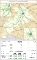
 Railway map of France - 31 - 2020 - fr - small.svg 705 × 1,126; 6.47 MB


