Category:Rail transport maps of Gard
Jump to navigation
Jump to search
Media in category "Rail transport maps of Gard"
The following 9 files are in this category, out of 9 total.
-
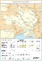
 Railway map of France - 30 - 1850 - fr - small.svg 705 × 1,020; 5.02 MB
-
 Railway map of France - 30 - 1880 - fr - small.svg 705 × 1,020; 5.12 MB
-
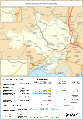
 Railway map of France - 30 - 1900 - fr - small.svg 705 × 1,020; 5.22 MB
-
 Railway map of France - 30 - 1930 - fr - small.svg 705 × 1,020; 5.31 MB
-
 Railway map of France - 30 - 1950 - fr - small.svg 705 × 1,020; 5.29 MB
-
 Railway map of France - 30 - 1980 - fr - small.svg 705 × 1,020; 5.27 MB
-
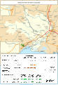
 Railway map of France - 30 - 2001 - fr - small.svg 705 × 1,020; 5.28 MB
-
 Railway map of France - 30 - 2020 - fr - small.svg 705 × 1,020; 5.1 MB
-
 Railway map of France - 30 - animated - fr.gif 1,566 × 2,266; 6.01 MB


