Category:Radio navigation
Appearance
navigation using radio signals | |||||
| Upload media | |||||
| Subclass of | |||||
|---|---|---|---|---|---|
| Said to be the same as | radiodetermination | ||||
| |||||
Subcategories
This category has the following 22 subcategories, out of 22 total.
A
B
- Butler matrix (9 F)
C
- Corner reflectors (55 F)
D
- Decca Navigator System (33 F)
F
- FuG28a Knickebein (5 F)
- FuSAn 724 Bernhard (4 F)
G
- Gee (navigation) (6 F)
- Gee-H (navigation) (1 F)
I
L
N
O
P
- Peilturm Kap Arkona (65 F)
R
- RSBN (3 F)
S
T
V
W
Media in category "Radio navigation"
The following 89 files are in this category, out of 89 total.
-
-TACAN-RPG-PAM.png 1,027 × 604; 108 KB
-
20220517 Radiobaken1 Eelde Airport Onnerpolder.jpg 5,053 × 3,368; 3.66 MB
-
20220517 Radiobaken2 Eelde Airport Onnerpolder.jpg 5,184 × 3,456; 4.87 MB
-
A-N-signals.png 610 × 254; 1 KB
-
AIMFig 1 1 19.gif 550 × 327; 25 KB
-
Alpha (radionavigazione) websdr recording 2014-01-02T19 29 04Z 14.9kHz.ogg 1 min 27 s; 306 KB
-
AN APN-4 display in Consolidated Canso.png 1,000 × 1,269; 1,007 KB
-
Anten yayınımı.jpg 745 × 528; 20 KB
-
ARK zpracovaní signálu.svg 512 × 384; 191 KB
-
Balise aerienne Skeyes Olne.jpg 4,864 × 3,648; 3.2 MB
-
Blind landing system.jpg 3,500 × 5,365; 945 KB
-
Comparison of radio navigation systems in aviation.webp 1,240 × 620; 118 KB
-
Consol-Sonne.ogg 42 s; 118 KB
-
Dials for blind landing aircraft.jpg 5,260 × 4,311; 1.5 MB
-
DME system block schema.svg 810 × 324; 124 KB
-
Dopfrp.svg 590 × 500; 27 KB
-
Dopsirp.png 519 × 539; 12 KB
-
Eliminace snosu větrem s využitím ARK.svg 512 × 384; 136 KB
-
F0101008.gif 550 × 697; 22 KB
-
F0101010.gif 550 × 680; 32 KB
-
FAA VHF Omnidirectional Radio Range Site Carleton Michigan.JPG 4,749 × 2,778; 3.98 MB
-
Frequency modulated radiofrequency altimeter.svg 765 × 385; 155 KB
-
Funkce ARK.svg 900 × 650; 110 KB
-
Gdańsk – Wieża radionawigacyjna 20220418 141630 ubt.jpg 3,172 × 1,784; 2.97 MB
-
Goniometr automatického rádiového kompasu.jpg 686 × 686; 64 KB
-
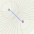
Hyperbelkarte.svg 1,500 × 1,200; 22 KB
-
Hyperbelkarte1.svg 1,500 × 1,200; 17 KB
-
Hyperbelkarte2.svg 1,500 × 1,200; 9 KB
-
Hyperbelkarte3.svg 1,500 × 1,200; 24 KB
-
Hyperbelkarte4.svg 1,500 × 1,200; 13 KB
-
Hyperbelkarte5.svg 1,500 × 1,200; 10 KB
-
Hyperbelkarte6.svg 1,500 × 1,200; 17 KB
-
Hyperbelnavigation Function 1.png 1,600 × 1,500; 319 KB
-
Hyperbelnavigation Function 2.png 1,600 × 1,500; 341 KB
-
Hyperbelnavigation Function 2SVG.svg 800 × 800; 41 KB
-
ILA 2018, Schönefeld (1X7A5524).jpg 2,560 × 1,444; 1.59 MB
-
Impulse radiofrequency altimeter block schema.svg 727 × 339; 64 KB
-
Indikované veličiny ARK.svg 512 × 384; 180 KB
-
Iperboli TDOA.jpg 1,097 × 656; 117 KB
-
JOT-LFR.png 1,472 × 2,288; 4.27 MB
-
K-29 trailer for SCR-277 radio navigation.jpg 1,089 × 826; 632 KB
-
Landing beacon indicator and control panel.jpg 4,373 × 3,334; 1.02 MB
-
LFR-photo.jpg 246 × 131; 4 KB
-
LORAN R-65 APN-9.jpg 1,960 × 4,032; 3.12 MB
-
LORAN-A radio signal.jpg 590 × 165; 15 KB
-
Lorenz beam.svg 555 × 215; 6 KB
-
Luchtvaartbaken Grazen.jpg 4,640 × 2,877; 2.99 MB
-
Microwave Landing System.svg 550 × 680; 4 KB
-
NavigationResearch 001.jpg 5,302 × 4,824; 23.07 MB
-
NavigationResearch 002.jpg 5,443 × 3,874; 14.4 MB
-
NavigationResearch 003.jpg 3,869 × 2,789; 7.47 MB
-
NavigationResearch 004.jpg 5,002 × 3,291; 11.65 MB
-
NavigationResearch 005.jpg 4,461 × 3,817; 16.13 MB
-
NavigationResearch 006.jpg 4,671 × 3,066; 10.66 MB
-
NavigationResearch 007.jpg 5,062 × 3,652; 15.46 MB
-
NavigationResearch 008.jpg 4,596 × 3,141; 10.2 MB
-
NavigationResearch 009.jpg 5,693 × 4,554; 21.12 MB
-
NavigationResearch 010.jpg 3,695 × 2,043; 5.44 MB
-
NavigationResearch 011.jpg 3,139 × 5,967; 16.2 MB
-
NavigationResearch 019.jpg 4,701 × 5,741; 20.72 MB
-
NavigationResearch 020.jpg 3,199 × 5,260; 15.1 MB
-
Oboe control room.jpg 370 × 264; 38 KB
-
Oboe illustration.jpg 800 × 581; 57 KB
-
Radio beacon Grazen.jpg 3,302 × 2,504; 1.21 MB
-
Radio Fix on 1 Station.svg 300 × 475; 62 KB
-
Radio Fix on 2 Stations.svg 600 × 475; 104 KB
-
RSDN-A-723-Tu-154B.jpg 1,200 × 800; 221 KB
-
SRMF 60-62 approach beacon and Bekker 12-50 F radio.JPG 3,456 × 5,184; 6.71 MB
-
Syg LORAN.JPG 387 × 92; 8 KB
-
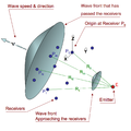
TDOA Geometry-ru.svg 751 × 443; 35 KB
-
TDOA Geometry.png 1,350 × 1,350; 136 KB
-
TDOA2.jpg 282 × 176; 16 KB
-
Telefunken Kompass Sender 01.gif 866 × 866; 892 KB
-
Telefunken1.jpg 720 × 908; 95 KB
-
TLS GCA console surveillance.JPG 1,201 × 991; 93 KB
-
TLS PAR console all in view.JPG 1,202 × 993; 47 KB
-
TLS PAR console approach.JPG 1,202 × 989; 63 KB
-
Transportable TLS.jpg 3,264 × 2,448; 1.64 MB
-
TTLS 2009 undisclosed USAF location.JPG 2,592 × 1,944; 1.33 MB
-
Unit 62A (Oboe).jpg 2,272 × 1,704; 2.06 MB
-
Us-gov-publication-117-radio-navigation-aids.png 520 × 674; 79 KB
-
VOR instrument OBI 2.png 458 × 458; 34 KB
-
VOR instrument OBI.png 458 × 458; 34 KB
-
VOR orientation.png 500 × 500; 19 KB
-
VORDME-Orsk.jpg 1,100 × 800; 199 KB
-
X-Gerät v3.svg 281 × 661; 947 KB
-
Ψ křivka letu.svg 512 × 384; 293 KB
-
Джигит Илья Семенович.jpg 924 × 1,277; 230 KB
-
Курсовой радиомаяк крм-100 и крм-300 - panoramio.jpg 2,112 × 2,816; 3.46 MB


