Category:Navigational aids
Jump to navigation
Jump to search
English: Category:Navigational aids. A navigational aid (also known as aid to navigation or navaid) is any sort of marker which aids the traveler in navigation; the term is most commonly used to refer to nautical or aviation travel. Common types of such aids include lighthouses, buoys, fog signals, and daymarks.
Nederlands: Categorie:Navigatievoorzieningen. Een categorie voor navigatievoorzieningen voor de scheep- en luchtvaart: alle soorten van oriëntatiepunten die de navigator ten dienste staan: vuurtorens, bakens, boeien, mistsignalen etc.
marker that assists a traveler in navigation | |||||
| Upload media | |||||
| Subclass of |
| ||||
|---|---|---|---|---|---|
| Has use | |||||
| |||||
Subcategories
This category has the following 17 subcategories, out of 17 total.
*
+
A
B
D
F
G
- Graphomètre (6 F)
I
N
- Navigational aids in GDR (52 F)
P
- NAVAID pictograms (7 F)
R
S
T
- Traverse tables (2 F)
Media in category "Navigational aids"
The following 68 files are in this category, out of 68 total.
-
2D Mlat Service Area v2.jpg 624 × 614; 118 KB
-
49km - geograph.org.uk - 1432619.jpg 640 × 479; 155 KB
-
750mm Navigation Buoy with Marine Lantern.jpg 1,072 × 1,280; 168 KB
-
750mm Navigation Buoy.jpg 2,592 × 1,728; 1.47 MB
-
Ambrose Channel pilot cable in action.PNG 363 × 229; 99 KB
-
AvisoNavegantes.jpg 2,112 × 2,816; 4.44 MB
-
Avon signal.jpg 2,536 × 3,913; 1.78 MB
-
Bankeck-EBV.JPG 1,075 × 817; 1.16 MB
-
Beacon above Plymouth Sound - geograph.org.uk - 1579711.jpg 640 × 420; 62 KB
-
Beacons-ble-module.jpg 226 × 246; 37 KB
-
Borda-repeating-circle.svg 454 × 341; 19 KB
-
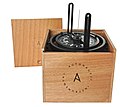
Boxed Pelorus.jpg 1,093 × 978; 297 KB
-
Bris.jpg 699 × 753; 36 KB
-
Chip-log01.png 400 × 144; 985 bytes
-
Compass Rose 32 Points.png 1,303 × 1,299; 515 KB
-
Corp1134 - Flickr - NOAA Photo Library.jpg 1,636 × 1,168; 1.23 MB
-
Course (navigation).svg 1,072 × 258; 62 KB
-
Course and Heading German.svg 800 × 475; 47 KB
-
Course and Heading.svg 800 × 475; 95 KB
-
Course Heading Track NoLang.svg 800 × 475; 35 KB
-
Course Heading Track.png 849 × 536; 96 KB
-
Coursptbtrp.png 510 × 464; 82 KB
-
Deducang.jpg 404 × 417; 9 KB
-
Depth marker, Ria Formosa, Faro, Portugal julesvernex2.jpg 2,963 × 3,952; 2.79 MB
-
Doublethumbs.jpg 195 × 196; 13 KB
-
Ecobarrier Mooring Buoys EMB650 - 1.jpg 2,592 × 1,728; 614 KB
-
Ecomoor Synthetic Mooring.jpg 4,000 × 3,000; 3.11 MB
-
HM55B.jpg 359 × 244; 18 KB
-
Hochspannungs-Flächenleuchte Seekanal Rostock 1978 J.Schmehl.jpg 4,195 × 2,802; 948 KB
-
Honda internavi Ver.11 User interface.jpg 4,912 × 3,264; 2.75 MB
-
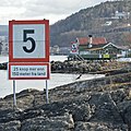
Hovedøya Shore - Oslo, Norway 2021-03-25.jpg 3,075 × 3,075; 6.34 MB
-
Kapen van Rottum -1800.jpg 300 × 303; 45 KB
-
Kortmaal M70.jpg 3,088 × 3,158; 11.47 MB
-
Landegassenboje bearb um 1975 Archiv WSA Stralsund.jpg 1,818 × 1,228; 421 KB
-
Laspotech.jpg 1,080 × 809; 119 KB
-
Leitfeuer Mukran mit Raconbake 1987 Archiv WSA Stralsund.jpg 1,074 × 1,523; 341 KB
-
Magneticdeclination.jpg 768 × 738; 86 KB
-
Marine Lantern for Buoys.jpg 5,143 × 2,893; 2.04 MB
-
Mil estimation.jpg 445 × 664; 65 KB
-
Model Si Nan of Han Dynasty.jpg 839 × 573; 300 KB
-
Moire-Leitmarke seitliche Abweichung 1988 Archiv WSA Stralsund.jpg 681 × 690; 83 KB
-
Mooring Buoy.jpg 2,592 × 1,728; 613 KB
-
Most generála Chábery, Litoměřice, 2020 (07).jpg 4,272 × 2,848; 4.54 MB
-
Most generála Chábery, Litoměřice, 2020 (08).jpg 4,272 × 2,848; 4.07 MB
-
Most generála Chábery, Litoměřice, 2020 (09).jpg 4,272 × 2,848; 4.4 MB
-
Most generála Chábery, Litoměřice, 2020 (10).jpg 4,272 × 2,848; 5.06 MB
-
Most generála Chábery, Litoměřice, 2020 (11).jpg 4,272 × 2,848; 4.23 MB
-
Most generála Chábery, Litoměřice, 2020 (12).jpg 4,272 × 2,848; 4.5 MB
-
Nairne & blunt barometer.jpg 546 × 2,000; 228 KB
-
Navcourp.svg 695 × 633; 14 KB
-
NavGuide.jpg 822 × 524; 128 KB
-
Navigation marks - geograph.org.uk - 1386241.jpg 640 × 479; 76 KB
-
Pilote automatique.JPG 4,724 × 3,502; 3.63 MB
-
Readyaid1 (2899781554).jpg 500 × 357; 241 KB
-
SAILING DIRECTIONS-ENROUTE-Caribbean Sea Vol 1-4Sector 1-Chart Information.jpg 5,867 × 4,529; 1.58 MB
-
Spiere schmal.jpg 283 × 2,272; 295 KB
-
Sport Fishfinder.jpg 1,712 × 2,288; 1.57 MB
-
Starr 060405-6920 Cenchrus ciliaris.jpg 1,944 × 2,592; 1.5 MB
-
Starr 060405-6925 Leucaena leucocephala.jpg 1,944 × 2,592; 1.22 MB
-
Starter's box - geograph.org.uk - 1386252.jpg 640 × 479; 77 KB
-
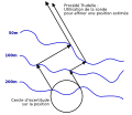
Trudelle.jpg 329 × 329; 42 KB
-
Trudelle.svg 410 × 353; 10 KB
-
Tåkeklokken på Rødtangen på Hurumlandet.jpg 5,616 × 3,744; 2.17 MB
-
VHF gmdss.jpg 1,536 × 2,048; 451 KB
-
VisibilityArc.svg 602 × 780; 10 KB
-
Wind correction angle 02.PNG 894 × 504; 25 KB
-
Wind correction angle.png 894 × 504; 22 KB


