Category:QIs by Jakec
Jump to navigation
Jump to search
Quality Images taken by Jakec.
Media in category "QIs by Jakec"
The following 117 files are in this category, out of 117 total.
-
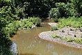
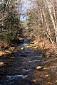
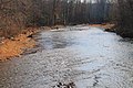
 Beaver Run looking downstream.JPG 2,256 × 1,504; 2 MB
-
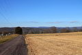
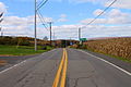
 Brandonville Road.JPG 2,256 × 1,504; 2.08 MB
-
 Briar Creek Lake in August.JPG 2,256 × 1,504; 2.39 MB
-
 Bridge in Huntington Township, Luzerne County, Pennsylvania.JPG 2,247 × 1,327; 2.57 MB
-
 Buck Mountain Road.JPG 2,256 × 1,504; 2.12 MB
-
 Building in Pine Township, Columbia County, Pennsylvania.JPG 2,256 × 1,504; 3.21 MB
-
 Catawissa Creek looking downstream south of Zion Grove.JPG 2,256 × 1,504; 3.08 MB
-
 Catawissa Creek near Brandonville 2.JPG 2,256 × 1,454; 3.1 MB
-
 Catawissa Mountain from the west in November (2).JPG 2,256 × 1,504; 2.3 MB
-
 Central Mountain from west of Central.JPG 1,504 × 2,256; 2.24 MB
-
 Clouds above Catawissa Township.JPG 1,440 × 2,256; 1.21 MB
-
 Clouds in the sky in August 2014.JPG 2,256 × 1,504; 286 KB
-
 Coal waste pile west of Trevorton, Pennsylvania far shot 2.JPG 2,256 × 1,504; 2.63 MB
-
 County Bridge No. 23 sign (Columbia County, Pennsylvania).JPG 2,256 × 1,504; 2.89 MB
-
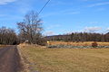
 Cranberry Run Road sign.JPG 1,504 × 2,256; 2.33 MB
-
 Cumulus clouds as seen from an airplane.JPG 2,256 × 1,504; 931 KB
-
 Davis Hollow looking upstream.JPG 2,256 × 1,504; 3.1 MB
-
 Devil Hole Run looking upstream.JPG 1,504 × 2,256; 2.51 MB
-
 East Branch Briar Creek in August.JPG 2,256 × 1,477; 3.24 MB
-
 Field in Anthony Township, Montour County, Pennsylvania 2.JPG 2,256 × 1,504; 2.09 MB
-
 Field in Anthony Township, Montour County, Pennsylvania 3.JPG 2,256 × 1,504; 2.29 MB
-
 Field in Madison Township, Columbia County, Pennsylvania.JPG 1,952 × 1,504; 1.8 MB
-
 Field in Mahoning Township, Montour County, Pennsylvania.JPG 2,256 × 1,482; 2.53 MB
-
 Field in Roaring Creek Township, Columbia County, Pennsylvania 1.JPG 2,256 × 1,504; 2.57 MB
-
 Fisher Run Road 2.JPG 2,256 × 1,504; 3.26 MB
-
 Fishing Creek north of Benton.JPG 2,256 × 1,504; 3.41 MB
-
 Greenwood Township, Columbia County, Pennsylvania in January.JPG 2,256 × 1,504; 2.85 MB
-
 Greenwood Valley from Turkey Path Road 3.JPG 1,999 × 1,504; 1.8 MB
-
 Greenwood Valley scenery 1.JPG 2,256 × 1,504; 2.75 MB
-
 Hill in Catawissa Township.JPG 2,256 × 1,504; 2.18 MB
-
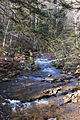
 Huntington Creek in its upper reaches 1.JPG 1,985 × 1,322; 2.47 MB
-
 Huntington Creek looking upstream from Winding Road.JPG 1,504 × 2,256; 3.4 MB
-
 Ice formation on Shingle Run Road 2.JPG 2,256 × 1,504; 2.51 MB
-
 Ice formation on Shingle Run Road 3.JPG 2,256 × 1,504; 2.3 MB
-
 Icicles on Shingle Run Road.JPG 1,504 × 2,256; 1.89 MB
-
 Little Fishing Creek looking downstream above Millville.JPG 2,256 × 1,504; 2.28 MB
-
 Madison Township, Columbia County, Pennsylvania in January (2).JPG 2,071 × 1,504; 2.31 MB
-
 Mahanoy Creek in Little Mahanoy Township, Northumberland County, Pennsylvania 1.JPG 2,256 × 1,504; 3.2 MB
-
 Maple Run looking upstream.JPG 1,504 × 2,256; 2.83 MB
-
 Mauses Creek looking downstream.JPG 2,256 × 1,504; 3.21 MB
-
 Montour Power Plant 2.JPG 2,256 × 1,504; 1.4 MB
-
 Mountains in southwestern Columbia County, Pennsylvania 1.JPG 2,256 × 1,504; 1.85 MB
-
 Mud Run near the Kramer Covered Bridge.JPG 2,256 × 1,504; 3.48 MB
-
 Mugser Run.JPG 2,256 × 1,504; 3.68 MB
-
 Muncy Creek Township, Lycoming County, Pennsylvania.JPG 2,253 × 1,371; 1.77 MB
-
 Northeastern Huntington Township, Luzerne County, Pennsylvania from Cemetery Hill Road 3.JPG 2,256 × 1,504; 2.17 MB
-
 Northeastern Huntington Township, Luzerne County, Pennsylvania from Cemetery Hill Road 6.JPG 2,256 × 1,504; 2.24 MB
-
 Old Reading Road in the foothills of Catawissa Mountain.JPG 2,256 × 1,504; 3.56 MB
-
 Painter Run looking upstream above Oxhorn Run 1.JPG 1,504 × 2,256; 3.29 MB
-
 Painter Run looking upstream near its mouth 1.JPG 1,504 × 2,256; 3.39 MB
-
 Pennsylvania Route 118 in Lycoming County.JPG 2,256 × 1,504; 2.27 MB
-

-
 Pennsylvania Route 254 east of Washingtonville.JPG 2,256 × 1,504; 1.32 MB
-
 Pennsylvania Route 254 in Derry Township, Montour County, Pennsylvania looking west.JPG 2,256 × 1,504; 1.94 MB
-
 Pennsylvania Route 254 looking west in Rohrsburg.JPG 1,504 × 2,256; 2.15 MB
-
 Pennsylvania Route 254 north of Rohrsburg.JPG 1,504 × 2,256; 2.44 MB
-
 Pennsylvania Route 254 west of Millville.JPG 2,226 × 1,459; 2.17 MB
-
 Pennsylvania Route 339 in Brandonville.JPG 2,256 × 1,504; 2.21 MB
-
 Pennsylvania Route 42 in Eyers Grove.JPG 2,256 × 1,504; 2.63 MB
-
 Pennsylvania Route 42 northbound northwest of Slabtown.JPG 2,256 × 1,504; 2.35 MB
-
 Pennsylvania Route 442 east.JPG 2,256 × 1,504; 2.31 MB
-
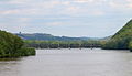
 Pennsylvania Route 54 bridge over the West Branch Susquehanna River.JPG 2,256 × 1,504; 2.51 MB
-
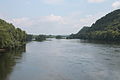
 Pennsylvania Route 54 crossing of the Susquehanna River.JPG 2,256 × 1,504; 1.55 MB
-
 Pennsylvania Route 54 in Anthony Township, Montour County, Pennsylvania.JPG 2,256 × 1,504; 1.94 MB
-
 Pennsylvania Route 54 near Turbotville.JPG 1,504 × 2,256; 2.4 MB
-
 Pennsylvania Route 924 in Sheppton.JPG 2,256 × 1,504; 1.82 MB
-
 Pine Creek in New Columbus, Pennsylvania.JPG 1,990 × 1,504; 2.78 MB
-
 Pothole on Huntington Creek Road.JPG 2,256 × 1,504; 3.6 MB
-
 Power lines on Catawissa Mountain 1.JPG 2,256 × 1,504; 2.58 MB
-
 Pylons in Briar Creek Township, Columbia County, Pennsylvania.JPG 2,256 × 1,504; 2.82 MB
-
 Railroad bridge over the Susquehanna River north of Catawissa.JPG 2,256 × 1,297; 1.49 MB
-
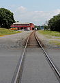 Railroad in Montgomery, Pennsylvania.JPG 1,270 × 1,736; 1.41 MB
-
 Railroad in Northumberland County, Pennsylvania.JPG 1,504 × 2,256; 2.18 MB
-
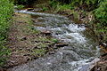
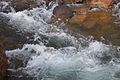
 Rapids on West Branch Fishing Creek 1.JPG 2,256 × 1,504; 2.59 MB
-
 Rapids on West Branch Fishing Creek 5.JPG 2,256 × 1,504; 2.2 MB
-
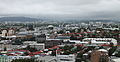
 Reykjavík Harbor vista 4.JPG 2,256 × 1,504; 1.53 MB
-
 Rock formation in Fairmount Township, Luzerne County, Pennsylvania 2.JPG 2,256 × 1,504; 3.76 MB
-
 Scenery of Benton Township, Columbia County, Pennsylvania 1.JPG 2,256 × 1,192; 2.28 MB
-
 Scenery of Mahoning Township, Montour County, Pennsylvania.JPG 2,047 × 1,504; 1.75 MB
-
 Scenery of southern Pine Township, Columbia County, Pennsylvania.JPG 2,256 × 1,504; 1.95 MB
-
 Scenery of Sugarloaf Township, Columbia County, Pennsylvania 1.JPG 2,256 × 1,504; 2.51 MB
-
 Sechler Run looking upstream.jpg 2,256 × 1,504; 2.35 MB
-
 Shamokin Creek looking downstream in Shamokin, Pennsylvania.JPG 2,034 × 1,501; 2.52 MB
-
 Shingle Run in its lower reaches.JPG 2,256 × 1,504; 2.83 MB
-
 Spruce Run looking downstream in wintertime.JPG 2,256 × 1,504; 2.58 MB
-
 Stream bed of Fishing Creek.JPG 2,256 × 1,504; 3.63 MB
-
 Streambed of Kitchen Creek.JPG 2,256 × 1,504; 2.82 MB
-
 Streambed of Phillips Creek.JPG 2,256 × 1,504; 2.56 MB
-
 Surface of Muncy Creek.JPG 2,256 × 1,504; 2.61 MB
-
 Tenmile Run in its lower reaches 2.JPG 2,256 × 1,504; 2.78 MB
-
 U.S. Route 11 in Danville.JPG 2,256 × 1,504; 2 MB
-
 Valley of Long Hollow.JPG 2,256 × 1,504; 1.35 MB
-
 View from Hallgrímskirkja 11.JPG 2,256 × 1,504; 1.77 MB
-
 View from Hallgrímskirkja 12.JPG 2,070 × 1,219; 1.4 MB
-
 View from Hallgrímskirkja 13.JPG 2,256 × 1,159; 1.62 MB
-
 View from Hallgrímskirkja 4.JPG 2,256 × 1,504; 2.75 MB
-
 View of Catawissa Mountain from the east.JPG 2,256 × 1,504; 1.89 MB
-
 View of Catawissa, Pennsylvania from the southeast 2.JPG 2,256 × 1,504; 2.32 MB
-
 View of East Cameron Township, Northumberland County, Pennsylvania.JPG 2,256 × 1,504; 2.12 MB
-
 View of Little Mahanoy Township, Northumberland County, Pennsylvania 2.JPG 2,256 × 1,504; 1.77 MB
-
 View of New Columbus, Pennsylvania from Fishing Creek Township 1.JPG 2,256 × 1,504; 2.62 MB
-
 View of New Columbus, Pennsylvania from Fishing Creek Township 2.JPG 2,256 × 1,504; 2.52 MB
-
 View of New Columbus, Pennsylvania from Fishing Creek Township 3.JPG 2,256 × 1,504; 3.26 MB
-
 View of Nuremberg, Pennsylvania from the south.JPG 2,256 × 1,504; 2.29 MB
-
 View of Orange Township, Columbia County, Pennsylvania looking east.JPG 2,256 × 1,504; 2.39 MB
-
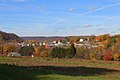
 View of Scott Township, Columbia County, Pennsylvania.JPG 2,223 × 1,467; 2.03 MB
-
 View of southeastern Fishing Creek Township, Columbia County, Pennsylvania.JPG 2,107 × 1,377; 1.99 MB
-
 View of West Cameron Township, Northumberland County, Pennsylvania looking north.JPG 2,256 × 1,504; 2.28 MB
-
 West Branch Fishing Creek looking downstream in December.JPG 2,256 × 1,504; 3.2 MB
-
 West Branch Fishing Creek sign.JPG 2,256 × 1,504; 3.27 MB
-
 West Branch Run in wintertime 1.JPG 1,504 × 2,256; 2.24 MB
-
 West Branch Susquehanna River looking upstream near Montgomery, Pennsylvania.JPG 2,256 × 1,504; 1.83 MB
-
 West Creek (Pennsylvania).JPG 2,256 × 1,504; 3.28 MB
-
 Western edge of Central Mountain.JPG 2,256 × 1,504; 1.95 MB
-
 Wetland near the headwaters of Stony Brook 1.JPG 2,256 × 1,504; 3.78 MB
-
 Zerbe Run in Trevorton looking downstream.JPG 2,256 × 1,504; 3.63 MB
-
 Zerbe Run in Trevorton looking upstream.JPG 2,256 × 1,504; 3.75 MB


.JPG)


.JPG)


.JPG)


.JPG)


