Category:Images taken by Jakec
Jump to navigation
Jump to search
Images created by User:Jakec.
Media in category "Images taken by Jakec"
The following 200 files are in this category, out of 1,628 total.
(previous page) (next page)-
 Adam T. Bower Memorial Dam detail.JPG 3,088 × 2,056; 1.76 MB
-
 Adam T. Bower Memorial Dam.JPG 3,088 × 2,056; 1.07 MB
-
 Adams Falls 1.JPG 2,056 × 3,088; 1.91 MB
-
 Adams Falls 2.JPG 2,056 × 3,088; 2.37 MB
-
 Algae on Green Creek.JPG 2,256 × 1,504; 4.62 MB
-
 Allegheny Front from South Comstock Road 1.JPG 2,256 × 1,504; 2.19 MB
-
 Alley in Marion Heights.JPG 2,056 × 3,088; 2 MB
-
 Amish horse and buggy near Washingtonville, Pennsylvania.JPG 1,549 × 1,504; 1.49 MB
-
 Anthracite chunk.JPG 2,056 × 3,088; 957 KB
-
 Area in front of Hallgrímskirkja.JPG 2,256 × 1,504; 2.15 MB
-
 Aristes, Pennsylvania (cropped).JPG 747 × 485; 175 KB
-
 Aristes, Pennsylvania.JPG 3,088 × 2,056; 2.57 MB
-
 Armor on the banks of Kinney Run.JPG 1,600 × 1,200; 949 KB
-
 Arnold Creek looking downstream.JPG 1,504 × 2,256; 3.23 MB
-
 Arnold Creek looking upstream 1.JPG 2,256 × 1,504; 3.28 MB
-
 Arnold Creek looking upstream 2.JPG 1,504 × 2,256; 3.14 MB
-
 Atlas, Pennsylvania.JPG 3,088 × 1,683; 1,004 KB
-
 B. Frank Mather General Merchandise building.JPG 3,088 × 2,056; 1.79 MB
-
 Baker Run.JPG 2,056 × 3,088; 3.23 MB
-
 Bald Top.JPG 2,256 × 1,504; 1.93 MB
-
 Balliet Run near its mouth 1.JPG 2,056 × 3,088; 2.78 MB
-
 Balliet Run near its mouth 2.JPG 2,056 × 3,088; 2.86 MB
-
 Barry King Bridge 1.JPG 2,056 × 3,088; 1.43 MB
-
 Barry King Bridge 2.JPG 3,088 × 2,056; 1.55 MB
-
 Beach at Lake Jean.JPG 3,088 × 2,056; 1.39 MB
-
 Bear Hollow Creek.JPG 2,056 × 3,088; 3.4 MB
-
 Beaver Pond (Luzerne County, Pennsylvania).JPG 2,256 × 1,504; 2.56 MB
-
 Beaver Run looking downstream in its upper reaches.JPG 2,056 × 3,088; 2.74 MB
-
 Beaver Run looking downstream in Liberty Township.JPG 2,056 × 3,088; 1.92 MB
-
 Beaver Run looking downstream near its mouth.JPG 2,056 × 3,088; 2.73 MB
-
 Beaver Run looking downstream.JPG 2,256 × 1,504; 2 MB
-
 Beaver Run looking upstream in its upper reaches.JPG 2,056 × 3,088; 2.32 MB
-
 Beaver Run looking upstream near its mouth.JPG 2,056 × 3,088; 2.66 MB
-
 Beaver Run looking upstream.JPG 2,256 × 1,504; 3.1 MB
-
 Beaver Run near Shumans, Pennsylvania 1.JPG 1,504 × 2,256; 3.05 MB
-
 Beaver Run near Shumans, Pennsylvania 2.JPG 2,256 × 1,504; 2.93 MB
-
 Beaver Run near Turbotville.JPG 2,256 × 1,504; 2.79 MB
-
 Bee Sellers Hollow.JPG 2,256 × 1,504; 3.51 MB
-
 Beech tree trunk.JPG 1,504 × 2,256; 1.87 MB
-
 Beginning of the Falls Trail.JPG 2,256 × 1,504; 3 MB
-
 Bell Bend from Council Cup 1.JPG 2,256 × 1,504; 2.88 MB
-
 Bell Bend from Council Cup 2.JPG 2,167 × 1,498; 3.42 MB
-
 Bell Bend from Council Cup 3.JPG 2,256 × 1,504; 2.21 MB
-
 Bell Bend Nuclear Power Plant cooling towers from the east.JPG 3,264 × 2,448; 1.89 MB
-
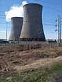 Bell Bend Nuclear Power Plant cooling towers from the north.JPG 2,448 × 3,264; 2.64 MB
-
 Bennys Run looking downstream.JPG 2,056 × 3,088; 3.02 MB
-
 Bennys Run looking upstream.JPG 1,941 × 2,997; 1.96 MB
-
 Benson Hollow looking downstream.JPG 2,056 × 3,088; 3.08 MB
-
 Benson Hollow looking upstream.JPG 2,056 × 3,088; 3.07 MB
-
 Benton Dam from the side 1.JPG 2,256 × 1,504; 2.31 MB
-
 Benton Dam from the side 2.JPG 2,256 × 1,504; 2.57 MB
-
 Benton Dam from the side 3.JPG 2,256 × 1,504; 3.5 MB
-
 Benton Dam from the side 4.JPG 2,256 × 1,504; 2.46 MB
-
 Benton Dam in August 2014.JPG 2,256 × 1,504; 2.48 MB
-
 Benton Foundry 1.JPG 2,256 × 1,504; 2.34 MB
-
 Benton Foundry 2.JPG 2,256 × 1,504; 2.84 MB
-
 Benton Township, Columbia County, Pennsylvania in April (1).JPG 2,256 × 1,504; 1.94 MB
-
 Benton Township, Columbia County, Pennsylvania in April (2).JPG 2,256 × 1,504; 2.37 MB
-
 Benton Township, Columbia County, Pennsylvania looking northwest.JPG 2,256 × 1,504; 2.5 MB
-
 Benton Township, Columbia County, Pennsylvania looking southwest.JPG 2,256 × 1,504; 2.98 MB
-
 Benton Township, Columbia County, Pennsylvania looking west.JPG 2,256 × 1,411; 1.71 MB
-
 Benton United Methodist Church.JPG 1,504 × 2,256; 2.65 MB
-
 Beth Run.JPG 3,088 × 2,056; 2.53 MB
-
 Big Run falls 1.JPG 3,088 × 2,056; 1.16 MB
-
 Big Run falls 2.JPG 3,088 × 2,056; 1.91 MB
-
 Big Run from US Route 220 (1).JPG 2,056 × 3,088; 2.39 MB
-
 Big Run from US Route 220 (2).JPG 2,056 × 3,088; 2.97 MB
-
 Big Run looking downstream.JPG 2,056 × 3,088; 1.79 MB
-
 Big Run looking upstream.JPG 2,056 × 3,088; 2.04 MB
-
 Big Wapwallopen Creek looking downstream in its upper reaches.JPG 3,088 × 2,056; 3.25 MB
-
 Big Wapwallopen Creek looking downstream in June.JPG 3,088 × 2,056; 1.98 MB
-
 Big Wapwallopen Creek looking upstream in its upper reaches.JPG 2,056 × 3,088; 2.73 MB
-
 Big Wapwallopen Creek looking upstream in June.JPG 2,056 × 3,088; 3.06 MB
-
 Big Wapwallopen Creek.JPG 3,264 × 2,448; 2.58 MB
-
 Black Ash Creek.JPG 1,504 × 2,256; 2.95 MB
-
 Black bear crossing the road.gif 1,470 × 979; 4.9 MB
-
 Black Creek (Nescopeck Creek).JPG 3,264 × 2,448; 3.83 MB
-
 Black Hole Creek.JPG 2,037 × 1,504; 2.61 MB
-
 Black Run 1.JPG 2,056 × 3,088; 6.3 MB
-
 Black Run 2.JPG 2,056 × 3,088; 6.37 MB
-
 Black Run Road (QR 4016).JPG 2,816 × 2,112; 2.37 MB
-
 Blizzards Run looking downstream in its lower reaches.JPG 2,256 × 1,504; 2.86 MB
-
 Blizzards Run looking upstream in its lower reaches.JPG 2,256 × 1,504; 2.49 MB
-
 Bloody Run.JPG 1,504 × 2,256; 3.58 MB
-
 Bloomsburg and Sullivan Railroad Jamison City station.JPG 3,088 × 2,056; 2.33 MB
-
 Bloomsburg Municipal Airport.JPG 2,256 × 1,504; 1.68 MB
-
 Blue Giant Meadow Lake 1.JPG 3,088 × 2,056; 1.06 MB
-
 Blue Giant Meadow Lake 2.JPG 3,088 × 2,056; 1.86 MB
-
 Bluff and the Susquehanna River.JPG 2,256 × 1,504; 2.28 MB
-
 Boat on the banks of Lake Jean.JPG 3,088 × 2,056; 1.47 MB
-
 Boats at Lily Lake.JPG 3,088 × 2,056; 1.71 MB
-
 Boats on Harveys Lake.JPG 3,088 × 2,056; 1.54 MB
-
 Boile Run 1.JPG 3,088 × 2,056; 2.41 MB
-
 Boile Run 2.JPG 2,056 × 3,088; 2.35 MB
-
 Boone's Dam.JPG 1,600 × 1,200; 827 KB
-
 Boston Run looking downstream.JPG 2,056 × 3,088; 2.01 MB
-
 Boston Run looking upstream.JPG 2,056 × 3,088; 2.58 MB
-
 Bottom of waterfall on Maple Run.JPG 2,256 × 1,504; 1.98 MB
-
 Bow Creek looking downstream.JPG 2,056 × 3,088; 2.41 MB
-
 Bow Creek looking upstream.JPG 2,056 × 3,088; 2.53 MB
-
 Bowman Creek at the mouth of Sorber Run.JPG 3,088 × 2,056; 3.27 MB
-
 Bowman Creek Ledges.JPG 3,088 × 2,056; 2.22 MB
-
 Bowman Creek looking downstream above Noxen.JPG 3,088 × 2,056; 2.49 MB
-
 Bowman Creek looking downstream from Pennsylvania Route 292.JPG 2,056 × 3,088; 2.64 MB
-
 Bowman Creek looking downstream from State Route 3003 (1).JPG 2,056 × 3,088; 2.38 MB
-
 Bowman Creek looking downstream from State Route 3003 (2).JPG 3,088 × 2,056; 2.04 MB
-
 Bowman Creek looking downstream from Wilson Road.JPG 2,056 × 3,088; 3.86 MB
-
 Bowman Creek looking downstream in Eaton Township, Wyoming County.JPG 3,088 × 1,991; 2.25 MB
-
 Bowman Creek looking downstream in its lower reaches.JPG 2,056 × 3,088; 1.62 MB
-
 Bowman Creek looking downstream in its upper reaches.JPG 2,056 × 3,088; 2.61 MB
-
 Bowman Creek looking downstream in Noxen 1.JPG 1,826 × 2,703; 2.19 MB
-
 Bowman Creek looking downstream in Noxen 2.JPG 3,088 × 2,056; 2.56 MB
-
 Bowman Creek looking downstream near Noxen 1.JPG 3,088 × 2,056; 2.62 MB
-
 Bowman Creek looking downstream near Noxen 2.JPG 2,056 × 3,088; 2.25 MB
-
 Bowman Creek looking downstream near Sorber Run.JPG 2,056 × 3,088; 2.47 MB
-
 Bowman Creek looking upstream above Noxen.JPG 2,056 × 3,088; 2.57 MB
-
 Bowman Creek looking upstream above Stone Run.JPG 2,721 × 2,056; 2.65 MB
-
 Bowman Creek looking upstream from Pennsylvania Route 292.JPG 2,056 × 3,088; 2.68 MB
-
 Bowman Creek looking upstream from State Route 3003.JPG 2,056 × 3,088; 2.95 MB
-
 Bowman Creek looking upstream from Wilson Road.JPG 2,020 × 3,021; 3.18 MB
-
 Bowman Creek looking upstream in Eaton Township, Wyoming County.JPG 3,088 × 2,056; 2.51 MB
-
 Bowman Creek looking upstream in its lower reaches.JPG 2,056 × 2,924; 2.29 MB
-
 Bowman Creek looking upstream in its upper reaches.JPG 2,056 × 3,088; 2.5 MB
-
 Bowman Creek looking upstream in Noxen 1.JPG 2,056 × 2,888; 2.71 MB
-
 Bowman Creek looking upstream in Noxen 2.JPG 3,088 × 2,056; 2.67 MB
-
 Bowman Creek looking upstream near Noxen 1.JPG 2,056 × 3,088; 2.58 MB
-
 Bowman Creek looking upstream near Noxen 2.JPG 3,088 × 2,056; 2.79 MB
-
 Bowman Creek looking upstream near Sorber Run.JPG 2,056 × 3,088; 2.86 MB
-
 Bowman Creek sign.JPG 3,088 × 2,056; 1.67 MB
-
 Bowmans Mill Road in Greenwood Township, Columbia County, Pennsylvania.JPG 2,256 × 1,504; 2.74 MB
-
 Brandonville Road.JPG 2,256 × 1,504; 2.08 MB
-
 Brandonville, Pennsylvania.JPG 2,256 × 1,504; 1.94 MB
-
 Breezy Acres.JPG 2,256 × 1,504; 2.54 MB
-
 Briar Creek in August.JPG 2,256 × 1,504; 3.42 MB
-
 Briar Creek Lake in August.JPG 2,256 × 1,504; 2.39 MB
-
 Briar Creek Lake.JPG 3,264 × 2,448; 1.9 MB
-
 Briar Creek Park sign.JPG 2,256 × 1,504; 3.08 MB
-
 Briar Creek.JPG 2,448 × 3,264; 2.35 MB
-
 Bridge across the Susquehanna River at Mifflinville, Pennsylvania.JPG 2,448 × 3,264; 1.6 MB
-
 Bridge in Huntington Township, Luzerne County, Pennsylvania.JPG 2,247 × 1,327; 2.57 MB
-
 Bridge over Beaver Run.JPG 2,256 × 1,504; 2.97 MB
-
 Bridge over Boston Run.JPG 3,088 × 2,056; 1.47 MB
-
 Bridge over Catawissa Creek in Main Township, Columbia County, Pennsylvania.JPG 1,504 × 2,256; 2.44 MB
-
 Bridge over Catawissa Creek.JPG 2,256 × 1,504; 3.07 MB
-
 Bridge over Cider Run.JPG 3,088 × 2,056; 2.74 MB
-
 Bridge over Leonard Creek.JPG 3,088 × 2,056; 2.5 MB
-
 Bridge over Little Pine Creek.JPG 2,256 × 1,504; 3.14 MB
-
 Bridge over Marsh Creek.JPG 3,088 × 2,056; 2.43 MB
-
 Bridge over Mitchler Run.JPG 2,256 × 1,504; 2.17 MB
-
 Bridge over Rapid Run.JPG 3,088 × 2,056; 4.91 MB
-
 Bridge over South Run.JPG 3,088 × 2,056; 1.93 MB
-
 Bridge over Sugar Hollow Creek.JPG 3,088 × 2,056; 1.94 MB
-
 Bridge over the Susquehanna River at Catawissa.JPG 2,256 × 1,504; 2.14 MB
-
 Bridge over Walker Run.JPG 3,088 × 2,056; 2.61 MB
-
 Bridge Street Bridge (east side).JPG 3,088 × 2,056; 1.38 MB
-
 Bridge Street Bridge (west side).JPG 3,084 × 1,063; 560 KB
-
 Brush Valley Reservoir 1.JPG 3,088 × 2,056; 1.88 MB
-
 Brush Valley Reservoir 2.JPG 3,088 × 2,056; 1.41 MB
-
 Buck Mountain (Pennsylvania).JPG 2,256 × 1,504; 1.14 MB
-
 Buck Mountain 1.JPG 2,256 × 1,504; 2.1 MB
-
 Buck Mountain 2.JPG 2,256 × 1,504; 1.73 MB
-
 Buck Mountain from Buck Mountain Road.JPG 2,256 × 1,504; 2.64 MB
-
 Buck Mountain Road on Buck Mountain.JPG 2,256 × 1,504; 2.84 MB
-
 Buck Mountain Road.JPG 2,256 × 1,504; 2.12 MB
-
 Buckwheat Hollow Road.JPG 3,088 × 2,056; 1.58 MB
-
 Buffalo Creek from QR 1001 (2).JPG 2,056 × 3,088; 5.58 MB
-
 Buffalo Creek from QR 1001.JPG 2,056 × 3,088; 5.63 MB
-
 Buffalo Creek looking downstream near Cowan.JPG 3,088 × 2,056; 6.1 MB
-
 Buffalo Creek looking downstream.JPG 3,088 × 2,056; 1.91 MB
-
 Buffalo Creek looking upstream near Cowan.JPG 2,056 × 3,088; 4.79 MB
-
 Buffalo Creek looking upstream.JPG 3,088 × 2,056; 1.85 MB
-
 Building in Pine Township, Columbia County, Pennsylvania.JPG 2,256 × 1,504; 3.21 MB
-
 Butt Street sign.JPG 2,256 × 1,504; 1.57 MB
-
 Cabin Run.JPG 2,256 × 1,504; 2.81 MB
-
 Camel in Northumberland County, Pennsylvania.JPG 2,152 × 1,353; 1.3 MB
-
 Carbon Run looking downstream.JPG 2,056 × 3,088; 2.36 MB
-
 Carbon Run.JPG 2,256 × 1,504; 3.08 MB
-
 Catawissa Community Park.JPG 2,256 × 1,504; 3.18 MB
-
 Catawissa Creek from Cranberry Run Road 1.JPG 2,256 × 1,504; 1.92 MB
-
 Catawissa Creek from Cranberry Run Road 2.JPG 2,256 × 1,504; 2.69 MB
-
 Catawissa Creek from Foose Lane looking upstream 1.JPG 2,256 × 1,504; 3.09 MB
-
 Catawissa Creek from Foose Lane looking upstream 2.JPG 1,504 × 2,256; 3.05 MB
-
 Catawissa Creek from Greenhouse Lane 1.JPG 2,256 × 1,504; 2.54 MB
-
 Catawissa Creek from Greenhouse Lane 2.JPG 1,504 × 2,256; 2.43 MB
-
 Catawissa Creek from Greenhouse Lane 3.JPG 2,256 × 1,504; 2.59 MB
-
 Catawissa Creek from Greenhouse Lane 4.JPG 2,256 × 1,504; 2.27 MB
-
 Catawissa Creek in Catawissa.JPG 2,256 × 1,504; 2.53 MB
-
 Catawissa Creek in Zion Grove, Pennsylvania.JPG 3,264 × 2,448; 2.77 MB
-
 Catawissa Creek looking downstream from Foose Lane.JPG 1,504 × 2,256; 3.38 MB
-
 Catawissa Creek looking downstream in Main Township, Columbia County, Pennsylvania.JPG 2,256 × 1,504; 4.02 MB
-
 Catawissa Creek looking downstream near Mainville.JPG 3,264 × 2,448; 2.46 MB
-
 Catawissa Creek looking downstream south of Zion Grove.JPG 2,256 × 1,504; 3.08 MB
-
 Catawissa Creek looking upstream in Main Township, Columbia County, Pennsylvania.JPG 2,256 × 1,504; 3.62 MB
-
 Catawissa Creek looking upstream near Mainville.JPG 3,264 × 2,448; 2.86 MB
-
 Catawissa Creek looking upstream south of Zion Grove.JPG 2,256 × 1,504; 3.32 MB
-
 Catawissa Creek near Brandonville 2.JPG 2,256 × 1,454; 3.1 MB
-
 Catawissa Creek near its mouth.JPG 1,504 × 2,256; 3 MB
-
 Catawissa Mountain and Nescopeck Mountain.jpg 2,256 × 1,504; 1.13 MB
-
 Catawissa Mountain from Buck Mountain Road 1.JPG 2,256 × 1,504; 1.87 MB
-
 Catawissa Mountain from Buck Mountain Road 2.JPG 2,256 × 1,504; 2.12 MB


.JPG)


.JPG)


.JPG)
.JPG)


.JPG)
.JPG)


.JPG)


.JPG)


.JPG)
.JPG)


.JPG)


.JPG)


.JPG)


.JPG)