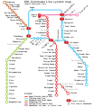
Category:Public transport maps of Jakarta
Jump to navigation
Jump to search
Subcategories
This category has the following 3 subcategories, out of 3 total.
M
- Maps of Jabodebek LRT (11 F)
- Maps of TransJakarta (39 F)
Media in category "Public transport maps of Jakarta"
The following 6 files are in this category, out of 6 total.
-
Greater Jakarta LRT Lines zh-hans.svg 512 × 495; 23 KB
-
KRL Commuter Line map 2007.jpg 425 × 600; 36 KB
-
KRL Jabotabek Lines.svg 512 × 594; 35 KB
-
KRL Jabotabek Route Map.png 2,668 × 3,634; 228 KB
-
MRTJ north South MapJP.png 3,000 × 1,000; 618 KB
-
MRTjakarta plan.png 4,800 × 3,375; 600 KB


