Category:Postcode maps covering the West Midlands (region)
Jump to navigation
Jump to search
Media in category "Postcode maps covering the West Midlands (region)"
The following 13 files are in this category, out of 13 total.
-
 B postcode area inset map.svg 500 × 500; 54 KB
-
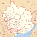
 B postcode area map.svg 700 × 1,000; 996 KB
-
 CV postcode area map.svg 700 × 1,000; 867 KB
-
 DY postcode area map.svg 1,000 × 800; 430 KB
-
 HR postcode area map.svg 1,000 × 1,000; 548 KB
-
 LD postcode area map.svg 1,000 × 1,000; 373 KB
-
 NP postcode area map.svg 1,000 × 1,000; 519 KB
-
 ST postcode area map.svg 800 × 1,000; 643 KB
-
 SY postcode area map.svg 1,000 × 1,000; 1.23 MB
-
 TF postcode area map.svg 600 × 1,000; 340 KB
-
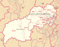
 WR postcode area map.svg 1,000 × 700; 409 KB
-
 WS postcode area map.svg 1,000 × 1,000; 431 KB
-
 WV postcode area map.svg 1,000 × 800; 496 KB


