Category:Maps of the West Midlands (region)
Jump to navigation
Jump to search
Subcategories
This category has the following 11 subcategories, out of 11 total.
H
M
O
S
W
Media in category "Maps of the West Midlands (region)"
The following 24 files are in this category, out of 24 total.
-
 Bromford Tower Map.jpg 727 × 392; 126 KB
-
 East and West Midlands in the United Kingdom location map.svg 871 × 1,289; 2.23 MB
-
 England Region - West Midlands.svg 525 × 650; 83 KB
-
 EnglandGovernmentMidlands.png 2,165 × 2,670; 100 KB
-
 EnglandWestMidlands.png 200 × 247; 15 KB
-
 EnglishSouthMidlandsCountiesMap.png 625 × 569; 27 KB
-
 NUTS 3 regions of the West Midlands 2010 map.svg 1,161 × 1,306; 1.36 MB
-
 NUTS 3 regions of the West Midlands map.svg 1,161 × 1,306; 1.36 MB
-
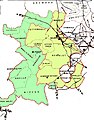 Seisdon Hundred parishes.jpg 1,574 × 2,013; 1.17 MB
-
 The local government structure within the Black Country (Pre-1966).png 478 × 507; 315 KB
-
 United Kingdom AV referendum West Midlands results.svg 1,161 × 1,306; 1.33 MB
-
 West Midlands BUA 2011 with TTWA overlay.png 800 × 690; 185 KB
-
 West Midlands Combined Authority among combined authorities in England map, 2021.svg 1,152 × 1,152; 8.93 MB
-
 West Midlands constituencies 2011 map.svg 1,161 × 1,306; 1.66 MB
-
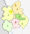 West Midlands counties 2009 map.svg 1,161 × 1,306; 1.38 MB
-
 West Midlands counties.png 1,160 × 1,306; 166 KB
-
 West Midlands districts 2011 map.svg 1,161 × 1,306; 1.33 MB
-
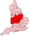
 West Midlands in England.png 814 × 953; 107 KB
-
 West Midlands in England.svg 816 × 991; 996 KB
-
 West Midlands wards 2011 map coloured.svg 1,161 × 1,306; 4.46 MB
-
 West Midlands wards 2011 map.svg 1,161 × 1,306; 4.45 MB
-
 West Midlands wards 2012 map.svg 1,161 × 1,306; 4.45 MB
-
 WestMidlandsRegion.jpg 726 × 822; 340 KB
-
 WestMidlandsUrbanArea.svg 1,282 × 1,024; 83 KB


.png)


