Category:Portolan charts made in the 15th century
Jump to navigation
Jump to search
Subcategories
This category has the following 17 subcategories, out of 17 total.
1
- Jorge de Aguiar (5 F)
- Map of Juan de la Cosa (38 F)
B
- Battista Beccario (2 F)
- Maps by Grazioso Benincasa (14 F)
- Bodleian-Douce atlas (2 F)
C
- Catalan round mapamundi (15 F)
- Corbitis Atlas (6 F)
- Cornaro Atlas (37 F)
G
- Gabriel de Vallseca (16 F)
L
- Luxoro Atlas (7 F)
P
- Pinelli-Walckenaer Atlas (4 F)
R
- Petrus Roselli (11 F)
V
- Mecia de Viladestes (10 F)
Media in category "Portolan charts made in the 15th century"
The following 64 files are in this category, out of 64 total.
-
Grazioso Benincasa. Biblioteca Universitaria, Bolonia.1482.jpg 1,103 × 600; 229 KB
-
Portolano (Egerton MS 2855, f.2r).jpeg 8,275 × 6,514; 54.61 MB
-
Portolano (Egerton MS 2855, f.3r).jpeg 8,275 × 6,514; 12.82 MB
-
Portolano (Egerton MS 2855, f.4r).jpeg 8,275 × 6,514; 56.73 MB
-
Portolano (Egerton MS 2855, f.5r).jpeg 8,275 × 6,514; 52.15 MB
-
Portolano (Egerton MS 2855, f.6r).jpeg 8,275 × 6,514; 10.82 MB
-
Portolano (Egerton MS 2855, f.7r).jpeg 8,275 × 6,514; 10.92 MB
-
Portolano (Egerton MS 2855, f.8r).jpeg 8,275 × 6,514; 52.71 MB
-
Île du Levant. Portulan. Benincasa. 1466.jpg 683 × 621; 68 KB
-
Francesco Beccario chart (1403).jpg 8,772 × 5,651; 17.14 MB
-
Virga chart (1409).jpg 5,568 × 3,709; 5.64 MB
-
Mussa Melli and Timbuktu Cropped from 1413 Portolan chart by Mecia de Viladestes.jpg 1,387 × 1,306; 281 KB
-
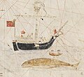
Whaling Cropped from 1413 Portolan chart by Mecia de Viladestes.jpg 1,664 × 1,536; 337 KB
-
Brooklyn Museum - Map The Western Mediterranean.jpg 768 × 617; 98 KB
-
Anonim mallorquí taller de Rosell Yale.JPG 7,645 × 4,142; 9.54 MB
-
1455 Nautical Chart by Bartolomeo Pareto.jpg 6,065 × 2,982; 5.67 MB
-
1455 Nautical Chart of Albania by Bartolomeo Pareto.jpg 1,364 × 1,180; 772 KB
-
Pareto 1455.jpg 486 × 486; 192 KB
-
Weimar map (Atlantic islands detail).jpg 744 × 932; 92 KB
-
Anonymous Portuguese map c.1471 (Estense).jpg 520 × 654; 173 KB
-
A map of the Black Sea by Gratioz Beninkazy, 1474.jpg 760 × 637; 117 KB
-
ColombusMap.jpg 13,616 × 8,421; 57.23 MB
-
1492 center.jpg 2,079 × 1,185; 322 KB
-
Facsimile of the Columbus Mappa Mundi.jpg 14,587 × 8,407; 19.48 MB
-
Jorge Aguiar Wind rose.jpg 711 × 720; 437 KB
-
Benincasa 1476.jpg 428 × 437; 178 KB
-
Mediterranean Sea and NE Atlantic RMG 3089.tiff 4,800 × 3,853; 52.91 MB
-
Mediterranean Sea and NE Atlantic RMG K1004.jpg 1,280 × 832; 1.24 MB
-
Portolano anónimo do século XV.jpg 16,261 × 10,058; 20.5 MB
-
Senyeres a l'atlas de Benincasa (1473).jpg 395 × 369; 35 KB


