Category:Maps made in the 15th century
Jump to navigation
Jump to search
Subcategories
This category has the following 25 subcategories, out of 25 total.
Media in category "Maps made in the 15th century"
The following 26 files are in this category, out of 26 total.
-
 Constantinople in the 15th century (ver. 1).jpg 1,476 × 1,940; 996 KB
-
 British Isles as depicted in Harley Codex Minuscule 3686.jpg 1,171 × 1,500; 577 KB
-
 Brooklyn Museum - Map The Black Sea.jpg 768 × 575; 84 KB
-
 Brooklyn Museum - Map The Central Mediterranean and All of Italy.jpg 768 × 593; 83 KB
-

-
 Carta marchesato di Oristano.jpg 1,056 × 1,008; 540 KB
-
 Carte moderne de France par Pietro del Massaio et Hugues Commineau.jpg 1,584 × 1,178; 372 KB
-
 Constantinople in the 15th century (ver. 2).jpg 1,640 × 2,196; 177 KB
-

-
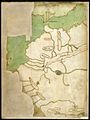
 Hispania in Harley MS 3686 - 15th century.jpg 940 × 1,230; 401 KB
-
 Jean Picart, Civitas Acon sive Ptolomaida (FL199657703 2368146).jpg 5,715 × 5,310; 15.96 MB
-
-

-
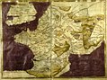
 Northwest Africa in Harley MS 3686.jpg 1,136 × 1,520; 339 KB
-
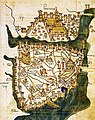
 Old Map Rom 15th century.jpg 408 × 532; 118 KB
-
 Benincasa 1476.jpg 428 × 437; 178 KB
-
 Portolano (Egerton MS 2855, f.2r).jpeg 8,275 × 6,514; 54.61 MB
-
 Portolano (Egerton MS 2855, f.3r).jpeg 8,275 × 6,514; 12.82 MB
-
 Portolano (Egerton MS 2855, f.4r).jpeg 8,275 × 6,514; 56.73 MB
-
 Portolano (Egerton MS 2855, f.5r).jpeg 8,275 × 6,514; 52.15 MB
-
 Portolano (Egerton MS 2855, f.6r).jpeg 8,275 × 6,514; 10.82 MB
-
 Portolano (Egerton MS 2855, f.7r).jpeg 8,275 × 6,514; 10.92 MB
-
 Portolano (Egerton MS 2855, f.8r).jpeg 8,275 × 6,514; 52.71 MB
-
 Île du Levant. Portulan. Benincasa. 1466.jpg 683 × 621; 68 KB
-
 Rome-15th Century.jpg 847 × 639; 260 KB
-
 Wiki Venezia mappa Brenta XV sec.gif 1,275 × 1,280; 198 KB
.jpg)


.jpg)
.jpg)

.jpg)
_by_Florentine_cartographer_Cristoforo_Buondelmonte.jpg)
.E.jpg)


.jpeg)
.jpeg)
.jpeg)
.jpeg)
.jpeg)
.jpeg)
.jpeg)


