Category:Political maps of Okinawa prefecture
Jump to navigation
Jump to search
English: Category for political maps of Okinawa Prefecture, Japan
日本語: 日本・沖縄県に関する政治地図のカテゴリ
Subcategories
This category has the following 3 subcategories, out of 3 total.
Media in category "Political maps of Okinawa prefecture"
The following 4 files are in this category, out of 4 total.
-
 Kyushu hrdist map 2003.PNG 1,100 × 847; 65 KB
-
 Map of license plates in Okinawa Japan.svg 800 × 579; 29 KB
-
 Naha tomigusuku city border in kanpo 2017-03-09.png 939 × 721; 223 KB
-
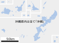
 衆議院小選挙区 沖縄県.svg 800 × 652; 33 KB


