Category:Political maps of Japan
Jump to navigation
Jump to search
Subcategories
This category has the following 7 subcategories, out of 7 total.
*
E
I
Media in category "Political maps of Japan"
The following 9 files are in this category, out of 9 total.
-
Japan - OSS - btv1b53196945n.jpg 7,974 × 10,454; 7.28 MB
-
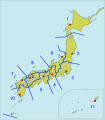
Japan Coast Guard region.png 1,345 × 1,593; 100 KB
-
Japan Coast Guard regions.svg 1,397 × 1,593; 343 KB
-
Japan disputed w1 countrymap.svg 1,000 × 1,000; 39 KB
-
Japan Election of House of Representatives - DPLA - 27168e1457bd608c053ee29c830a189a.jpg 7,034 × 9,278; 6.2 MB
-
Japan Union of Kansai Governments large.png 1,397 × 1,593; 79 KB
-
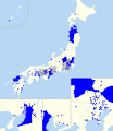
Japanese cities with partnership certificate laws.svg 1,024 × 1,184; 97 KB
-
Japanese municipalities with partnership certificates.png 5,310 × 5,310; 381 KB
-
Pref-gc.png 199 × 228; 6 KB


