Category:Pettinain (civil parish)
Jump to navigation
Jump to search
Scottish parish in South Lanarkshire, Scotland, UK | |||||
| Upload media | |||||
| Instance of | |||||
|---|---|---|---|---|---|
| Part of |
| ||||
| Named after |
| ||||
| Location |
| ||||
| Population |
| ||||
| Area |
| ||||
 | |||||
Media in category "Pettinain (civil parish)"
The following 165 files are in this category, out of 165 total.
-
 A bend in the Clyde, Libberton - geograph.org.uk - 6335277.jpg 1,600 × 1,060; 246 KB
-
 A Clydesdale meadow - geograph.org.uk - 2475448.jpg 640 × 480; 266 KB
-
 A row of cottages - geograph.org.uk - 3684388.jpg 640 × 399; 46 KB
-
 A train leaves Carstairs Junction - geograph.org.uk - 2474476.jpg 640 × 480; 258 KB
-
 Bagmoors - geograph.org.uk - 2474903.jpg 640 × 480; 295 KB
-
 Bank Farm, Pettinain - geograph.org.uk - 5968454.jpg 1,024 × 768; 188 KB
-
 Barley field at Pettinain - geograph.org.uk - 3615293.jpg 1,024 × 768; 143 KB
-
 Bend on the River Clyde - geograph.org.uk - 3651347.jpg 640 × 480; 70 KB
-
 Between roads, Cloburn - geograph.org.uk - 2910852.jpg 640 × 360; 254 KB
-
 Black sheep at Eastgate - geograph.org.uk - 5878169.jpg 1,024 × 768; 262 KB
-
 Burn by Grangehall - geograph.org.uk - 2734551.jpg 640 × 360; 237 KB
-
 Cairngryffe Hill (quarried) - geograph.org.uk - 3293748.jpg 1,600 × 1,200; 668 KB
-
 Cairngryffe Hill - geograph.org.uk - 2476831.jpg 640 × 480; 235 KB
-
 Cairngryffe Hill - geograph.org.uk - 2910922.jpg 640 × 360; 183 KB
-
 Cereals, Westraw - geograph.org.uk - 2474910.jpg 640 × 480; 245 KB
-
 Cereals, Westraw Mains - geograph.org.uk - 2476840.jpg 640 × 480; 320 KB
-
 Churchyard wall, Pettinain - geograph.org.uk - 5877851.jpg 1,024 × 768; 194 KB
-
 Cloburn granite quarry from the air - geograph.org.uk - 6199636.jpg 1,024 × 768; 290 KB
-
 Cloburn Quarry - geograph.org.uk - 2910895.jpg 640 × 360; 200 KB
-
 Cloburn Quarry - geograph.org.uk - 2910905.jpg 640 × 360; 204 KB
-
 Cloburn Quarry - geograph.org.uk - 3359842.jpg 640 × 360; 87 KB
-
 Cloburn Quarry - geograph.org.uk - 924979.jpg 640 × 425; 145 KB
-
 Cloburn Quarry - geograph.org.uk - 924982.jpg 640 × 425; 140 KB
-
 Cloburn Quarry from Carmichael Hill - geograph.org.uk - 4789931.jpg 4,896 × 3,672; 6.67 MB
-
 Cloburn Quarry from Swaites Hill - geograph.org.uk - 6300651.jpg 1,600 × 1,060; 348 KB
-
 Cloburn Quarry from the air - geograph.org.uk - 5669644.jpg 640 × 480; 142 KB
-
 Cloburn Quarry from the air - geograph.org.uk - 5679285.jpg 640 × 480; 163 KB
-
 Cloburn Quarry from the air - geograph.org.uk - 5680761.jpg 640 × 480; 146 KB
-
 Cloburn Quarry from the air - geograph.org.uk - 5680762.jpg 640 × 480; 165 KB
-
 Clyde flood plain - geograph.org.uk - 2735680.jpg 640 × 360; 213 KB
-
 Combination burn and hedgerow - geograph.org.uk - 924927.jpg 544 × 640; 135 KB
-

-
 Corner of Cloburn Quarry boundary fence - geograph.org.uk - 6300638.jpg 1,600 × 1,060; 632 KB
-
 Cottages at Pettinain - geograph.org.uk - 6300463.jpg 1,600 × 1,060; 391 KB
-
 Cottages at Pettinain - geograph.org.uk - 6300482.jpg 1,600 × 1,060; 437 KB
-
 Cottages, Pettinain - geograph.org.uk - 5877843.jpg 1,024 × 768; 123 KB
-
 Cutting, Pettinain Road - geograph.org.uk - 2474483.jpg 640 × 480; 253 KB
-
 Descending the track - geograph.org.uk - 6300668.jpg 1,600 × 1,060; 541 KB
-
 Dry Stone wall - geograph.org.uk - 924993.jpg 622 × 640; 151 KB
-
 Drystane dyke on Swaites Hill - geograph.org.uk - 6452656.jpg 5,035 × 3,777; 4.26 MB
-
 Edge of field borders beech avenue - geograph.org.uk - 924885.jpg 640 × 425; 176 KB
-
 Entering Pettinain - geograph.org.uk - 3651410.jpg 640 × 480; 69 KB
-
 Entrance to Pettinain - geograph.org.uk - 3494830.jpg 640 × 480; 120 KB
-
 Fair weather cloud over Clydesdale - geograph.org.uk - 6452669.jpg 5,035 × 3,777; 3.69 MB
-
 Farm track with avenue - geograph.org.uk - 924878.jpg 640 × 470; 132 KB
-
 Farm track, Westraw - geograph.org.uk - 2475451.jpg 640 × 480; 262 KB
-
 Farming activity near Northholm - geograph.org.uk - 3956639.jpg 640 × 377; 98 KB
-
 Farming activity near Northholm - geograph.org.uk - 3956641.jpg 640 × 381; 107 KB
-
 Farming Activity near Northholm - geograph.org.uk - 3956645.jpg 640 × 385; 111 KB
-
 Farmland, Pettinain - geograph.org.uk - 3729243.jpg 640 × 480; 247 KB
-
 Fence and railway bridge over the River Clyde - geograph.org.uk - 5877849.jpg 1,024 × 768; 213 KB
-
 Field above Pettinain - geograph.org.uk - 3729249.jpg 640 × 480; 256 KB
-
 Field Boundaries Near Eastfield Farm - geograph.org.uk - 1632054.jpg 640 × 480; 77 KB
-
 Field path to Pettinain - geograph.org.uk - 6301123.jpg 1,600 × 1,060; 416 KB
-
 Fields, Carmichael - geograph.org.uk - 3359836.jpg 640 × 360; 89 KB
-
 Fording the Clyde - geograph.org.uk - 2474443.jpg 640 × 480; 287 KB
-
 Freight on the West Coast Main line - geograph.org.uk - 2273488.jpg 640 × 416; 72 KB
-
 Gas Installation - geograph.org.uk - 924931.jpg 626 × 640; 158 KB
-
 Gate on Swaites Hill - geograph.org.uk - 6452625.jpg 5,152 × 3,864; 5.72 MB
-
 Gathering together by Eastfield Farm - geograph.org.uk - 813534.jpg 640 × 480; 124 KB
-
 Grange Road - geograph.org.uk - 2735672.jpg 640 × 360; 246 KB
-
 Grass field at Northholm - geograph.org.uk - 5877883.jpg 1,024 × 768; 164 KB
-
 Grass field near Swaites - geograph.org.uk - 5968318.jpg 1,024 × 768; 212 KB
-
 Grassland, Pettinain - geograph.org.uk - 2474520.jpg 640 × 480; 291 KB
-
 Grassland, Westown - geograph.org.uk - 2479076.jpg 640 × 480; 304 KB
-
 Grazing sheep at Pettinain - geograph.org.uk - 5968414.jpg 1,024 × 768; 206 KB
-
 Heading towards Pettianain - geograph.org.uk - 3684375.jpg 640 × 464; 35 KB
-
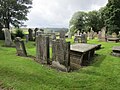 Headstones in the churchyard, Pettinain - geograph.org.uk - 5884954.jpg 1,024 × 768; 241 KB
-
 High point of Swaites Hill - geograph.org.uk - 924958.jpg 640 × 525; 172 KB
-
 Houses at Pettinain - geograph.org.uk - 6300494.jpg 1,600 × 1,060; 380 KB
-
 Houses in Pettinain - geograph.org.uk - 5968453.jpg 1,024 × 768; 116 KB
-
 Inside Cairngryffe Hill - geograph.org.uk - 2905693.jpg 640 × 360; 229 KB
-
 Line of beeches - geograph.org.uk - 2476832.jpg 640 × 480; 293 KB
-
 Looking across south top of Swaites Hill - geograph.org.uk - 924987.jpg 640 × 425; 154 KB
-
 Millhill Burn - geograph.org.uk - 2905696.jpg 640 × 360; 178 KB
-
 Monteith House - geograph.org.uk - 5304905.jpg 1,600 × 1,200; 349 KB
-
 Moorland on Swaites Hill - geograph.org.uk - 6300630.jpg 1,600 × 1,060; 529 KB
-
 New house, Grange Road, Pettinain - geograph.org.uk - 2504660.jpg 640 × 440; 62 KB
-
 Obligatory Snowy Gate Photograph - geograph.org.uk - 1632047.jpg 480 × 640; 101 KB
-
 Old track to Todholes, Pettinain - geograph.org.uk - 5985689.jpg 4,608 × 3,456; 5.43 MB
-
 Oxbow Lake beside the River Clyde - geograph.org.uk - 3663553.jpg 640 × 480; 79 KB
-
 Pasture between Westraw and Bagmoors - geograph.org.uk - 5957861.jpg 4,606 × 3,071; 2.63 MB
-
 Pettinain - geograph.org.uk - 2474899.jpg 640 × 480; 269 KB
-
 Pettinain Hall - geograph.org.uk - 5968410.jpg 1,024 × 768; 207 KB
-
 Pettinain Hall - geograph.org.uk - 6300466.jpg 1,600 × 1,060; 617 KB
-
 Pettinain Kirk - geograph.org.uk - 3684394.jpg 640 × 480; 57 KB
-
 Pettinain Parish Church - geograph.org.uk - 5884938.jpg 1,024 × 768; 214 KB
-
 Pettinain Parish Church - geograph.org.uk - 5884956.jpg 1,024 × 768; 188 KB
-
 Pettinain village - geograph.org.uk - 6300802.jpg 1,600 × 1,060; 402 KB
-
 Pettinain War Memorial - geograph.org.uk - 1483567.jpg 473 × 640; 56 KB
-
 Pump, Pettinain - geograph.org.uk - 2479072.jpg 502 × 640; 399 KB
-
 Quarry road - geograph.org.uk - 924943.jpg 640 × 502; 156 KB
-
 Raeburn Common - geograph.org.uk - 2475460.jpg 640 × 658; 422 KB
-
 Railway Bridge over the River Clyde - geograph.org.uk - 3651358.jpg 640 × 480; 63 KB
-
 Recent housing at Pettinain - geograph.org.uk - 5884948.jpg 1,024 × 768; 194 KB
-
 Ride, Westraw Hill - geograph.org.uk - 2910884.jpg 360 × 640; 215 KB
-
 River Clyde - geograph.org.uk - 2474437.jpg 640 × 458; 252 KB
-
 River Clyde - geograph.org.uk - 2479068.jpg 640 × 480; 257 KB
-
 River Clyde - geograph.org.uk - 3729289.jpg 640 × 480; 321 KB
-
 River Clyde, Carstairs Junction - geograph.org.uk - 2475444.jpg 640 × 480; 258 KB
-
 Road Bridge over the River Clyde - geograph.org.uk - 3651336.jpg 640 × 480; 66 KB
-
 Road east of Westraw Lodge - geograph.org.uk - 5957868.jpg 4,608 × 3,456; 5.12 MB
-
 Road Junction at Eastfield - geograph.org.uk - 3651393.jpg 640 × 480; 75 KB
-
 Road Junction at Pettinain - geograph.org.uk - 3651426.jpg 640 × 480; 60 KB
-
 Road junction near Pettinain - geograph.org.uk - 3684421.jpg 640 × 480; 64 KB
-
 Road to Bagmoors - geograph.org.uk - 2474897.jpg 640 × 480; 269 KB
-
 Road to Pettinain - geograph.org.uk - 2476820.jpg 640 × 480; 291 KB
-
 Road to Thankerton - geograph.org.uk - 6300596.jpg 1,600 × 1,060; 439 KB
-
 Roadside bench with rowan trees - geograph.org.uk - 5884930.jpg 1,024 × 768; 329 KB
-
 Rough grazing lands at Swaites Farm - geograph.org.uk - 3684490.jpg 640 × 480; 37 KB
-
 Round bales, Pettinain - geograph.org.uk - 3729270.jpg 640 × 480; 278 KB
-
 Sign, Bagmoors - geograph.org.uk - 2475454.jpg 640 × 480; 338 KB
-
 Snow covered field near Grangehall - geograph.org.uk - 2734513.jpg 640 × 360; 238 KB
-
 Sunny view near Eastfield Farm - geograph.org.uk - 3449088.jpg 1,024 × 768; 134 KB
-
 Swaites Farm and Covington Road - geograph.org.uk - 5877888.jpg 1,024 × 768; 187 KB
-
 Swaites Hill - geograph.org.uk - 3729261.jpg 640 × 480; 262 KB
-
 The Carstairs meanders from the air - geograph.org.uk - 5679293.jpg 640 × 480; 130 KB
-
 The Carstairs meanders from the air - geograph.org.uk - 5719843.jpg 480 × 640; 132 KB
-
 The Carstairs meanders from the air - geograph.org.uk - 5995136.jpg 1,024 × 768; 313 KB
-
 The Carstairs meanders from the air - geograph.org.uk - 5995139.jpg 1,024 × 768; 270 KB
-
 The Carstairs meanders from the air - geograph.org.uk - 5995141.jpg 1,024 × 768; 311 KB
-
 The last snow on Tinto - geograph.org.uk - 6452644.jpg 5,152 × 3,864; 5.03 MB
-
 The Mausoleum - geograph.org.uk - 5304923.jpg 1,600 × 1,200; 352 KB
-
 The Pettinain Burn - geograph.org.uk - 5877854.jpg 1,024 × 768; 169 KB
-
 The River Clyde - geograph.org.uk - 5304274.jpg 1,600 × 1,200; 375 KB
-
 The River Clyde - geograph.org.uk - 5304298.jpg 1,600 × 1,200; 440 KB
-
 The River Clyde - geograph.org.uk - 5304938.jpg 1,600 × 1,200; 437 KB
-
 The River Clyde from the air - geograph.org.uk - 2954989.jpg 640 × 480; 107 KB
-
 The River Clyde from the air - geograph.org.uk - 5680765.jpg 640 × 480; 114 KB
-

-

-
 The Shoals, River Clyde - geograph.org.uk - 6493577.jpg 5,152 × 3,864; 7.12 MB
-
 Tie Road No.2 - geograph.org.uk - 2474507.jpg 640 × 480; 323 KB
-
 Tinto from Swaites Hill - geograph.org.uk - 6300662.jpg 1,600 × 1,060; 387 KB
-
 Towards The Quarry - geograph.org.uk - 858354.jpg 640 × 443; 83 KB
-
 Track at Pettinain - geograph.org.uk - 5968413.jpg 1,024 × 768; 234 KB
-
 Track from Swaites Hill - geograph.org.uk - 6300611.jpg 1,600 × 1,060; 487 KB
-
 Track from Westraw Lodge - geograph.org.uk - 6301119.jpg 1,600 × 1,060; 518 KB
-
 Track in to the field - geograph.org.uk - 3684365.jpg 640 × 480; 93 KB
-
 Track junction at Westraw - geograph.org.uk - 5957863.jpg 4,608 × 3,456; 5.2 MB
-
 Track on Swaites Hill - geograph.org.uk - 6300623.jpg 1,600 × 1,060; 336 KB
-
 Track to Pettinain - geograph.org.uk - 6301127.jpg 1,600 × 1,060; 464 KB
-
 Track to Westraw - geograph.org.uk - 2474908.jpg 640 × 480; 239 KB
-
 View across Clydesdale from near Swaites - geograph.org.uk - 5968303.jpg 1,024 × 768; 169 KB
-
 View from Eastfield Farm - geograph.org.uk - 5303289.jpg 1,600 × 1,200; 489 KB
-
 View from the churchyard, Pettinain - geograph.org.uk - 5968457.jpg 1,024 × 768; 159 KB
-
 View of Tinto across a stubble field - geograph.org.uk - 4395468.jpg 4,608 × 3,456; 4.5 MB
-
 View to the east side - geograph.org.uk - 3449097.jpg 1,024 × 768; 120 KB
-
 View towards Pettinain - geograph.org.uk - 5968327.jpg 1,024 × 768; 172 KB
-
 View towards Raeburn Common - geograph.org.uk - 5968332.jpg 1,024 × 768; 242 KB
-
 Village sign, Pettinain - geograph.org.uk - 6300796.jpg 1,600 × 1,060; 446 KB
-
 Village well and old pump, Pettinain - geograph.org.uk - 6300472.jpg 1,600 × 1,060; 836 KB
-
 War memorial, Pettinain - geograph.org.uk - 5968459.jpg 1,024 × 768; 166 KB
-
 West Coast Main Line - geograph.org.uk - 2734536.jpg 640 × 360; 244 KB
-
 West Coast Main Line - geograph.org.uk - 2735676.jpg 640 × 360; 262 KB
-
 West Coast Main Line, Northolm - geograph.org.uk - 3361132.jpg 640 × 360; 91 KB
-
 Westraw estate - geograph.org.uk - 6301122.jpg 1,600 × 1,060; 391 KB
-
 Westraw Hill - geograph.org.uk - 2910871.jpg 640 × 360; 277 KB
-
 Westraw Mains Farm - geograph.org.uk - 924864.jpg 640 × 425; 155 KB
-
 Westraw Mains road - geograph.org.uk - 2476837.jpg 640 × 480; 314 KB
-
 Westraw road - geograph.org.uk - 2475466.jpg 640 × 480; 328 KB
-
 Westraw Wood - geograph.org.uk - 2475461.jpg 640 × 480; 380 KB
-
 Woodland, Cairngryffe Hill - geograph.org.uk - 2905689.jpg 640 × 360; 269 KB
-
 Woodland, Cloburn - geograph.org.uk - 2905686.jpg 640 × 360; 260 KB
-
 Pettinain Church - geograph.org.uk - 162213.jpg 640 × 480; 78 KB


_-_geograph.org.uk_-_3293748.jpg)


