Category:Petrified Forest Member - maps
Jump to navigation
Jump to search
Media in category "Petrified Forest Member - maps"
The following 8 files are in this category, out of 8 total.
-
 Geologic map of Sanders quadrangle northern Arizona.jpg 6,042 × 11,567; 6.35 MB
-
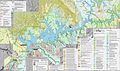
 NPS glen-canyon-geologic-map-central.jpg 3,143 × 1,859; 2.39 MB
-
 NPS glen-canyon-geologic-map-north.jpg 2,003 × 2,997; 2.24 MB
-
 NPS glen-canyon-geologic-map-south.jpg 3,145 × 1,865; 2.13 MB
-
 NPS petrified-forest-geologic-map-north.jpg 3,282 × 1,803; 1.09 MB
-
 NPS petrified-forest-geologic-map-south.jpg 2,608 × 2,954; 1.16 MB
-
 NPS wupatki-geologic-map-overview.jpg 4,546 × 2,512; 2.01 MB
-
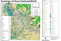 NPS zion-geologic-map.jpg 7,787 × 5,332; 10.96 MB


