Category:Penpont (civil parish)
Jump to navigation
Jump to search
Scottish parish in Dumfries and Galloway, Scotland, UK | |||||
| Upload media | |||||
| Instance of | |||||
|---|---|---|---|---|---|
| Named after | |||||
| Location |
| ||||
| Population |
| ||||
| Area |
| ||||
 | |||||
Subcategories
This category has the following 3 subcategories, out of 3 total.
N
- Nith Bridge (5 F)
- Nith Bridge cross (5 F)
P
Media in category "Penpont (civil parish)"
The following 200 files are in this category, out of 355 total.
(previous page) (next page)-
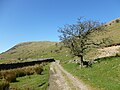
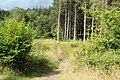
 A lightly used track - geograph.org.uk - 1812397.jpg 640 × 359; 90 KB
-
 A702 at Burnhead village - geograph.org.uk - 5903731.jpg 1,024 × 721; 149 KB
-
 A702 between Thornhill and Penpont - geograph.org.uk - 6249028.jpg 1,024 × 577; 226 KB
-
 A702 Clone Road at Penpont village boundary - geograph.org.uk - 5903730.jpg 1,024 × 778; 162 KB
-
 Ancient monument - geograph.org.uk - 2777944.jpg 640 × 427; 54 KB
-
 Approaching Craigdasher - geograph.org.uk - 3938955.jpg 4,608 × 3,456; 5.44 MB
-
 Arkland Bridge - geograph.org.uk - 1553742.jpg 640 × 480; 81 KB
-
 Arriving at Penpont - geograph.org.uk - 4643683.jpg 1,920 × 1,280; 1.28 MB
-
 Auchenlaw Burn - geograph.org.uk - 2020563.jpg 1,024 × 768; 61 KB
-
 Autumn foliage, Tibbers - geograph.org.uk - 3228697.jpg 640 × 480; 308 KB
-
 Back Wood - geograph.org.uk - 1553751.jpg 640 × 480; 71 KB
-
 Birch trees by the River Nith near Thornhill - geograph.org.uk - 6405840.jpg 1,024 × 768; 258 KB
-
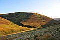
 Black Craig - geograph.org.uk - 1768099.jpg 640 × 359; 88 KB
-
 Black Rig - geograph.org.uk - 1768883.jpg 640 × 359; 64 KB
-
 Black Rig - geograph.org.uk - 1812086.jpg 640 × 359; 70 KB
-
 Black Rig - geograph.org.uk - 4425552.jpg 4,608 × 3,456; 5.17 MB
-
 Blocked path, Glenwhern Burn - geograph.org.uk - 1770412.jpg 640 × 359; 106 KB
-
 Blue Trail in Bogrie Wood - geograph.org.uk - 5091339.jpg 1,920 × 1,280; 2.55 MB
-
 Boggy moorland on Peat Hill - geograph.org.uk - 3467367.jpg 4,608 × 3,456; 5.47 MB
-
 Boulders by the Scaur Water - geograph.org.uk - 5068073.jpg 1,024 × 713; 155 KB
-
 Bridge and road crossing Mahomela Burn - geograph.org.uk - 5546072.jpg 4,000 × 3,000; 3.89 MB
-
 Bridge over the Chanlock Burn - geograph.org.uk - 3942691.jpg 4,608 × 3,456; 4.5 MB
-
 Bridge over the Scaur Water - geograph.org.uk - 1552640.jpg 640 × 480; 79 KB
-
 Bus Stop ^ Shelter, Penpont - geograph.org.uk - 6014796.jpg 2,976 × 1,984; 1.72 MB
-
 Cairn and trig pillar on Cairnkinna Hill - geograph.org.uk - 4425507.jpg 4,608 × 3,456; 4.66 MB
-
 Cairn by Carlinstane Bridge - geograph.org.uk - 4425645.jpg 4,608 × 3,456; 4.8 MB
-
 Cairn on Auchenbainze Hill - geograph.org.uk - 6691504.jpg 4,014 × 1,617; 1.3 MB
-
 Cairn on Auchenbainze Hill. - geograph.org.uk - 1074024.jpg 640 × 480; 71 KB
-
 Cairn, Cairnkinna Hill - geograph.org.uk - 1812055.jpg 640 × 480; 113 KB
-
 Cairnkinna Hill - geograph.org.uk - 1762704.jpg 640 × 359; 77 KB
-
 Cairnkinna Hill - geograph.org.uk - 1768110.jpg 640 × 359; 58 KB
-
 Cairnkinna Hill - geograph.org.uk - 1768113.jpg 640 × 480; 102 KB
-
 Carlinstane Bridge and road crossing Carlinstane Burn - geograph.org.uk - 5546047.jpg 4,000 × 3,000; 4.3 MB
-
 Carlinstane Burn and Woodend Craig - geograph.org.uk - 4424417.jpg 3,456 × 4,608; 4.8 MB
-
 Cattle at Penpont - geograph.org.uk - 1723180.jpg 640 × 427; 152 KB
-
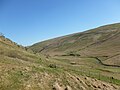
 Chanlock Glen - geograph.org.uk - 3938982.jpg 4,608 × 3,456; 5.04 MB
-
 Chanlock Rig - geograph.org.uk - 3938944.jpg 4,608 × 3,456; 5.4 MB
-
 Chanlockfoot Farm - geograph.org.uk - 1553101.jpg 640 × 480; 83 KB
-

-
 Clear felling on Colt Hill - geograph.org.uk - 3545432.jpg 3,264 × 2,448; 2.82 MB
-

-
 Corserine and the Galloway Forest Park - geograph.org.uk - 3644331.jpg 3,264 × 2,448; 3.46 MB
-
 Court Hill - geograph.org.uk - 3228690.jpg 640 × 480; 265 KB
-
 Cross drain, Cairnkinna Hill - geograph.org.uk - 1768878.jpg 640 × 480; 103 KB
-
 Cruffel Hill from the air - geograph.org.uk - 5282577.jpg 640 × 480; 135 KB
-
 Cut field - geograph.org.uk - 981667.jpg 640 × 480; 101 KB
-
 Dalgonar - geograph.org.uk - 1552501.jpg 640 × 480; 94 KB
-
 Dalgonar Craigs - geograph.org.uk - 1246202.jpg 640 × 480; 78 KB
-
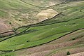
 Dalgonar Fields - geograph.org.uk - 1246219.jpg 640 × 480; 73 KB
-
 Dalzean - geograph.org.uk - 1553090.jpg 640 × 480; 78 KB
-
 Dalzean from the road - geograph.org.uk - 4425861.jpg 3,504 × 2,336; 3.27 MB
-
 Drains, Lamblair Knowe - geograph.org.uk - 1768869.jpg 640 × 359; 69 KB
-
 Drumlanrig Castle - geograph.org.uk - 4730917.jpg 1,024 × 768; 332 KB
-
 Drumlanrig Castle - geograph.org.uk - 5086537.jpg 800 × 600; 135 KB
-
 Drumlanrig Castle - geograph.org.uk - 5086542.jpg 800 × 600; 132 KB
-
 Drumlanrig Castle - geograph.org.uk - 6143576.jpg 1,804 × 2,706; 7.69 MB
-
 Drumlanrig Woods - geograph.org.uk - 3512127.jpg 800 × 600; 145 KB
-
 Dunduff - geograph.org.uk - 1770416.jpg 640 × 480; 89 KB
-
 Dunduff - geograph.org.uk - 1820323.jpg 640 × 359; 48 KB
-
 Dunduff cottage and hill - geograph.org.uk - 792661.jpg 640 × 480; 139 KB
-
 Dunduff hillside - geograph.org.uk - 6711320.jpg 640 × 480; 151 KB
-
 Dunduff hillside - geograph.org.uk - 792663.jpg 640 × 480; 148 KB
-
 Dunduff hilltop towards Glenwhern - geograph.org.uk - 6711321.jpg 640 × 480; 142 KB
-
 Eccles Mains - geograph.org.uk - 2527820.jpg 3,872 × 2,592; 3.86 MB
-
 Entering Penpont on Marrburn Road - geograph.org.uk - 3698577.jpg 4,296 × 2,988; 2.06 MB
-
 Farm road, Merkland - geograph.org.uk - 1762690.jpg 640 × 480; 103 KB
-
 Farm road, Merkland - geograph.org.uk - 1812045.jpg 640 × 359; 62 KB
-
 Farmland at Penpont - geograph.org.uk - 1719927.jpg 640 × 447; 187 KB
-
 Farmland at Penpont - geograph.org.uk - 6014769.jpg 2,976 × 1,984; 2.59 MB
-
 Farmland at Stepends - geograph.org.uk - 4114737.jpg 1,920 × 1,280; 1.25 MB
-
 Farmland at Stepends - geograph.org.uk - 4114741.jpg 1,920 × 1,280; 1.47 MB
-
 Farmland in Penpont - geograph.org.uk - 4114766.jpg 1,920 × 1,280; 1.87 MB
-
 Felled woodland near Glengar - geograph.org.uk - 1325404.jpg 640 × 480; 125 KB
-
 Fence junction on Craigdasher - geograph.org.uk - 3942993.jpg 4,608 × 3,456; 4.86 MB
-
 Fence junction on Rough Shoulder - geograph.org.uk - 6531565.jpg 640 × 480; 127 KB
-
 Fence on Craigdasher - geograph.org.uk - 3938962.jpg 4,608 × 3,456; 5.45 MB
-
 Fence posts on Corse Hill - geograph.org.uk - 6531494.jpg 640 × 480; 126 KB
-
 Fence towards Rough Shoulder - geograph.org.uk - 6531431.jpg 640 × 480; 126 KB
-
 Fenceline at Collar Knowe - geograph.org.uk - 4349734.jpg 4,608 × 3,456; 4.82 MB
-
 Field below Lambgang Plantation - geograph.org.uk - 1325409.jpg 640 × 480; 121 KB
-
 Field, Merkland - geograph.org.uk - 1768085.jpg 640 × 359; 111 KB
-
 Fields around Dunduff ruin - geograph.org.uk - 6711318.jpg 640 × 480; 165 KB
-
 Five sheep on an outcrop, Hallscaur Craig - geograph.org.uk - 4424487.jpg 4,608 × 3,456; 5.29 MB
-
 Footbridge over the Marr Burn - geograph.org.uk - 5091131.jpg 1,920 × 1,280; 2.39 MB
-
 Footbridge over the Marr Burn - geograph.org.uk - 5091438.jpg 1,920 × 1,280; 2.47 MB
-
 Footbridge over the Scaur Water. - geograph.org.uk - 1074081.jpg 640 × 480; 134 KB
-
 Former tollhouse - geograph.org.uk - 6693600.jpg 1,024 × 681; 133 KB
-
 Gate on Breconside Hill - geograph.org.uk - 6710437.jpg 640 × 480; 142 KB
-
 Gathering pens, Shield Cleuch - geograph.org.uk - 1768107.jpg 640 × 480; 104 KB
-
 Glenmanna and Dalzean Snout - geograph.org.uk - 4874495.jpg 3,504 × 2,336; 3.59 MB
-
 Glenmanna Burn - geograph.org.uk - 3467332.jpg 4,608 × 3,456; 5.52 MB
-
 Glenmanna Burn - geograph.org.uk - 5068081.jpg 800 × 577; 105 KB
-
 Glenmanna Burn - geograph.org.uk - 5068082.jpg 1,024 × 751; 180 KB
-
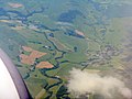
 Glenmanna from the air - geograph.org.uk - 5284675.jpg 640 × 378; 102 KB
-
 Glenmanna from the air - geograph.org.uk - 5410369.jpg 640 × 480; 127 KB
-
 Glenscoben Bridge and road crossing Woodend Burn - geograph.org.uk - 5545995.jpg 4,000 × 3,000; 5.02 MB
-
 Glenskelly Burn - geograph.org.uk - 6711311.jpg 640 × 480; 177 KB
-
 Glenwhargen Craig - geograph.org.uk - 4348124.jpg 4,608 × 3,456; 4.91 MB
-
 Glenwhargen Craig - geograph.org.uk - 4425909.jpg 3,504 × 2,336; 3.19 MB
-
 Glenwhargen from the air - geograph.org.uk - 6064428.jpg 1,024 × 768; 273 KB
-
 Glenwhargen Hass - geograph.org.uk - 999381.jpg 640 × 425; 114 KB
-
 Glenwhern Burn - geograph.org.uk - 1770400.jpg 640 × 359; 69 KB
-
 Glenwhern Burn - geograph.org.uk - 1770428.jpg 640 × 480; 113 KB
-
 Glenwhern Burn - geograph.org.uk - 1812414.jpg 640 × 359; 87 KB
-
 Glenwhern Burn - geograph.org.uk - 1812427.jpg 640 × 365; 72 KB
-
 Gnarled tree by the Chanlock Burn - geograph.org.uk - 3942783.jpg 3,456 × 4,608; 4.75 MB
-
 Gnarled tree in Chanlock Glen - geograph.org.uk - 3942717.jpg 4,608 × 3,456; 4.62 MB
-
 Graveyard at Parish Church of Penpont, Keir ^ Tynron - geograph.org.uk - 4101494.jpg 1,600 × 1,067; 579 KB
-
 Green Trail in Bogrie Wood - geograph.org.uk - 5091336.jpg 1,920 × 1,280; 2.58 MB
-
 Hall Burn - geograph.org.uk - 1762715.jpg 640 × 480; 102 KB
-
 Hall Burn - geograph.org.uk - 1768889.jpg 640 × 480; 120 KB
-
 Hallburn Bridge and road crossing Hall Burn - geograph.org.uk - 5546060.jpg 4,000 × 3,000; 4.4 MB
-
 Hallscaur - geograph.org.uk - 1553099.jpg 640 × 480; 77 KB
-
 Hallscaur Craig - geograph.org.uk - 4424465.jpg 4,608 × 3,456; 4.94 MB
-
 Hallscaur Rig - geograph.org.uk - 4424514.jpg 4,608 × 3,456; 5.12 MB
-
 Happy New Year - geograph.org.uk - 6014777.jpg 2,976 × 1,984; 2.81 MB
-
 Haugh, Drumlanrig - geograph.org.uk - 3228671.jpg 640 × 480; 283 KB
-
 Haulscaur Rig - geograph.org.uk - 1768895.jpg 640 × 359; 71 KB
-
 Hawthorn trees and outcrops, Scaur Glen - geograph.org.uk - 3467305.jpg 4,608 × 3,456; 5.48 MB
-
 Hazel hedge near Merkland - geograph.org.uk - 1553754.jpg 640 × 480; 103 KB
-
 Head of the March Burn - geograph.org.uk - 4348831.jpg 4,608 × 3,456; 5.43 MB
-
 Heading up Townhead Hill - geograph.org.uk - 6691463.jpg 4,032 × 1,960; 3.04 MB
-
 Heathery Hill - geograph.org.uk - 999392.jpg 640 × 425; 95 KB
-
-
 Hills above Glenmanna - geograph.org.uk - 4874502.jpg 3,504 × 2,336; 3.18 MB
-
 Hillside by Braxholme Rush - geograph.org.uk - 3941475.jpg 4,608 × 3,456; 4.95 MB
-
 Hillside east of Stell Bush - geograph.org.uk - 3942745.jpg 4,608 × 3,456; 4.58 MB
-
 Jarney Knowes - geograph.org.uk - 1768927.jpg 640 × 359; 74 KB
-
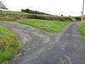
 Junction of roads at Druidhall Farm - geograph.org.uk - 5545971.jpg 4,000 × 3,000; 3.62 MB
-
 Junction of roads near Pleasure Knowe - geograph.org.uk - 5545989.jpg 4,000 × 3,000; 3.63 MB
-
 Keb Torrs - geograph.org.uk - 1706677.jpg 1,013 × 749; 272 KB
-
 Keir Road, Penpont - geograph.org.uk - 4114781.jpg 1,920 × 1,280; 1.5 MB
-

-

-

-
 Lime - geograph.org.uk - 1812040.jpg 640 × 480; 77 KB
-
 Linn Burn - geograph.org.uk - 793126.jpg 640 × 480; 175 KB
-
 Little Mote Hill from the air - geograph.org.uk - 5614762.jpg 640 × 422; 102 KB
-
 Lower and Upper Glenjaan - geograph.org.uk - 3545498.jpg 3,264 × 2,448; 2.24 MB
-
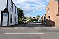
 Main Street, Penpont - geograph.org.uk - 4101423.jpg 5,184 × 3,456; 6.75 MB
-
 Main Street, Penpont - geograph.org.uk - 4114768.jpg 1,920 × 1,280; 1.64 MB
-
 Main Street, Penpont - geograph.org.uk - 4114770.jpg 1,920 × 1,280; 1.45 MB
-
 Main Street, Penpont - geograph.org.uk - 4114783.jpg 1,920 × 1,280; 1.2 MB
-
 Main Street, Penpont - geograph.org.uk - 4114786.jpg 1,920 × 1,280; 1.46 MB
-
 Main Street, Penpont - geograph.org.uk - 4643694.jpg 1,880 × 1,280; 392 KB
-
 Main Street, Penpont - geograph.org.uk - 6146469.jpg 1,024 × 577; 158 KB
-
 Marr Burn - geograph.org.uk - 5086505.jpg 768 × 1,024; 382 KB
-
 Marr Burn, Drumlanrig - geograph.org.uk - 4745360.jpg 3,504 × 2,336; 4.44 MB
-
 Marrburn Road, Penpont - geograph.org.uk - 4114782.jpg 1,920 × 1,280; 1.44 MB
-
 Merkland Bridge and road crossing Druidhill Burn - geograph.org.uk - 5545964.jpg 4,000 × 3,000; 5.09 MB
-
 Merkland Hill - geograph.org.uk - 1762701.jpg 640 × 359; 76 KB
-
 Michael's Crag - geograph.org.uk - 1768093.jpg 640 × 359; 72 KB
-
 Microwaved mail - geograph.org.uk - 1812031.jpg 480 × 640; 119 KB
-
 Millennium Cairn - geograph.org.uk - 1058081.jpg 640 × 406; 56 KB
-
 Millennium Cairn - geograph.org.uk - 6397996.jpg 1,024 × 768; 163 KB
-
 Millennium Cairn - geograph.org.uk - 6427926.jpg 4,032 × 1,960; 3.28 MB
-

-
 Millennium Cairn from A702 - geograph.org.uk - 2007430.jpg 1,600 × 1,184; 149 KB
-
 Millennium Cairn near Stepends - geograph.org.uk - 4101509.jpg 5,184 × 3,456; 7.44 MB
-
 Millennium Cairn, Penpont - geograph.org.uk - 6146460.jpg 1,024 × 577; 147 KB
-
 Minor road, Drumlanrig - geograph.org.uk - 3230601.jpg 640 × 480; 345 KB
-
 Minor road, Virginhall Plantation - geograph.org.uk - 3232862.jpg 640 × 480; 329 KB
-
 Mixed planting in Polskeoch Forest - geograph.org.uk - 1552487.jpg 640 × 480; 120 KB
-
 Moniaive from the northeast - geograph.org.uk - 3545971.jpg 3,264 × 2,448; 2.97 MB
-

-
 Moorland fences on Black Rig - geograph.org.uk - 4428906.jpg 640 × 480; 101 KB
-
 Moorland slopes below Welltrees Tappin - Welltrees Hill - geograph.org.uk - 6703936.jpg 2,000 × 1,203; 2.09 MB
-
 Mote Hill - geograph.org.uk - 6711314.jpg 640 × 480; 141 KB
-
 Mote Hill from track to Dunduff ruin - geograph.org.uk - 6711316.jpg 640 × 480; 154 KB
-
 MTB Trail (black), - geograph.org.uk - 5091142.jpg 1,920 × 1,280; 1.91 MB
-
 MTB Trail (black), - geograph.org.uk - 5091327.jpg 1,920 × 1,280; 2.51 MB
-
 MTB Trail (green), - geograph.org.uk - 5091348.jpg 1,920 × 1,280; 2.5 MB
-
 Muckspreading - geograph.org.uk - 1820331.jpg 640 × 359; 64 KB
-
 Mud, Tibbers - geograph.org.uk - 3230769.jpg 640 × 480; 275 KB
-
 Narrow bridge near Holm of Drumlanrig - geograph.org.uk - 2585868.jpg 3,264 × 2,448; 1.76 MB
-
 Near Honeyhole and Auchenbainzie - geograph.org.uk - 4281340.jpg 3,264 × 2,448; 3.42 MB
-
 Nith Bridge Cross - geograph.org.uk - 5357195.jpg 1,626 × 2,584; 951 KB
-
 Nith Bridge, Thornhill - geograph.org.uk - 4075395.jpg 640 × 480; 97 KB
-
 Old Building in Drumlanrig Woods - geograph.org.uk - 5091468.jpg 1,837 × 1,180; 665 KB
-

-
 Old Milestone near Auchenbainzie - geograph.org.uk - 6102279.jpg 576 × 768; 129 KB
-
 Old Milestone north of Penpont - geograph.org.uk - 6038005.jpg 1,024 × 768; 193 KB
-
 Old wall near Glenskelly Burn - geograph.org.uk - 6711309.jpg 640 × 480; 160 KB
-
 Old wall on Birny Rig - geograph.org.uk - 793195.jpg 640 × 480; 152 KB
-
 Old walls in Scaur Water Glen - geograph.org.uk - 1553085.jpg 640 × 480; 89 KB
-
 Ordnance Survey Cut Mark - geograph.org.uk - 5545985.jpg 4,000 × 3,000; 2.2 MB
-
 Ordnance Survey Cut Mark - geograph.org.uk - 5546030.jpg 4,000 × 3,000; 4.91 MB
-
 Ordnance Survey Flush Bracket G316 - geograph.org.uk - 3718778.jpg 4,000 × 3,000; 4.37 MB
-
 Parish Church of Penpont, Keir and Tynron - geograph.org.uk - 4114764.jpg 1,920 × 1,280; 1.61 MB
-
 Parish Church of Penpont, Keir and Tynron - geograph.org.uk - 4114788.jpg 1,920 × 1,280; 1.08 MB
-
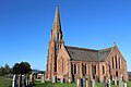 Parish Church of Penpont, Keir ^ Tynron - geograph.org.uk - 4101482.jpg 5,184 × 3,456; 6.45 MB
-
 Pasture, forest and moorland, Scaur Glen - geograph.org.uk - 4425718.jpg 4,608 × 3,456; 4.9 MB
-
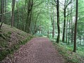 Path in the woods at Drumlanrig - geograph.org.uk - 1369085.jpg 640 × 480; 129 KB
-
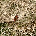 Peacock butterfly - geograph.org.uk - 4441829.jpg 3,452 × 3,456; 2.76 MB
-
 Peat Hill and the Scaur Glen - geograph.org.uk - 4348111.jpg 4,608 × 3,456; 5.19 MB
-
 Penpont Burn - geograph.org.uk - 1326069.jpg 640 × 480; 173 KB
-
 Penpont Cairn - geograph.org.uk - 3101812.jpg 2,048 × 1,536; 578 KB
-
 Penpont Caravan Site - geograph.org.uk - 6146467.jpg 1,024 × 577; 214 KB
-
 Penpont from the air - geograph.org.uk - 6064431.jpg 1,024 × 768; 265 KB
-
 Penpont houses - geograph.org.uk - 6460058.jpg 778 × 1,600; 350 KB


,_-_geograph.org.uk_-_5091142.jpg)
,_-_geograph.org.uk_-_5091327.jpg)
,_-_geograph.org.uk_-_5091348.jpg)


&filefrom=Penpont+Parish+Church+-+geograph.org.uk+-+4066856.jpg#mw-category-media)