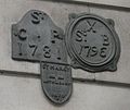
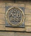
Category:Parish boundary plaques in the City of London
Jump to navigation
Jump to search
Subcategories
This category has only the following subcategory.
L
- Lost London Churches Project (23 F)
Media in category "Parish boundary plaques in the City of London"
The following 24 files are in this category, out of 24 total.
-
Parish bench mark in Philpot Lane.JPG 938 × 1,127; 442 KB
-
Parish Boundary Mark Frederick Place.JPG 2,448 × 3,264; 3.14 MB
-
Parish boundary mark in Little Trinity Lane.JPG 1,572 × 1,019; 713 KB
-
Parish boundary mark on Fish St Hill.JPG 2,448 × 3,264; 2.8 MB
-
Parish boundary mark on side of St Pauls Choir School.JPG 2,448 × 3,264; 2.82 MB
-
Parish boundary mark on wall of the Bank of England.JPG 2,475 × 2,093; 1.66 MB
-
Parish boundary marks - geograph.org.uk - 764178.jpg 640 × 480; 74 KB
-
Parish boundary, Chancery Lane, London-geograph-3582365-by-Christopher-Hilton.jpg 1,600 × 1,064; 378 KB
-
Parish mark in Lombard Lane - geograph.org.uk - 766522.jpg 640 × 480; 84 KB
-
Parish marks in Lombard Street.JPG 1,893 × 1,297; 674 KB
-
PBMAH.JPG 1,404 × 1,639; 1.06 MB
-
St faiths plaque in New Change.JPG 2,448 × 3,264; 1.78 MB


