Category:OpenStreetMap maps of Paris 7e arrondissement
Jump to navigation
Jump to search
Media in category "OpenStreetMap maps of Paris 7e arrondissement"
The following 13 files are in this category, out of 13 total.
-
 7e Arrondissement, Paris, France - Open Street Map.png 1,820 × 1,136; 2.48 MB
-
 7th arrondissement of Paris - OSM 2020.svg 2,114 × 1,396; 1.75 MB
-
 Champ-de-Mars, Paris - OSM 2020.svg 1,920 × 790; 462 KB
-
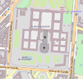
 Les Invalides - OpenStreetMap 1.svg 566 × 1,141; 2 MB
-
 Les Invalides - OpenStreetMap 2.svg 498 × 471; 745 KB
-
 Map of the 7th arrondissement of Paris - OSM 2020.svg 2,114 × 1,396; 1.78 MB
-
 Musée du Quai Branly, Paris (en) - OSM 2022.svg 1,920 × 1,080; 254 KB
-
 Musée du Quai Branly, Paris (fr) - OSM 2022.svg 1,920 × 1,080; 254 KB
-
 Musée Rodin, Paris - OSM 2022 01.svg 1,600 × 1,000; 153 KB
-
 Musée Rodin, Paris - OSM 2022 02.svg 1,100 × 1,600; 157 KB
-
 Place de Fontenoy-UNESCO - OSM 2022.svg 1,400 × 850; 249 KB
-
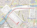 Plans of l'Expo Universelle 1889 Decauville Railway.jpg 923 × 711; 219 KB
-
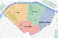 Quarters of the 7th arrondissement of Paris - OSM 2020.svg 2,114 × 1,396; 1.77 MB


_-_OSM_2022.svg)
_-_OSM_2022.svg)


