Category:OpenStreetMap maps of Paris 5e arrondissement
Jump to navigation
Jump to search
Media in category "OpenStreetMap maps of Paris 5e arrondissement"
The following 15 files are in this category, out of 15 total.
-
 2014 collegiale Saint-Marcel emplacement.jpg 533 × 446; 235 KB
-
 5e Arrondissement, Paris, France - Open Street Map.png 1,227 × 1,100; 1.88 MB
-
 5th arrondissement of Paris - OSM 2020.svg 1,833 × 1,663; 1.26 MB
-
 Champ-de-Mars - OpenStreetMap 1.svg 586 × 555; 2.33 MB
-
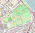
 Jardin des plantes de Paris - OpenStreetMap 2020 - Clos.png 1,280 × 957; 679 KB
-
 Jardin des plantes de Paris - OpenStreetMap 2020.svg 1,600 × 1,196; 587 KB
-
 Jardin des Plantes de Paris - OpenStreetMap.svg 873 × 821; 1.92 MB
-
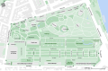 Jardin des plantes de Paris - OSM 2020.svg 1,320 × 860; 446 KB
-
 Map of the 5th arrondissement of Paris - OSM 2020.svg 1,833 × 1,663; 1.29 MB
-
 Ménagerie du Jardin des plantes, EN - OSM 2020.svg 2,200 × 1,500; 241 KB
-
 Ménagerie du Jardin des plantes, FR - OSM 2020.svg 2,200 × 1,500; 247 KB
-
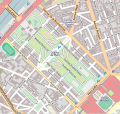
 Place du Panthéon - OpenStreetMap 2015.svg 512 × 366; 99 KB
-
 Place du Panthéon, Paris - OSM 2020.svg 512 × 410; 118 KB
-
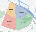 Quarters of the 5th arrondissement of Paris - OSM 2020.svg 1,833 × 1,663; 1.27 MB
-
 Val-de-Grâce - OpenStreetMap 1.svg 531 × 408; 746 KB


