Category:OpenStreetMap maps of Luxembourg (province)
Jump to navigation
Jump to search
Provinces of Belgium: Province of Antwerp · East Flanders · Flemish Brabant · Limburg · Province of Liege · Luxembourg · Province of Namur · Walloon Brabant · West Flanders
Media in category "OpenStreetMap maps of Luxembourg (province)"
The following 21 files are in this category, out of 21 total.
-
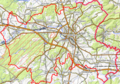
 Arlon OSM 01.png 1,131 × 777; 643 KB
-
 Arlon OSM 02.png 679 × 477; 414 KB
-
 Arlon OSM 03.png 679 × 477; 237 KB
-
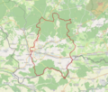
 Bastogne Limite administrative.png 949 × 577; 553 KB
-
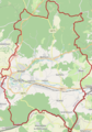
 Bastogne Limite communale.png 951 × 576; 361 KB
-
 Bastogne OSM 01.png 372 × 500; 368 KB
-
 Bastogne OSM 02.png 372 × 500; 507 KB
-
 Bouillon (Belgique) OSM 01.png 331 × 401; 165 KB
-
 Bouillon (Belgique) OSM 02.png 331 × 401; 331 KB
-
 Bouillon (Belgique) OSM 03.png 553 × 568; 519 KB
-
 Carte OpenStreetMap de Daverdisse.png 1,094 × 828; 571 KB
-
 Eisch (rivière).png 485 × 461; 293 KB
-
 LaRoche-en-Ardenne cityboundaries.png 860 × 483; 527 KB
-
 Le-Cheslé map.png 429 × 620; 102 KB
-
 Marche-en-Famenne OSM 01.png 715 × 520; 546 KB
-
 Marche-en-Famenne OSM 02.png 715 × 520; 898 KB
-
 Marche-en-Famenne OSM 03.png 715 × 520; 401 KB
-
 Virton OSM 01.png 986 × 836; 502 KB
-
 Virton OSM 02.png 422 × 603; 287 KB
-
 Virton OSM 03.png 422 × 603; 138 KB
-
 Éoliennes arlon-messancy.png 1,530 × 813; 504 KB


_OSM_01.png)
_OSM_02.png)
_OSM_03.png)

.png)


