Category:OpenStreetMap maps of Antwerp (province)
Jump to navigation
Jump to search
Provinces of Belgium: Province of Antwerp · East Flanders · Flemish Brabant · Limburg · Province of Liege · Luxembourg · Province of Namur · Walloon Brabant · West Flanders
Media in category "OpenStreetMap maps of Antwerp (province)"
The following 17 files are in this category, out of 17 total.
-
2017-03-16 Reiseroute Karte Antwerpen.jpg 1,051 × 786; 949 KB
-
Antwerp Map.png 686 × 704; 519 KB
-
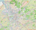
Anvers OSM 01.png 559 × 587; 402 KB
-
Anvers OSM 03.png 412 × 550; 209 KB
-
Belgium Antwerpse Kempen OSM.png 796 × 606; 548 KB
-
Groot-Antwerpen.png 1,044 × 877; 1.45 MB
-
Mechelen Tervuursesteenweg.jpg 945 × 737; 257 KB
-
Noordelijkebypass.jpg 1,055 × 862; 1.05 MB
-
OpenStreetMap - Wijk Savelkoul, Mortsel.png 1,219 × 914; 1.13 MB
-
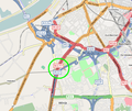
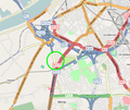
Osm locatie Bevrijdingstunnel.PNG 492 × 416; 92 KB
-
Osm locatie Frans Tijsmanstunnel.PNG 437 × 482; 54 KB
-
Osm locatie Jan De Vostunnel.PNG 492 × 416; 92 KB
-
Osm locatie Liefkenshoektunnel.PNG 437 × 482; 54 KB
-
R6, Mechelen.png 1,014 × 798; 585 KB
-
Ring Antwerpen - Oosterweelverbinding - Oosterweeltunnel.PNG 476 × 441; 94 KB
-
Ring Antwerpen - Oosterweelverbinding.PNG 476 × 441; 94 KB
-
Vrijheid (Hoogstraten).jpg 921 × 681; 180 KB


