Category:Old railroad maps of the United States
Jump to navigation
Jump to search
Subcategories
This category has the following 24 subcategories, out of 24 total.
Media in category "Old railroad maps of the United States"
The following 141 files are in this category, out of 141 total.
-
 1920 Philadelphia and Columbia.jpg 2,000 × 956; 595 KB
-
 Railroad map of Porto Rico. LOC 98687137.jpg 10,892 × 5,776; 5.98 MB
-
 1921 Southern Railway map.jpg 1,367 × 1,212; 721 KB
-
 1923 MEC.jpg 954 × 1,213; 456 KB
-
 1923 Reading.png 1,176 × 800; 222 KB
-
 Railroad map of Porto Rico. LOC 98687137.tif 10,892 × 5,776; 179.99 MB
-
 1928 Okeechobee Flood.png 855 × 819; 172 KB
-
 1929 NYCRR Water Level Route.jpg 2,234 × 1,151; 799 KB
-
 1930 D&RGW WP.jpg 2,154 × 1,113; 668 KB
-
 1937 Chicago Tunnel Terminal Company.jpg 12,694 × 7,334; 11.27 MB
-
 1937 original railroads in Pittsburgh.jpg 5,327 × 3,150; 2.85 MB
-
 1942 topographic map of Salem USGS.jpg 3,056 × 3,691; 4.62 MB
-
 Arizona & Swansea RR.jpg 1,500 × 754; 380 KB
-
 By trolley through eastern New England (1904) (14796493203).jpg 1,636 × 1,816; 395 KB
-
 Catawissa RR map 1895.jpg 960 × 520; 759 KB
-
 Chicago Aurora and Elgin Railroad 1936 map.jpg 1,929 × 1,080; 561 KB
-
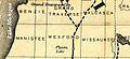 Clam Lake in Wexford County 1872.jpg 782 × 361; 91 KB
-

-
 EastBroadTop map.tif 14,450 × 9,632; 1.83 MB
-
 Eastern Oregon rail map 1931.jpg 1,739 × 1,073; 580 KB
-

-

-

-
 Fostoria Ohio Railroad Map 1880.jpg 624 × 361; 64 KB
-
 Frederick and Pennsylvania Line railroad from 1873 map.png 603 × 459; 480 KB
-
 Great Northern Railway and proprietary lines (10139229494).jpg 800 × 428; 114 KB
-
 Guide map of Chicago, October 11th, 1871 (14006569691).jpg 5,158 × 3,178; 5.16 MB
-
-
 Hanover Jct Hanover & Gettysburg RR map 1895.jpg 960 × 378; 510 KB
-

-
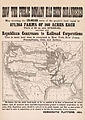 How The Public Domain Has Been Squandered 1884 Cornell CUL PJM 1088.jpg 6,600 × 9,300; 12.12 MB
-
 Index Map of the Maryland and Pennsylvania Railroad - NARA - 124451353.jpg 3,296 × 5,100; 2 MB
-
 Jacksonville South Eastern Line.jpg 540 × 880; 107 KB
-
 Julius Cahn's official theatrical guide. (1896) (14779543474).jpg 3,200 × 2,008; 953 KB
-

-
 Lloyds American railroad map (8347223966).jpg 800 × 623; 143 KB
-
 Lloyds American railroad map (9141774709).jpg 799 × 622; 150 KB
-
 LNOT railroad detail.jpg 1,800 × 2,700; 698 KB
-

-

-

-
-
 Map of Atlantic and Pacific Rail Road (10174995993).jpg 800 × 661; 124 KB
-

-

-

-
 Map of Chickamauga and Chattanooga National Park (10839206445).jpg 535 × 800; 112 KB
-
 Map of Cleveland and Toledo Rail Road, with its connections (13389335884).jpg 2,000 × 1,026; 1.91 MB
-
 Map of Illinois and Missouri WDL9602.png 1,024 × 1,367; 2.31 MB
-
 Map of Mississippi, Louisiana and Arkansas WDL9599.png 1,024 × 1,382; 2.47 MB
-
 Map of New Jersey and Pennsylvania WDL9594.png 1,376 × 1,024; 2.19 MB
-
 Map of New York WDL9593.png 1,368 × 1,024; 2.32 MB
-
 Map of North and South Carolina WDL9596.png 1,383 × 1,024; 2.37 MB
-
 Map of Pennsylvania, 1829 WDL9572.png 1,472 × 1,024; 3.11 MB
-
 Map of routes for a Pacific railroad (5121143386).jpg 2,000 × 1,792; 3.13 MB
-

-
-
 Map of the Chesapeake and Ohio Railroad and its connections. LOC 98688617.jpg 13,055 × 4,986; 11.34 MB
-

-
 Map of the eastern junc. Broad Sound Pier, & Pt. Shirley railroad (2674198025).jpg 5,232 × 3,532; 8.32 MB
-
 Map of the European & North American Railway and its connections (9141774223).jpg 9,434 × 5,710; 47.52 MB
-
-
 Map of the Louisville & Nashville Railroad (ca. 1890).jpg 2,927 × 5,368; 4.38 MB
-

-

-

-

-

-
 Map of the rail roads of New Jersey 1887 (10840408863).jpg 564 × 800; 107 KB
-

-

-

-

-
 Map of the Troy and Greenfield Rail Road and its connections (11838754365).jpg 2,000 × 1,393; 2.32 MB
-

-
 Map of Virginia, Maryland and Delaware WDL9595.png 1,379 × 1,024; 2.38 MB
-
 Map of West Virginia showing railroads and county products (11842969584).jpg 2,000 × 1,442; 2.46 MB
-

-
-
 Map showing the Burlington, Cedar Rapids and Minnesota Railway and its connections (10210704914).jpg 7,291 × 10,024; 16.63 MB
-

-
 Marshall Pass Scheme.jpg 1,832 × 1,166; 725 KB
-
-
 MobileOhioRailRoad1848.gif 1,730 × 2,633; 1.82 MB
-
 NCRY map 1863.jpg 720 × 960; 516 KB
-
 New Orleans City of Old Romance and New Opportunity 30.jpg 2,238 × 3,476; 574 KB
-
 New Orleans City of Old Romance and New Opportunity 31.jpg 2,238 × 3,476; 1.08 MB
-
-
 New York Central Railroad System map 1926th.jpg 1,595 × 764; 1.28 MB
-
 Norfolk and Portsmouth Traction Company's lines are shown in red (11840196525).jpg 1,524 × 2,000; 3.46 MB
-
 Northern Pacific Rail Road and connections (14533461260).jpg 2,000 × 1,376; 3.26 MB
-
 Northern Virginia Map - Potomac, Fredericksburg, & Piedmont Railroad.jpg 3,382 × 1,616; 4.97 MB
-
 OMRmap1924.jpg 989 × 666; 113 KB
-
 P&BC RR map 1895.jpg 960 × 720; 170 KB
-
 Paddock Fort-Worth, Tex., and Rail-Roads 1888 UTA.jpg 7,762 × 5,768; 30.01 MB
-
 Pennsylvania Railroad tunnels and terminals in New York City - (1908) (14757964051).jpg 3,536 × 2,360; 902 KB
-
-
 Plan Showing Alignment of the Proposed Electric RR - DPLA - d590eeeda140654a286a82bfc85a3163.jpg 23,030 × 10,816; 46.78 MB
-

-
 Railroad and county map of Mississippi (14069857673).jpg 1,518 × 2,000; 3.79 MB
-
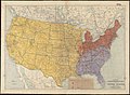
 Railroad distance map of the United States, Mexico and Canada (14009382364).jpg 2,000 × 1,100; 2.59 MB
-
 Railroad map of Illinois (13388105204).jpg 1,372 × 2,000; 3.3 MB
-
 Railroad of Confederacy-1861.jpg 1,234 × 947; 814 KB
-
 Railways US 1870 mark Louisville.png 1,332 × 803; 611 KB
-

-

-
 Route of the Albany and West Stockbridge Rail Road (10176174055).jpg 800 × 561; 93 KB
-
 Santa Fe Route Map 1891.jpg 1,435 × 1,023; 355 KB
-
 Sights and scenes in Idaho and Montana for tourists (1892) (14572010717).jpg 4,411 × 2,069; 1.82 MB
-

-

-

-
 The American Railway Page 431(Railways US 1870).png 1,558 × 1,001; 1.52 MB
-
-

-
 The Denver & Rio Grande system - DPLA - 380c9b4b2cfcc9e550486539f91828a9.jpg 9,000 × 2,754; 5.93 MB
-
 The Denver & Rio Grande system - DPLA - 516e3a38a936d39ee9fa8962d589f3b8.jpg 9,000 × 2,766; 5.14 MB
-
 The Denver & Rio Grande system - DPLA - 5d9bb8fa0e514245339053304175ba87.jpg 9,000 × 2,760; 5.02 MB
-

-

-

-
-
 The Pacific Railway, as completed May 10, 1869 - DPLA - e8fc58eb07d771ebc3178d527e130dbc.jpg 9,000 × 3,152; 4.88 MB
-

-
 The Philadelphia & Western Railroad and connecting lines 1941.jpg 1,626 × 1,554; 754 KB
-

-
 The street railway review (1891) (14758081111).jpg 2,908 × 2,043; 668 KB
-

-

-

-

-
 US Pacific Railroads 1887.jpg 855 × 769; 319 KB
-
 US Transcontinental Railroads 1887.jpg 2,060 × 1,848; 469 KB
-

-
 Virginia Central Map 1852 cropped.png 1,425 × 655; 2.05 MB
-
 Virginia Central Map 1852.jpg 8,425 × 5,747; 12.16 MB
-
 Western Pacific RR 1931 California.jpg 3,087 × 2,525; 2.75 MB
-
 Western Pacific RR 1931 Nevada.jpg 3,558 × 1,708; 1.82 MB
-
 Western Pacific RR 1931 Utah.jpg 2,368 × 1,759; 1.47 MB
-

-


_(14796493203).jpg)


.jpg)


.jpg)
.jpg)
.jpg)
_(14781152023).jpg)


_(14779543474).jpg)
.jpg)
.jpg)
.jpg)


.jpg)
.jpg)
.jpg)
.jpg)
.jpg)
.png)

.jpg)
.jpg)


.jpg)
.jpg)
.jpg)
.jpg)

.jpg)
_and_the_Denver_%26_Rio_Grande_Railway,_showing_proposed_extensions_%26_connections,_also_the_relative_position_of_Mexi_-_DPLA_-_cc4cd287d44b6e627e5872d54336ed4b.jpg)
.jpg)

.jpg)
.jpg)

.jpg)
.jpg)
.jpg)


.jpg)
.jpg)
.jpg)
.jpg)

.jpg)


.jpg)
.jpg)


_(14757964051).jpg)

.jpg)
.jpg)
.jpg)
.jpg)


.jpg)
.jpg)
.jpg)

_(14572010717).jpg)
.jpg)
.jpg)
.jpg)
.png)
_(14574660339).jpg)
_(14761305365).jpg)
.jpg)
_(14574674748).jpg)
.jpg)
.jpg)
.jpg)

_(14738072506).jpg)
_(14758081111).jpg)
.jpg)

.jpg)


_(14757591691).jpg)
_(14758425914).jpg)
_(14758428414).jpg)
.jpg)
.jpg)
.jpg)
_(14004191533).jpg)
.jpg)
.jpg)
.jpg)