Category:1880s railroad maps of the United States
Jump to navigation
Jump to search
Subcategories
This category has only the following subcategory.
Media in category "1880s railroad maps of the United States"
The following 77 files are in this category, out of 77 total.
-
Fitchburg Railroad with its branches and connections. LOC 86692426.jpg 3,588 × 1,054; 666 KB
-
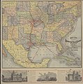
Map of South West.jpg 598 × 600; 142 KB
-
O. M. Roberts Texas Map No. 1 1881 UTA.jpg 3,277 × 2,824; 3.68 MB
-
1881 BHT&W.jpg 9,059 × 5,809; 13.59 MB
-
1881 Boston and Maine Railroad map.png 3,500 × 2,957; 13.86 MB
-
Campaigns of the civil war (1881) (14576053599).jpg 1,574 × 1,832; 240 KB
-
1882 FT&PRR.jpg 8,240 × 5,792; 14.02 MB
-
1882 SF&W.jpg 908 × 708; 162 KB
-
Map of Nebraska showing the Union Pacific Railroad land grant (14046904301).jpg 2,000 × 1,173; 2.65 MB
-
1883 Consolidated Southern Railway.jpg 6,592 × 4,928; 11.07 MB
-
Atlantic & Pacific Railroad Map.jpg 9,936 × 4,384; 7.2 MB
-
1884 Chicago & Alton map only.jpg 2,796 × 1,910; 1.67 MB
-
1884 Chicago & Alton.jpg 8,872 × 4,694; 12.58 MB
-
1884 Erie.gif 1,840 × 1,404; 754 KB
-
Catawissa RR map 1884.jpg 1,445 × 1,160; 2.38 MB
-
1884 Massachusetts railroad map (14574236209).jpg 3,702 × 2,764; 1.8 MB
-
1884 PRR RDG LVRR.jpg 9,024 × 8,048; 16.8 MB
-
1884 South Penn RR.jpg 3,898 × 808; 782 KB
-
1885 ACL cover.jpg 2,236 × 2,463; 1.32 MB
-
1885 ACL map.jpg 5,466 × 4,847; 7.84 MB
-
1885 ACL text.jpg 5,502 × 4,857; 6.87 MB
-
1885 Chicago & Alton map only.jpg 2,791 × 1,904; 1.72 MB
-
1885 Chicago & Alton text.jpg 8,912 × 4,720; 13.01 MB
-
1885 GT text.jpg 9,764 × 4,852; 13.75 MB
-
1885 GT.jpg 9,752 × 4,840; 15.18 MB
-
1886 D&H.jpg 1,728 × 2,040; 285 KB
-
1886 Map of the Connecticut River Line and connections.jpg 7,848 × 9,517; 9.75 MB
-
1886 Wabash text.jpg 9,892 × 5,032; 13.69 MB
-
1886 Wabash.jpg 9,836 × 4,996; 18.94 MB
-
1886rail-usgenweb-mapproject.jpg 1,772 × 2,092; 1.16 MB
-
1887 C> map only.jpg 6,364 × 4,000; 7.98 MB
-
1887 C> text.jpg 4,740 × 10,660; 10.17 MB
-
1887 C>.jpg 10,540 × 4,604; 11.34 MB
-
1887 CV text.jpg 8,716 × 4,624; 11.34 MB
-
1887 CV.jpg 8,685 × 4,636; 12.71 MB
-
Map of Seattle, Lake Shore, & Eastern Railway - NARA - 55302636.jpg 22,333 × 13,216; 28.53 MB
-
Map of Seattle, Lake Shore, & Eastern Railway - NARA - 55302638.jpg 21,600 × 63,324; 41.73 MB
-
1887 Montreal - Boston.jpg 5,147 × 9,309; 11.11 MB
-
1887 Norfolk and Western Map.jpg 8,696 × 6,912; 20.84 MB
-
1887 Wabash cover.jpg 2,380 × 2,316; 1.21 MB
-
1887 Wabash map only.jpg 2,803 × 1,924; 1.51 MB
-
1887 Wabash.jpg 4,177 × 2,308; 2.49 MB
-
1888 B&M map.jpg 8,812 × 4,676; 12.7 MB
-
1888 B&M text.jpg 8,824 × 4,668; 12.9 MB
-
1888 Central Mass.gif 2,153 × 1,183; 132 KB
-
1888 Old Colony Railroad South Shore map.png 2,384 × 3,975; 20.2 MB
-
1888 OCRR.gif 597 × 694; 111 KB
-
1888 OCRR.PNG 597 × 694; 114 KB
-
1888 SFRR north.jpg 9,696 × 6,752; 17.9 MB
-
1888 SFRR south.jpg 9,696 × 6,736; 15.29 MB
-
Railway map of Nebraska issued by State Board of Transportation 1889. LOC 98688510.jpg 9,344 × 5,168; 7.48 MB
-
1889 - The Man of Commerce - a map of the United States of America.jpg 12,000 × 7,538; 11.79 MB
-
1889 PRR.jpg 11,424 × 6,048; 15.69 MB
-
G. W. & C. B. Colton & Co. True Southern Pacific Railway c. 1881 UTA.jpg 9,594 × 3,594; 9.22 MB
-
Fitchburg Railroad with its branches and connections. LOC 86692426.tif 3,588 × 1,054; 10.82 MB
-
Guide to the summer resorts and watering places of East Tennessee (1880) (14761168885).jpg 3,328 × 1,971; 1.43 MB
-
Map of the mexican central railway and connections... - btv1b53023094c (1 of 2).jpg 7,697 × 6,401; 9.22 MB
-
Pensacola and Atlantic RR map 1885.jpg 600 × 474; 82 KB
-
The St. Paul Minneapolis & Manitoba Railway (1880) (3751818593).jpg 13,119 × 7,025; 16.05 MB
-
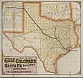
Map of the Gulf, Colorado and Santa Fe 'Texas Midland Route' 1880 UTA.jpg 9,230 × 8,592; 13.64 MB
-
Rand, McNally and Co. Map of the Houston and Texas Central Railway 1880 UTA.jpg 8,476 × 8,528; 11.04 MB


