Category:Old maps of Venango County, Pennsylvania
Jump to navigation
Jump to search
Counties of Pennsylvania : Adams · Allegheny · Armstrong · Beaver · Bedford · Berks · Blair · Bradford · Bucks · Butler · Cambria · Cameron · Carbon · Centre · Chester · Clarion · Clearfield · Clinton · Columbia · Crawford · Cumberland · Dauphin · Delaware · Elk · Erie · Fayette · Franklin · Fulton · Greene · Huntingdon · Indiana · Jefferson · Juniata · Lackawanna · Lancaster · Lawrence · Lebanon · Lehigh · Luzerne · Lycoming · McKean · Mercer · Mifflin · Monroe · Montgomery · Montour · Northampton · Northumberland · Perry · Philadelphia · Pike · Potter · Schuylkill · Snyder · Somerset · Sullivan · Susquehanna · Tioga · Union · Venango · Warren · Washington · Wayne · Westmoreland · Wyoming · York
Subcategories
This category has the following 7 subcategories, out of 7 total.
Pages in category "Old maps of Venango County, Pennsylvania"
This category contains only the following page.
Media in category "Old maps of Venango County, Pennsylvania"
The following 38 files are in this category, out of 38 total.
-
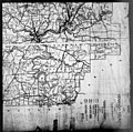
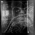
 McLaurin(1902) pic.013 Map of Oil City.jpg 546 × 815; 96 KB
-
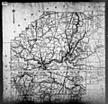
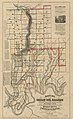
 McLaurin(1902) pic.038 Map of Venango Conty, PA.jpg 745 × 861; 223 KB
-

-

-

-

-

-

-

-
-

-

-
-

-
-

-
-

-

-
-

-

-

-

-

-

-

-
-

-

-
-

-

-

-
-

-
-
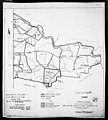
 Map of the great Venango oil basin (4231293977).jpg 2,000 × 1,486; 2.43 MB
_pic.013_Map_of_Oil_City.jpg)
_pic.038_Map_of_Venango_Conty,_PA.jpg)


.jpg)
.jpg)
.jpg)
.jpg)
.jpg)
.jpg)


.jpg)
.jpg)
.jpg)
.jpg)


.jpg)
.jpg)


.jpg)
.jpg)

.jpg)

.jpg)