Category:Old maps of Spain from the Norman B. Leventhal Map Center
Jump to navigation
Jump to search
Countries of Europe: Belgium · Cyprus‡ · Denmark · France‡ · Germany · Greece · Hungary · Republic of Ireland · Italy · Lithuania · Netherlands‡ · Poland · Portugal‡ · Romania · Russia‡ · Spain‡ · Switzerland · Turkey‡ · United Kingdom
‡: partly located in Europe
‡: partly located in Europe
Media in category "Old maps of Spain from the Norman B. Leventhal Map Center"
The following 2 files are in this category, out of 2 total.
-
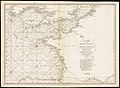 British Channel Bay of Biscay Chart 1780.jpg 9,041 × 6,638; 15.7 MB
-
 The kingdoms of Spain and Portugal, divided into their great provinces (20118951603).jpg 2,000 × 1,458; 3.04 MB

.jpg)