Category:Old maps of Germany from the Norman B. Leventhal Map Center
Jump to navigation
Jump to search
Media in category "Old maps of Germany from the Norman B. Leventhal Map Center"
The following 9 files are in this category, out of 9 total.
-
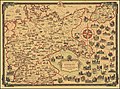
 1935 pictorial map of Germany.tif 6,018 × 4,468; 76.95 MB
-
 A Pictorial Map of Germany By Ernest Dudley Chase.jpg 10,014 × 7,459; 20.81 MB
-
 A pictorial map of Germany.tif 5,898 × 4,516; 76.23 MB
-

-

-

-
 Plan de Cologne by Hòtel Disch.jpg 651 × 479; 313 KB
-
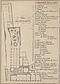 Plan de Hotel Disch (and map key for Cologne).jpg 473 × 658; 329 KB
-
 Rhein Panorama von Cöln nach Düsseldorf und Mainz (35179324375).jpg 714 × 2,000; 1.33 MB

.jpg)
.jpg)
.jpg)

.jpg)
.jpg)