Category:Old maps of Orléans
Jump to navigation
Jump to search
See also Old maps of Orléanais
Subcategories
This category has only the following subcategory.
M
Media in category "Old maps of Orléans"
The following 58 files are in this category, out of 58 total.
-
 Plan de la ville et siège d'Orléans en 1428.jpg 6,350 × 2,819; 4.36 MB
-

-
 1575-carte 'le vrai portait de la ville d'Orléans'.JPG 390 × 300; 27 KB
-
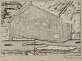 1634-Plan d'Orléans.JPG 402 × 300; 33 KB
-
 1640-Plan de la ville d'Orléans (Fleury).JPG 379 × 300; 25 KB
-
 1648-Plan et profil au naturel de la ville d'Orléans.JPG 600 × 263; 53 KB
-
 Dioecese de lEvesché dOrleans (5121154146).jpg 2,000 × 1,492; 3.31 MB
-
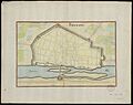 1657-Plan d'Orléans.JPG 379 × 300; 19 KB
-
 1657-Plan d'Orléans.pdf 764 × 604; 2.06 MB
-

-
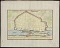
 1662-Plan d'Orléans.JPG 351 × 300; 29 KB
-
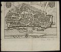
 1680-autre plan de la ville d'Orléans.JPG 380 × 300; 35 KB
-
 1680-plan de la ville d'Orléans.JPG 401 × 300; 24 KB
-
 La Généralité d'Orléans, divisée en ses eslections - par H. Iaillot - btv1b530531848.jpg 9,022 × 6,511; 10.62 MB
-
 1705-Plan de la ville d'Orléans.JPG 408 × 300; 30 KB
-
 1713-La ville d'Orléans et ses environs.JPG 366 × 300; 37 KB
-
 1738-Plan d'Orléans.JPG 460 × 300; 31 KB
-

-
 1765-Plan des maisons autour de l'église de Notre-Dame-de-Recouvrance.pdf 768 × 533; 1.73 MB
-
 1778-Nouveau plan d'Orléans.JPG 367 × 300; 28 KB
-
 1778-plan d'Orléans et de ses faubourgs.JPG 404 × 300; 28 KB
-
 1783-Plan de la ville et du nouveau pont d'Orléans.JPG 282 × 300; 20 KB
-

-

-
 Plan monumental d'Orléans 1-6.000 - dressé par G. Peltier - btv1b530649661.jpg 9,592 × 6,968; 10.6 MB
-
 405 of 'Cassell's History of the War between France and Germany' (11225409716).jpg 1,962 × 1,497; 613 KB
-

-
 Cosmographie universelle 40917 ville d'Orléans.png 8,576 × 7,296; 2.69 MB
-
 Diocèse d'Orléans. - dressé par Charle ; gravé par Dumortier - btv1b8445580g.jpg 9,250 × 7,332; 8.57 MB
-
 EB1911 - Orleans.png 2,154 × 1,566; 787 KB
-
 France & Colonies-1894-source du Loiret.jpg 3,212 × 2,352; 1.23 MB
-
 Kärtchen zu den Gefechten bei Orléans (12.1870).jpg 754 × 451; 151 KB
-
 Novissima totius Aureliani Generalitatis Exhibitio.jpg 7,680 × 6,512; 17.04 MB
-
 Orleanois et pays voisins - par G. DELISLE - btv1b8593256s.jpg 11,024 × 8,779; 17.52 MB
-

-

-

-
 Orléans - btv1b84426797.jpg 5,856 × 4,459; 3.13 MB
-
 Orléans, (carte du réseau des chemins de fer) - gravé par Delamare - btv1b8459575p.jpg 7,140 × 8,789; 7.32 MB
-
-
 Orléans. Chemin de la classe. Souvenir - btv1b8445937v.jpg 6,180 × 8,962; 7.62 MB
-

-
 Plan d'Orléans Alphonse Gatineau.jpg 8,086 × 6,723; 43.38 MB
-
 Plan d'Orléans détail, pont des Tourelles.jpg 1,756 × 1,058; 1.52 MB
-
 Plan d'Orléans en 1836 par Charles Pensée.jpg 1,162 × 953; 332 KB
-
 Plan du grand séminaire d'Orléans.jpg 1,431 × 1,054; 267 KB
-
 Plan général du grand cimetière et du hall au bled.jpg 1,890 × 2,458; 364 KB
-
 Plaque Autrefois Port Loire Place Loire - Orléans (FR45) - 2022-07-16 - 1.jpg 3,623 × 2,236; 3.22 MB
-

-
 Sources Loiret-plan 1 et 2.png 751 × 361; 483 KB
-
 Sources Loiret-plan 3.png 755 × 532; 657 KB
-
-

-

-
 Ville d'Orléans. Plan - dressé et dessiné par E. Moreau... - btv1b84389185.jpg 6,738 × 8,599; 8.23 MB
-
 Ville d'Orléans. Plan - dressé et dessiné par E. Moreau... - btv1b8441402p.jpg 5,490 × 6,542; 6.32 MB
-
 Vue d'Orléans par G. Hotot.jpg 2,638 × 3,025; 3.08 MB
-
 Карта к статье «Орлеан». Военная энциклопедия Сытина (Санкт-Петербург, 1911-1915).jpg 1,749 × 1,723; 587 KB

.jpg)


.JPG)

.jpg)

.jpg)


.jpg)


.jpg)


.jpg)
.jpg)


.jpg)


_-_cantonnement_de_Lorris._-_For%C3%AAt_domaniale_d%27Orl%C3%A9ans._Plan_g%C3%A9n%C3%A9ral_du_cantonnement_de_Lorris_-_dress%C3%A9e_par_les_g%C3%A9om%C3%A8tres_des_for%C3%AAts..._Cri%C3%A8s_p%C3%A8re_;_Ch._Cri%C3%A8s_fils,_30_d%C3%A9cembre_1870_-_btv1b53063601t.jpg)
._Plan_topographique_de_la_ville_et_de_ses_faubourgs_-_btv1b84447336.jpg)

_-_grav%C3%A9_par_Delamare_-_btv1b8459575p.jpg)


_-_2022-07-16_-_1.jpg)


.jpg)