Category:Maps of Orléans by Braun & Hogenberg
Jump to navigation
Jump to search
Subcategories
This category has only the following subcategory.
M
Media in category "Maps of Orléans by Braun & Hogenberg"
The following 8 files are in this category, out of 8 total.
-
 1682-Aurelia vernaculo Orliens.JPG 363 × 300; 31 KB
-
 Aurelia Franciae civitas ad Ligerim fluv. sita - btv1b531788583 (1 of 2).jpg 6,492 × 4,968; 4.94 MB
-
 Civitates orbis terrarvm. LOC 2008627031-18.jpg 8,166 × 6,165; 7.88 MB
-
 Civitates orbis terrarvm. LOC 2008627031-18.tif 8,166 × 6,165; 144.03 MB
-
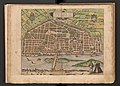
 1581-Aurelia Franciae civitas ad Ligeri flu.JPG 2,616 × 2,103; 2.02 MB
-

-
-
 Vrbivm praecipvarvm totivs Mvndi liber tertivs 1616 (34062951).jpg 14,337 × 10,062; 25.28 MB

.jpg)


.jpg)
.jpg)
.jpg)