Category:Old maps of Old City of Acre
Jump to navigation
Jump to search
Media in category "Old maps of Old City of Acre"
The following 15 files are in this category, out of 15 total.
-
Bodleian Libraries, Map of Acre.jpg 1,000 × 675; 115 KB
-
Mont Carmel 1666.jpg 4,676 × 3,284; 3.81 MB
-
Monte Carmelo Alexis.jpg 1,894 × 2,723; 2.4 MB
-
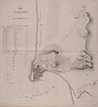
1840–43 Royal Engineers map of Acre (close up).jpg 2,344 × 3,098; 440 KB
-
1840–44 Royal Engineers map of Acre and surrounding region.jpg 2,270 × 2,475; 658 KB
-
City Acre.jpg 922 × 614; 190 KB
-
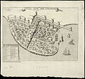
Civitas acon sive Ptolomaida - Bosio Giacomo & Boissat Pierre De - 1659.jpg 1,478 × 1,172; 1.1 MB
-
Civitas Acon sive Ptolomaida.jpg 807 × 750; 225 KB
-
Jean Picart. Civitas Acon sive Ptolomaida. 17th century.jpg 5,421 × 3,864; 4.56 MB
-
Marino Sanudo's plan of ACRE.jpg 2,280 × 1,800; 1.17 MB
-
Plan de St. Jean d'Acre. 1799.jpg 2,615 × 1,743; 672 KB
-
Plan of Acre. After a Drawing by Marino Sanuto (11229880494).jpg 1,923 × 1,278; 732 KB
-
Ptolémaïde ou Acre. Jean Baptiste Bourguignon d'Anville. 18th century.jpg 1,120 × 1,300; 194 KB


