Category:Maps of Old City of Acre
Jump to navigation
Jump to search
Subcategories
This category has only the following subcategory.
O
- Old maps of Old City of Acre (15 F)
Media in category "Maps of Old City of Acre"
The following 13 files are in this category, out of 13 total.
-
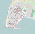
 Acco IMG 0191.JPG 3,648 × 2,736; 5.53 MB
-
 Acre 1291 in Masri.JPG 451 × 464; 36 KB
-
 Acre1291 made by samsam hebrew.svg 455 × 468; 203 KB
-
 Acre1291 made by samsam.JPG 442 × 455; 155 KB
-
 Acre1291es.png 656 × 654; 157 KB
-
 Crusader and Ottoman settlements in Akka.svg 629 × 561; 318 KB
-
 Crusader and Ottoman Sites in Acre.svg 512 × 457; 80 KB
-
 Map of Acre in 1291-es.svg 1,460 × 1,441; 290 KB
-
 Map of Acre in 1291.svg 1,460 × 1,441; 50 KB
-
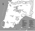
 Map oud akko.png 1,012 × 988; 338 KB
-
 Mapka stara akka.jpg 393 × 328; 38 KB
-
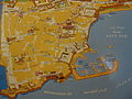
 PikiWiki Israel 84105 historic sites.jpg 2,910 × 1,861; 2 MB
-
 Plan Saint-Jean-d'Acre.png 320 × 326; 9 KB


