Category:Old maps of Lorraine
Jump to navigation
Jump to search
Administrative regions and territorial collectivity of Metropolitan France (‡ since start of 2016):
Auvergne-Rhône-Alpes‡ · Bourgogne-Franche-Comté‡ · Brittany · Centre-Val de Loire · Corsica · Grand Est‡ · Hauts-de-France‡ · Île-de-France · Normandy‡ · New Aquitaine‡ · Occitania‡ · Pays de la Loire · Provence-Alpes-Côte d'Azur
Former administrative regions of Metropolitan France (until end of 2015):
Alsace · Aquitaine · Auvergne · Burgundy · Champagne-Ardenne · Franche-Comté · Languedoc-Roussillon · Limousin · Lorraine · Midi-Pyrénées · Nord-Pas-de-Calais · Lower Normandy · Upper Normandy · Picardy · Poitou-Charentes · Rhône-Alpes
Overseas departments and regions: Guadeloupe · Martinique · French Guiana · Réunion · Mayotte
Overseas collectivities: Saint Barthélemy · Saint-Martin · Saint Pierre and Miquelon · French Polynesia · Wallis and Futuna · French Southern and Antarctic Lands+
Sui generis territories: New Caledonia · Clipperton Island+
Use the appropriate category for maps showing all or a large part of Lorraine. See subcategories for smaller areas:
| If the map shows | Category to use |
|---|---|
| Lorraine on a recently created map | Category:Maps of Lorraine or its subcategories |
| Lorraine on a map created more than 70 years ago | Category:Old maps of Lorraine or its subcategories |
| the history of Lorraine on a recently created map | Category:Maps of the history of Lorraine or its subcategories |
| the history of Lorraine on a map created more than 70 years ago | Category:Old maps of the history of Lorraine or its subcategories |

Subcategories
This category has the following 13 subcategories, out of 13 total.
Media in category "Old maps of Lorraine"
The following 45 files are in this category, out of 45 total.
-
-

-

-

-
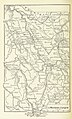
 Meyers leiner Hand-atlas 1893 (73136696).jpg 6,352 × 9,522; 11.82 MB
-
 Autour de Toul 1866.png 1,596 × 982; 3.57 MB
-
 Biding.jpg 576 × 384; 156 KB
-
 Carte Nousseviller-lès-Bitche.jpg 867 × 1,091; 362 KB
-
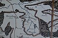
 Dräi Bistümer.png 393 × 432; 386 KB
-
 Fonderie mouterhouse.jpg 405 × 305; 25 KB
-
 Front de Lorraine - btv1b84461360.jpg 10,486 × 7,992; 14.65 MB
-
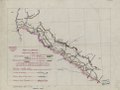
 Front de Lorraine LOC 92684032.jpg 6,087 × 4,589; 3.52 MB
-
 Front de Lorraine LOC 92684032.tif 6,087 × 4,589; 79.92 MB
-

-
-

-

-

-

-
-

-

-
 Herzogtum Lothringen 1000.PNG 980 × 976; 623 KB
-
 Herzogtum Lothringen 1250.PNG 368 × 382; 138 KB
-
 Herzogtum Lothringen 1400.PNG 659 × 883; 456 KB
-
 Hingsange Morhange Château Voué 1700.jpg 800 × 600; 323 KB
-

-
 Le Verdunois XIIIe-XVIe siecle.jpg 1,475 × 1,023; 496 KB
-
 Lorraine - Province.jpg 2,793 × 1,866; 1.91 MB
-
 Lorraine 1618-1648.JPG 414 × 504; 90 KB
-
 Lotharingia-1508.jpg 1,521 × 2,086; 2.05 MB
-
 Meyers b11 s0553a.jpg 2,360 × 1,468; 4.19 MB
-
 Moyenvic1662.png 380 × 263; 181 KB
-
 Palatinatus Rheni (Merian) 253 (Jamez).jpg 1,464 × 556; 142 KB
-
 Palatinatus Rheni (Merian) 253 (Moyenvic).jpg 1,451 × 551; 184 KB
-
 Palatinatus Rheni (Merian) 253 (vic sur seille).jpg 1,488 × 556; 153 KB
-
 Palatinatus Rheni (Merian) 274.jpg 2,000 × 2,890; 737 KB
-
 Palatinatus Rheni Merian 274 Lixheim.jpg 1,523 × 1,162; 908 KB
-
 PlanLocalUrbanismeVigy CarteDeCassini1760-c.jpg 1,000 × 725; 118 KB
-
 PlanLocalUrbanismeVigy CarteDeCassini1760.jpg 740 × 390; 111 KB
-
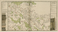
 Postrouten1786L1100283 (2).jpg 2,520 × 3,776; 4.45 MB
-
 Toulois chatellenie 69186 MT (Commercy).jpg 901 × 617; 550 KB
-
 Toulois chatellenie 69186 MT.jpg 2,921 × 2,002; 4.37 MB
-
 Trois-Évêchés.png 393 × 432; 359 KB
-
 Карта к статье «Нуасвиль». Военная энциклопедия Сытина (Санкт-Петербург, 1911-1915).jpg 2,602 × 2,684; 1.1 MB
.jpg)
.jpg)
.jpg)
.jpg)
.jpg)


_274.jpg)


.jpg)
.jpg)


.jpg)
_253_(Jamez).jpg)
_253_(Moyenvic).jpg)
_253_(vic_sur_seille).jpg)