Category:Old maps of Franche-Comté
Jump to navigation
Jump to search
Administrative regions and territorial collectivity of Metropolitan France (‡ since start of 2016):
Auvergne-Rhône-Alpes‡ · Bourgogne-Franche-Comté‡ · Brittany · Centre-Val de Loire · Corsica · Grand Est‡ · Hauts-de-France‡ · Île-de-France · Normandy‡ · Nouvelle-Aquitaine‡ · Occitania‡ · Pays de la Loire · Provence-Alpes-Côte d'Azur
Former administrative regions of Metropolitan France (until end of 2015):
Alsace · Aquitaine · Auvergne · Burgundy · Champagne-Ardenne · Franche-Comté · Languedoc-Roussillon · Limousin · Lorraine · Midi-Pyrénées · Nord-Pas-de-Calais · Lower Normandy · Upper Normandy · Picardy · Poitou-Charentes · Rhône-Alpes
Overseas departments and regions: Guadeloupe · Martinique · French Guiana · Réunion · Mayotte
Overseas collectivities: Saint Barthélemy · Saint-Martin · Saint Pierre and Miquelon · French Polynesia · Wallis and Futuna · French Southern and Antarctic Lands+
Sui generis territories: New Caledonia · Clipperton Island+
Use the appropriate category for maps showing all or a large part of Franche-Comté. See subcategories for smaller areas:
| If the map shows | Category to use |
|---|---|
| Franche-Comté on a recently created map | Category:Maps of Franche-Comté or its subcategories |
| Franche-Comté on a map created more than 70 years ago | Category:Old maps of Franche-Comté or its subcategories |
| the history of Franche-Comté on a recently created map | Category:Maps of the history of Franche-Comté or its subcategories |
| the history of Franche-Comté on a map created more than 70 years ago | Category:Old maps of the history of Franche-Comté or its subcategories |

Subcategories
This category has the following 4 subcategories, out of 4 total.
Media in category "Old maps of Franche-Comté"
The following 28 files are in this category, out of 28 total.
-
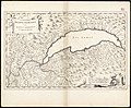
 "Burgundia comitatus vulgo la Franche comté." (21632334314).jpg 3,774 × 2,976; 2.73 MB
-
 Burgundia Comitatus, Vulgo la Franche Comté - btv1b5973017s.jpg 7,129 × 5,529; 5.65 MB
-
-
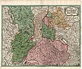
 1716 Homann Map of Burgundy, France - Geographicus - Burgundiae-homan-1716.jpg 4,000 × 4,759; 4.58 MB
-

-

-

-

-
 C. 1575 France (Northern).jpg 2,206 × 1,275; 3.11 MB
-
 C. 1575 France (Southern).jpg 1,980 × 1,381; 2.99 MB
-
 C. 1668-1699 Europe (treaty adjustments).jpg 1,753 × 984; 760 KB
-

-

-

-

-
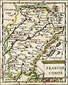 Franche comte.jpg 380 × 475; 114 KB
-
 G. Bruno - Le Tour de la France par deux enfants p077.jpg 856 × 1,208; 179 KB
-
 Hugues Cousin (fl.c.1532-1566), Burgundiae comitatus (FL33133754 2583514).jpg 12,189 × 9,151; 140.23 MB
-
 LASB K Hellwig 0095.jpg 7,700 × 6,430; 9.32 MB
-
 LASB K Hellwig 0288.jpg 8,896 × 11,344; 31.35 MB
-

-
 Les pagis bourguignons au 9e siècle.gif 405 × 396; 33 KB
-
 Maxima Sequanorum.jpg 613 × 524; 402 KB
-
 Michelin nr 66, 1940 Besançon.jpg 5,044 × 5,830; 10.05 MB
-
 Michelin nr 66, 1940 Cray Dole.jpg 5,021 × 5,829; 9.82 MB
-

-
 UBBasel Map 1658 Kartenslg Mappe 233-35-1.tif 9,571 × 9,890, 2 pages; 270.84 MB
-
 UBBasel Map 1658 Kartenslg Mappe 233-35-2.tif 10,088 × 9,959, 2 pages; 287.46 MB
.jpg)

.jpg)

.jpg)

%27_(11047273045).jpg)
)%27_(11092573314).jpg)
.jpg)
.jpg)
.jpg)

,_est_extraite_d%27un_travail_in%C3%A9dit_et_commenc%C3%A9_par_M.M._Ed._Clerc_et_Bourgon_-_btv1b53088167f.jpg)


,_Burgundiae_comitatus_(FL33133754_2583514).jpg)


.jpg)


