Category:Old maps of Haarlem
Jump to navigation
Jump to search
Subcategories
This category has the following 5 subcategories, out of 5 total.
Media in category "Old maps of Haarlem"
The following 200 files are in this category, out of 269 total.
(previous page) (next page)-

-
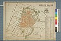
 1043 of 'Atlas, etc' (11168002673).jpg 1,550 × 2,342; 736 KB
-
 Haarlem (1600) a closer view.jpg 800 × 600; 177 KB
-
 Haarlem (1600).jpg 800 × 1,067; 169 KB
-
 Een Ontwerp door S de Bray Tot de gheheele Vergrootinge der Stad Haerlem (BM 1976,U.130).jpg 1,869 × 2,500; 1.01 MB
-
 Leyda ; Haerlema - btv1b532254855 (1 of 2).jpg 4,426 × 6,311; 6.37 MB
-

-

-

-
 Haarlem 1865.png 1,500 × 1,266; 137 KB
-
 Haarlem city 1865.png 1,495 × 1,851; 331 KB
-
 Haarlemmerliede.gif 1,500 × 1,249; 175 KB
-
 Schoten.gif 1,500 × 1,261; 179 KB
-
 Spaarndam 1867.png 1,500 × 1,308; 140 KB
-

-
 Braakensiek's Plan van Haarlem 1881.jpg 3,120 × 4,201; 2.23 MB
-
-

-

-
 387 of 'Tafereel der Stad Haarlem en derzelver Geschiedenis, etc' (11001088996).jpg 4,222 × 3,880; 4.34 MB
-
 51-1102-1.tjp.jpg 2,806 × 3,349; 1.93 MB
-
 587.tjp.jpg 7,669 × 5,282; 6.38 MB
-

-

-

-
 Atlante Neroni - Harlem.jpg 2,314 × 1,498; 671 KB
-
 Atlas de Wit 1698-pl015-Haarlem-KB PPN 145205088.jpg 2,000 × 1,631; 2.23 MB
-
 Beleg van Haarlem, Inventarisnummer NL-HlmNHA 53000867.JPG 6,729 × 5,117; 9.01 MB
-
 Blaeu 1652 - Haarlem.jpg 2,446 × 2,012; 995 KB
-
 Bor-Nederlantsche-Oorloghen 9168.tif 4,368 × 3,411; 42.66 MB
-
 Bouwplan Bosch en Vaart.tjp.jpg 11,357 × 9,381; 21.41 MB
-

-
 Caert van Schoten ca 1525.png 1,044 × 856; 1.51 MB
-
-

-
-
 Cornelis Velsen - Kaart van Haarlem en Omstreken - 1724.jpg 9,640 × 7,630; 9.51 MB
-
 De Haarlemmerhout (1755-1756-), Jan van Varel.jpg 13,315 × 19,281; 45.65 MB
-
 Deel van de plattegrond van Haarlem, RP-P-1895-A-18784.jpg 6,212 × 4,992; 6.39 MB
-
 Deel van de plattegrond van Haarlem, RP-P-1895-A-18785.jpg 6,140 × 4,992; 8.23 MB
-
 Deel van de plattegrond van Haarlem, RP-P-1895-A-18786.jpg 5,590 × 4,992; 6.74 MB
-
 Deel van de plattegrond van Haarlem, RP-P-1895-A-18787.jpg 5,590 × 4,924; 8.11 MB
-
-
 Detail 2 Hoogheemraadschap Rijnland map, 2nd edition, 1687.jpg 3,024 × 4,032; 3.31 MB
-
 Eerste ontwerp voor de noordelijke uitleg van Haarlem, Inventarisnummer NL-HlmNHA 51000402.JPG 6,104 × 8,793; 15.08 MB
-

-

-
-

-

-

-

-

-

-

-
 Haarlem 1612 Guicciardini Blaeu.jpg 1,500 × 1,168; 230 KB
-
 Haarlem 1905.jpg 2,914 × 3,588; 9.74 MB
-
-

-
-
-

-

-
 Haarlem en Zandvoort 1905.jpg 3,487 × 2,421; 8.68 MB
-
 Haarlem in vogelvlucht, Inventarisnummer NL-HlmNHA 51001112 02.JPG 3,767 × 2,824; 4.27 MB
-
 Haarlem Noordelijke Gracht 1560 01.jpg 1,302 × 578; 308 KB
-
 Haarlem Noordelijke Gracht 1578.jpg 1,814 × 784; 525 KB
-
 Haarlem Noordelijke Gracht 1646.jpg 1,804 × 547; 385 KB
-
 Haarlem-City-Map-1550.jpg 1,213 × 1,332; 807 KB
-
 Haarlem1646.JPG 2,048 × 2,896; 2.78 MB
-
 Haarlem1827.JPG 1,808 × 2,622; 3.03 MB
-
 Haarlemmerhout (1837) F.J. Nautz .jpg 2,480 × 4,198; 1.86 MB
-
 Haerlem - btv1b550052111.jpg 5,277 × 4,331; 2.38 MB
-
 Harlemum - Haerlem - Haarlem (1646, Atlas van Loon).jpg 5,310 × 4,338; 9.26 MB
-

-

-
 Harlemum, vulgo Haerlem - btv1b8445027c.jpg 9,756 × 7,777; 14.82 MB
-
 Het beleg van Haarlem, 1572-1573 't Beleg van Haarlem (titel op object), RP-P-OB-79.232.jpg 5,516 × 4,048; 4.51 MB
-

-

-

-
 Hoekwater polderkaart - polders bij Haarlem.PNG 392 × 381; 357 KB
-
 Hoekwater polderkaart - Waarderpolder.PNG 441 × 389; 438 KB
-

-
 J.E. van den Arend manege voor het garnizoen in Haarlem.jpg 456 × 651; 38 KB
-
 Jacob-van-deventer1560.jpg 3,306 × 8,152; 4.22 MB
-

-

-
-

-

-

-

-

-

-

-

-

-
 Kaart van de buitenplaats Spaarenoog, Inventarisnummer NL-HlmNHA 51001165.JPG 7,272 × 5,924; 10.91 MB
-

-
 Kaart van de gemeente Haarlem door H, Inventarisnummer NL-HlmNHA 51000731.JPG 4,288 × 2,848; 2.79 MB
-

-

-
 Kaart van de Haarlemmerhout, Inventarisnummer NL-HlmNHA 51000480.JPG 8,377 × 6,656; 13.39 MB
-

-

-
-

-
-

-

-

-

-

-

-
 Kaart van de Vrijheid van Haarlem, Inventarisnummer NL-HlmNHA 51000364.JPG 5,077 × 4,062; 6.08 MB
-

-
-
 Kaart van den weg tusschen Haarlem en Alkmaar, NL-HlmNHA 269 0016.JPG 23,479 × 5,715; 13.55 MB
-

-

-

-

-

-
-
-
-

-
 Kaart van een stukje land, Inventarisnummer NL-HlmNHA 51001192 002.JPG 676 × 1,297; 232 KB
-
-

-

-
-

-
 Kaart van Haarlem en omgeving, de vrijheid van Haarlem, Inventarisnummer NL-HlmNHA 51000978.JPG 6,776 × 6,000; 11.48 MB
-
-
 Kaart van Haarlem en omgeving, Inventarisnummer NL-HlmNHA 51000840.JPG 2,904 × 11,564; 10.04 MB
-
 Kaart van Haarlem en omgeving, Inventarisnummer NL-HlmNHA 51000977.JPG 6,706 × 6,804; 14.67 MB
-

-
 Kaart van Haarlem en omstreken, Inventarisnummer NL-HlmNHA 51000365.JPG 9,640 × 7,630; 18.15 MB
-
 Kaart van Haarlem en omstreken, Inventarisnummer NL-HlmNHA 51000366.JPG 3,643 × 4,968; 4.68 MB
-
 Kaart van Haarlem en omstreken, Inventarisnummer NL-HlmNHA 51000371.JPG 4,687 × 3,048; 3.5 MB
-

-
 KAART van HAARLEM kartografisch dokument door N, Inventarisnummer NL-HlmNHA 1100 KNA006000025.JPG 14,511 × 14,941; 29.94 MB
-

-

-

-
 Kaart van Haarlem uit 1742, Inventarisnummer NL-HlmNHA 1100 KNA006000042.JPG 3,553 × 2,052; 3.08 MB
-
 Kaart van Haarlem voor het jaar 1572, Inventarisnummer NL-HlmNHA 51000861.JPG 4,678 × 4,157; 6.57 MB
-
 Kaart van Haarlem, Inventarisnummer NL-HlmNHA 51000725.JPG 11,882 × 8,253; 33.7 MB
-
 Kaart van Haarlem, Inventarisnummer NL-HlmNHA 51000726.JPG 12,319 × 10,554; 37.96 MB
-
 Kaart van Haarlem, Inventarisnummer NL-HlmNHA 511102-1.JPG 2,806 × 3,349; 3.12 MB
-

-

-
 Kaart van het zuidelijke gedeelte van de voormalige gemeente Schoten.png 2,848 × 4,288; 12.14 MB
-

-
 Kaart van of ontwerp voor de Haarlemmerhout, Inventarisnummer NL-HlmNHA 51000742.JPG 10,728 × 7,256; 19.6 MB
-
 Kaart van percelen gelegen binnen de stad aan de Raampoort, NL-HlmNHA 51000430.jpg 3,680 × 4,997; 6.14 MB
-

-
 Kaartboek met de landerijen van het St. Elsabeth's of Groote Gasthuis te Haarlem.JPG 3,072 × 2,048; 2.18 MB
-

-

-
 Karte der Umgebung von Haarlem.jpg 3,000 × 1,808; 589 KB
-
 Kopie uit ca, Inventarisnummer NL-HlmNHA 1100 KNA006000027.JPG 10,966 × 7,872; 10.74 MB
-
-
-
 Manuscriptkaart van Haarlem en omgeving, Inventarisnummer NL-HlmNHA 51000730.JPG 7,798 × 10,542; 25.5 MB
-

-
-

-

-
-
 Map of Haarlem Bloemendaal and Schoten in 1890.jpg 2,809 × 4,198; 2.76 MB
-
 Map of Hofjes in Haarlem.GIF 1,730 × 2,060; 652 KB
-
 Nautz - Spaarne-Houtmarkt-Stads Buiten Singel.jpg 1,206 × 1,792; 859 KB
-
 Nautz1827.jpg 2,312 × 1,680; 2.74 MB
-
 Nieuwe Kaart van Haarlems Schoone Omstreken, Inventarisnummer NL-HlmNHA 1100 KNA006000015.JPG 11,785 × 7,955; 18.71 MB
-
-

-

-

-
 NL-HlmNHA 51000418.tjp.jpg 3,995 × 2,693; 1.32 MB
-
 Officiele geillustreerde gids voor Haarlem en omstreken2.jpg 3,000 × 4,522; 2.59 MB
-
 Officiele geillustreerde gids voor Haarlem en omstreken3.jpg 3,066 × 4,463; 2.75 MB
-
 Ontwerp uitbreidingsplan van de stad, Inventarisnummer NL-HlmNHA 51000398.JPG 6,370 × 9,155; 15.99 MB
-

-

-
 Ontwerp voor de reconstructie van de v, Inventarisnummer NL-HlmNHA 1100 KNA006000054.JPG 11,738 × 7,319; 10.34 MB
-
-
 Ontwerp voor de uitbreiding van Haarlem, Inventarisnummer NL-HlmNHA 51000879.JPG 1,799 × 2,487; 1.71 MB
-

-

-

-

-
 Ontwerp voor uitbreidingsplan van Haarlem, Inventarisnummer NL-HlmNHA 51000399.JPG 8,015 × 5,708; 15.62 MB
-
 Ontwerp voor uitbreidingsplan van Haarlem, Inventarisnummer NL-HlmNHA 51000401.JPG 8,016 × 5,600; 15.97 MB
-
 Ontwerp voor uitbreidingsplan van Haarlem, Inventarisnummer NL-HlmNHA 51000403.JPG 8,748 × 6,236; 15.59 MB
-
 Ontwerp voor uitbreidingsplan van Haarlem, Inventarisnummer NL-HlmNHA 51000404.JPG 8,712 × 6,176; 15.59 MB
-
 Ontwerp voor uitbreidingsplan van Haarlem, Inventarisnummer NL-HlmNHA 51000405.JPG 8,520 × 6,128; 17.17 MB
-
 Ontwerp voor uitbreidingsplan van Haarlem, Inventarisnummer NL-HlmNHA 51000407.JPG 7,501 × 4,991; 11.44 MB
_(14578720577).jpg)
.jpg)
_a_closer_view.jpg)
.jpg)
.jpg)
.jpg)
.jpg)
.jpg)


.jpg)

.jpg)
.jpg)
.jpg)
.jpg)


,_Jan_van_Varel.jpg)


_Hilmar_Johannes_Backer_(litho),_Inventarisnummer_NL-HlmNHA_1100_KNA006000854.JPG)


_F.J._Nautz_.jpg)

.jpg)


,_RP-P-OB-79.232.jpg)


.jpg)


_boom,_Inventarisnummer_NL-HlmNHA_51000428.JPG)


