Category:1689 map of Haarlem
Jump to navigation
Jump to search
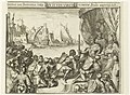
set of engravings that can be assembled into a map of Haarlem with decorated edges, 100 versions were printed in 1889  | |||||
| Upload media | |||||
| Instance of | |||||
|---|---|---|---|---|---|
| Depicts | Haarlem | ||||
| Creator | |||||
| Collection | |||||
| Inception |
| ||||
| |||||
Media in category "1689 map of Haarlem"
The following 33 files are in this category, out of 33 total.
-

-

-

-

-

-

-

-

-

-

-

-

-
 Gegevens cataloguskaartje Ond, Inventarisnummer NL-HlmNHA 1100 KNA006004052.JPG 2,870 × 2,224; 1.94 MB
-

-

-

-
 Haarlem Kenau 1573.png 1,400 × 1,110; 3.04 MB
-
 Photo of Blik op Haarlem exhibition 18.jpeg 4,032 × 3,024; 3.36 MB
-
 Photo of Blik op Haarlem exhibition 19.jpeg 4,032 × 3,024; 3.3 MB
-
 Photo of Blik op Haarlem exhibition 20.jpeg 3,024 × 4,032; 2.83 MB
-
 Photo of Blik op Haarlem exhibition 21.jpeg 3,024 × 4,032; 2.83 MB
-
 Photo of Blik op Haarlem exhibition 22.jpeg 4,032 × 3,024; 4.29 MB
-
 Photo of Blik op Haarlem exhibition 23.jpeg 4,032 × 3,024; 4.17 MB
-
 Plattegrond 1689 - Haarlem - 20095725 - RCE.jpg 1,200 × 1,044; 487 KB
-
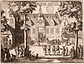
 Romeyn de Hooghe - De Waag Haarlem UBL01 P328N102.jpg 910 × 694; 288 KB
-
 Romeyn de Hooghe - Doelen Gasthuisstraat Haarlem UBL01 P328N094.jpg 970 × 733; 349 KB
-
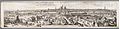 Romeyn de Hooghe - Harlemum.jpg 14,771 × 3,558; 9.45 MB
-

-
 Romeyn de Hooghe - Prinsenhof Haarlem UBL01 P328N104.jpg 955 × 721; 309 KB
-
 Romeyn de Hooghe - Vleeshal Haarlem UBL01 P328N100.jpg 940 × 697; 276 KB
-
 SintBavo-map.JPG 2,901 × 2,329; 1.68 MB
-
-
 Wybrand hendriks proveniershuis 1800.jpg 1,024 × 768; 205 KB


,_oostzijde,_Inventarisnummer_NL-HlmNHA_1100_KNA006004051.JPG)
,_oostzijde,_Inventarisnummer_NL-HlmNHA_1100_KNA006002008.JPG)


_Kopergravure_door_Romeyn_de_Hooghe,_1688,_Inventarisnummer_NL-HlmNHA_1100_KNA006000152.JPG)