Category:Old maps of Georgia (U.S. state) in the American Civil War
Jump to navigation
Jump to search
States of the United States: Alabama · Arkansas · Florida · Georgia · Kentucky · Louisiana · Maryland · Mississippi · Missouri · North Carolina · Pennsylvania · South Carolina · Tennessee · Texas · Virginia – Washington, D.C.
Subcategories
This category has the following 4 subcategories, out of 4 total.
Media in category "Old maps of Georgia (U.S. state) in the American Civil War"
The following 34 files are in this category, out of 34 total.
-
 1863 09 20 Chickamauga hour 0700 to 1200.jpg 6,616 × 8,284; 19.45 MB
-
 1863 09 20 Chickamauga hour 1200 to night.jpg 6,685 × 8,302; 14.39 MB
-

-
-
 286 of 'History of the American Civil War, etc' (11094781675).jpg 1,423 × 2,390; 686 KB
-
 328 of 'History of the American Civil War, etc' (11093795014).jpg 2,368 × 1,389; 725 KB
-

-

-
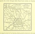
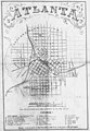 Atlanta. From Vincent's subdivision map - Army of the Cumberland 1864.jpg 1,226 × 1,766; 172 KB
-
 FortPulaskiMap.jpg 2,016 × 1,504; 568 KB
-
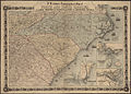
 Genl. Shermans campaign war map (6094150828).jpg 2,000 × 1,609; 3.13 MB
-
 History of the American Civil War (1867) (14576036509).jpg 1,536 × 2,536; 664 KB
-
 History of the American Civil War (1867) (14782546073).jpg 1,512 × 2,532; 791 KB
-
-
-

-
 Map I illustrating the military operations of the Atlanta campaign ... 1864 (5960837335).jpg 1,575 × 2,000; 2.89 MB
-

-

-
-
-
 Map illustrating the operations of Gen. W.T. Sherman, in Georgia.jpg 1,464 × 1,678; 196 KB
-
 Map illustrating the siege of Atlanta. Poe 1864.jpg 2,093 × 1,157; 227 KB
-

-
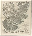
 Map of northern Georgia (6093648813).jpg 1,816 × 2,000; 3.85 MB
-
-

-
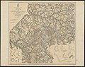
 Map V illustrating the military operations of the Atlanta campaign ... 1864 (5961396758).jpg 2,000 × 1,566; 2.79 MB
-
 RG77 CWMF N76 02.jpg 5,104 × 4,952; 3.68 MB
-
 RG77 CWMF N76 03.jpg 7,563 × 9,939; 8.51 MB
-
 RG77 CWMF N76 04.jpg 4,800 × 7,433; 5.64 MB
-

-
 The battlefield at Chickamauga. Fergus 1863.jpg 1,371 × 1,896; 457 KB
-
 The Mississippi Valley in the Civil War (1900) (14575994310).jpg 1,736 × 2,764; 435 KB


.jpg)
.jpg)
.jpg)
.jpg)
.jpg)
.jpg)


.jpg)
_(14576036509).jpg)
_(14782546073).jpg)
.jpg)
.jpg)
_(14784514962).jpg)
.jpg)
.jpg)
.jpg)
_of_Savannah,_Ga._and_the_operations_resulting_in_its_capture_by_the_army_commanded_by_Maj._Genl._W.T._Sherman,_Dec._21st,_1864_(10842853716).jpg)
.jpg)


.jpg)
.jpg)
.jpg)
.jpg)
.jpg)


.jpg)

_(14575994310).jpg)